Category:Environs of North Walsham
Jump to navigation
Jump to search

Subcategories
This category has the following 7 subcategories, out of 7 total.
Media in category "Environs of North Walsham"
The following 100 files are in this category, out of 100 total.
-
 -2019-11-15 North Walsham wood, Skeyton Road, Norfolk.JPG 3,864 × 5,152; 11.82 MB
-
 -2021-01-29 Countryside north of North Walsham.jpg 1,024 × 768; 161 KB
-
 -2021-01-29 Drainage channel north of North Walsham.jpg 1,024 × 768; 284 KB
-
 -2021-01-29 Railway embankment footpath north of North Walsham.jpg 1,024 × 768; 409 KB
-
 -2021-02-01 Looking across a feild from Feild Lane, North Walsham.jpg 1,024 × 768; 146 KB
-
 -2021-02-01 Ploughed field next to Field Lane, North Walsham.jpg 1,024 × 768; 156 KB
-
 -2021-02-07 Dismantled railway bridge, Paston Way, Norfolk.JPG 5,152 × 3,864; 6.38 MB
-
-

-

-
 -2021-02-09 Frozen muddy track, White Horse Common, North Walsham.jpg 1,024 × 768; 211 KB
-
 -2021-02-09 Winter landscape, White Horse Common, North Walsham.jpg 1,024 × 768; 120 KB
-
 -2021-10-24 A149, North Walsham, Norfolk (1).JPG 4,966 × 3,000; 2.14 MB
-
 -2021-10-24 A149, North Walsham, Norfolk (2).JPG 4,295 × 2,941; 1.62 MB
-
 -2021-10-24 A149, North Walsham, Norfolk (3).JPG 4,264 × 2,446; 1.66 MB
-
 -2021-10-24 A149, North Walsham, Norfolk (4).JPG 4,122 × 2,692; 1.78 MB
-
 -2022-04-01 Disused railway bridge on Paston Way, North Walsham to Knapton section.JPG 5,152 × 3,864; 9.68 MB
-

-

-

-
 A battle was fought here in 1381 - geograph.org.uk - 1029627.jpg 640 × 385; 91 KB
-
 A rare glimpse of the River Ant - geograph.org.uk - 1020806.jpg 480 × 640; 139 KB
-
 A Saturday in mid-May - geograph.org.uk - 1306041.jpg 640 × 549; 158 KB
-
 A shaded woodland track - geograph.org.uk - 1297846.jpg 640 × 480; 143 KB
-
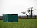 A square green box - geograph.org.uk - 1065535.jpg 640 × 480; 63 KB
-
 A Sugar Beet crop - geograph.org.uk - 1087148.jpg 640 × 480; 106 KB
-
 A wet day - geograph.org.uk - 1065542.jpg 640 × 408; 69 KB
-
 Access road to the Toll Barn - geograph.org.uk - 1306083.jpg 640 × 480; 91 KB
-
 An ancient battleground - geograph.org.uk - 1027064.jpg 640 × 409; 116 KB
-
 Approaching Bradfield Road - geograph.org.uk - 1087114.jpg 480 × 640; 167 KB
-

-
 Approaching the industrial estate - geograph.org.uk - 1087151.jpg 640 × 548; 110 KB
-
 Bare fields - geograph.org.uk - 1065538.jpg 551 × 640; 103 KB
-
 Crickmore Farm - geograph.org.uk - 3135587.jpg 640 × 480; 62 KB
-
 Cultivated field - geograph.org.uk - 1063537.jpg 640 × 480; 101 KB
-
 Cultivated field adjoining path - geograph.org.uk - 1029758.jpg 640 × 482; 87 KB
-

-
 Farm hardstand and farm track beyond - geograph.org.uk - 1306023.jpg 640 × 480; 84 KB
-

-
 Field beside Marshgate - geograph.org.uk - 646547.jpg 640 × 480; 82 KB
-
 Field bordering Hall Lane - geograph.org.uk - 720310.jpg 640 × 447; 83 KB
-
 Field Lane past Warren Wood - geograph.org.uk - 541199.jpg 640 × 480; 51 KB
-
 Flowering shrubs in hedge field boundary - geograph.org.uk - 1297903.jpg 640 × 480; 136 KB
-
 Following the circular walk - geograph.org.uk - 1020827.jpg 640 × 410; 104 KB
-
 Footpath from Mundesley Road to the B1145 - geograph.org.uk - 961111.jpg 480 × 640; 168 KB
-
 Footpath leading east - geograph.org.uk - 1029772.jpg 480 × 640; 131 KB
-
 Footpath to North Walsham - geograph.org.uk - 1063476.jpg 480 × 640; 166 KB
-
 Footpath to Swanton Hill - geograph.org.uk - 1028235.jpg 640 × 480; 176 KB
-
 Footpath traversing cereal crop - geograph.org.uk - 3929437.jpg 640 × 480; 213 KB
-
 Forest track leading west - geograph.org.uk - 1029829.jpg 480 × 640; 151 KB
-
 From soggy track to muddy path - geograph.org.uk - 1065531.jpg 640 × 480; 86 KB
-
 From Tungate to Felmingham Station - geograph.org.uk - 1063576.jpg 640 × 456; 103 KB
-
 Gated Level Crossing - geograph.org.uk - 1305979.jpg 640 × 480; 116 KB
-
 Heading north towards the car park - geograph.org.uk - 1020831.jpg 640 × 480; 202 KB
-

-
 Heath Plantation - geograph.org.uk - 1027025.jpg 480 × 640; 138 KB
-
 Himalayan Balsam (Impatiens glandulifera) - geograph.org.uk - 540748.jpg 480 × 640; 117 KB
-
 House near Bradmoor Farm - geograph.org.uk - 515357.jpg 640 × 480; 59 KB
-
 Houses on Hadfield Road - geograph.org.uk - 1087615.jpg 640 × 450; 97 KB
-
 Houses on Pellew Place - geograph.org.uk - 1087619.jpg 640 × 458; 86 KB
-
 Meadow Side - geograph.org.uk - 598366.jpg 640 × 480; 86 KB
-
 Mill Farm - geograph.org.uk - 1087145.jpg 640 × 480; 61 KB
-
 Mill Farm and adjoining cottage - geograph.org.uk - 1087140.jpg 640 × 480; 72 KB
-
 Minor road at Scarborough Hill - geograph.org.uk - 3135607.jpg 640 × 480; 93 KB
-
 Mound by the site of the Battle of North Walsham.jpg 600 × 800; 150 KB
-
 North Norfolk Sunset (45415254).jpeg 900 × 672; 90 KB
-
 North Walsham and Dilham Canal - geograph.org.uk - 469668.jpg 640 × 480; 143 KB
-
 Overgrown pond beside rural lane - geograph.org.uk - 1306067.jpg 640 × 480; 123 KB
-
 Padlock and barbed wire - geograph.org.uk - 646550.jpg 640 × 480; 115 KB
-
 Path from Bradfield Road to Lyngate Road - geograph.org.uk - 1087587.jpg 480 × 640; 155 KB
-

-

-
 Pumpkins and farmland near Tungate - geograph.org.uk - 538570.jpg 480 × 640; 111 KB
-
 Remains of a building - geograph.org.uk - 1029774.jpg 480 × 640; 160 KB
-
 Remains of a potato crop - geograph.org.uk - 1065547.jpg 480 × 640; 104 KB
-
 Rural lane to the A149 - geograph.org.uk - 1306071.jpg 640 × 480; 117 KB
-
 Several paths meet here - geograph.org.uk - 1027047.jpg 480 × 640; 83 KB
-
 Sheds at Heath Farm - geograph.org.uk - 1306076.jpg 640 × 445; 82 KB
-
 Sundial and Roses - geograph.org.uk - 541214.jpg 480 × 640; 107 KB
-
 This way to the B1150 - geograph.org.uk - 1305998.jpg 640 × 480; 127 KB
-
 Through wet maize - geograph.org.uk - 1027057.jpg 522 × 640; 164 KB
-
 Tollgate Farm - geograph.org.uk - 458412.jpg 640 × 480; 67 KB
-
 Track near Bradmoor Farm - geograph.org.uk - 515362.jpg 640 × 480; 67 KB
-
 Tramlines in a barley crop - geograph.org.uk - 1306062.jpg 630 × 589; 102 KB
-
 Transformer in field - geograph.org.uk - 1305916.jpg 512 × 640; 113 KB
-
 Tungate Farm - geograph.org.uk - 493636.jpg 640 × 480; 132 KB
-
 View across cultivated field - geograph.org.uk - 1297832.jpg 640 × 480; 101 KB
-

-
 View across fields - geograph.org.uk - 1029683.jpg 480 × 640; 99 KB
-
 View across fields - geograph.org.uk - 1063545.jpg 640 × 444; 77 KB
-
 View across the A149 - geograph.org.uk - 1305863.jpg 640 × 480; 87 KB
-
 View from Lyngate Road - geograph.org.uk - 529204.jpg 640 × 480; 72 KB
-
 View from the edge of Lord Anson's Wood - geograph.org.uk - 1028173.jpg 480 × 640; 125 KB
-
 View from the woodland edge - geograph.org.uk - 1297859.jpg 480 × 640; 78 KB
-
 View north across fields - geograph.org.uk - 1063557.jpg 640 × 480; 85 KB
-
 View northwest across fields - geograph.org.uk - 961140.jpg 480 × 640; 83 KB
-
 View northwest along the circular walk - geograph.org.uk - 1020817.jpg 640 × 452; 139 KB
-

-
 View west across cultivated field - geograph.org.uk - 1065533.jpg 640 × 480; 96 KB
-
 Waiting for a sunny day - geograph.org.uk - 708684.jpg 480 × 640; 208 KB


.JPG)
.JPG)
.JPG)


.JPG)
.JPG)
.JPG)
.JPG)


.jpg)


_-_geograph.org.uk_-_540748.jpg)


.jpeg)


