Category:Entrenched meanders in Germany
Jump to navigation
Jump to search
Subcategories
This category has the following 2 subcategories, out of 2 total.
S
Media in category "Entrenched meanders in Germany"
The following 17 files are in this category, out of 17 total.
-
 Aerial image of the Danube Gorge near Weltenburg.jpg 5,000 × 3,200; 6.89 MB
-
 Beim 366 km langen Neckartalradweg, Hochnebel - panoramio.jpg 4,536 × 3,358; 6.55 MB
-
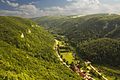
 Blick in den Talbogen vor der Neckarburg.JPG 3,600 × 2,400; 4.24 MB
-
 Blick ins Neckartal - panoramio.jpg 1,200 × 798; 248 KB
-
 Blick zur Neckarburg von der Zufahrtsstraße aus.JPG 3,600 × 2,400; 3.98 MB
-
 Ermstal Kalktuff Schwaebische-Alb.jpg 1,800 × 1,200; 2.29 MB
-
 Grosse Lauter Umlaufberg Gundelfingen Schwaebische Alb.jpg 2,000 × 1,325; 2.82 MB
-
 Hirschhorn Neckarschleife N nw von Ersheim 20200222 1613.jpg 4,160 × 2,971; 2.26 MB
-
 Hirschhorn Neckarschleife NW nne von Staustufe 20200222 1602.jpg 4,040 × 2,886; 1.39 MB
-
 Hitzlay.JPG 3,432 × 2,396; 3.41 MB
-
 Neckartal - Neckartalbrücke - panoramio.jpg 1,200 × 798; 225 KB
-
 NSG-Neckarburg Maeanderdurchbruch Obere-Gaeue.jpg 1,800 × 1,200; 2.06 MB
-
 NSG-Neckarburg Umlauftal Oberer-Neckar Wacholderheide Obere-Gaeue.jpg 1,800 × 1,200; 1.67 MB
-
 Talbogen und Wacholderhänge NSG Neckarburg.jpg 3,600 × 2,400; 4.08 MB
-
 Talbogen vor der Neckarburg mit Wacholderheide.jpg 3,600 × 2,400; 3.81 MB
-
 The valley of the Mosel, view to Mehring.jpg 1,701 × 2,551; 1.05 MB
-
 Umlaufberge Neckarburg derivative & OTM.png 2,387 × 1,023; 3.53 MB


