Category:English-language maps of South America
Jump to navigation
Jump to search
Subcategories
This category has the following 17 subcategories, out of 17 total.
A
B
C
E
G
P
U
V
Media in category "English-language maps of South America"
The following 19 files are in this category, out of 19 total.
-
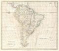
1799 Clement Cruttwell Map of South America - Geographicus - SouthAmerica-cruttwell-1799.jpg 3,500 × 3,031; 2.58 MB
-
Airline Routes in South America, March,1949 - DPLA - 587ef873c1242698a31a8378f5cccb42.jpg 8,424 × 12,581; 10.42 MB
-
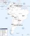
Base Map of South America.png 2,366 × 2,813; 352 KB
-
Index Map D000 South America - DPLA - f85efe927e50edf7793834b6f353d778.jpg 7,210 × 10,327; 6.5 MB
-
John Russell, South America (FL13728529 2511715).jpg 3,920 × 4,595; 27.08 MB
-
Karta sydamerika 1892.jpg 1,222 × 1,678; 417 KB
-
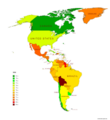
Life expectancy map -Americas -2019 -with names.png 5,500 × 6,000; 1.68 MB
-
Life expectancy map -Americas -2020 -with names.png 5,500 × 6,000; 1.68 MB
-
Life expectancy map -Americas -2021 -with names.png 5,500 × 6,000; 1.69 MB
-
Life expectancy map -South America -2019 -with names.png 2,400 × 3,000; 343 KB
-
Life expectancy map -South America -2020 -with names.png 2,400 × 3,000; 342 KB
-
Life expectancy map -South America -2021 -with names.png 2,400 × 3,000; 336 KB
-
Pan American Highway - DPLA - 7f0fcead9e4524c25c1d3efc9dde78b7.jpg 6,610 × 5,374; 3.2 MB


