Category:English-language maps of Germany
Jump to navigation
Jump to search
Subcategories
This category has the following 3 subcategories, out of 3 total.
Media in category "English-language maps of Germany"
The following 62 files are in this category, out of 62 total.
-

-
 1945 Berlin Zones (30249103203).jpg 1,762 × 1,330; 1.46 MB
-

-

-
 Allied Access Routes to West Berlin - DPLA - 58e9514df54c04c423c5829727d0ff08.jpg 2,396 × 3,118; 6.96 MB
-
 Berlin - DPLA - f951d04cc1bec49d06df2678eff05459.jpg 3,278 × 2,554; 1.94 MB
-
 Berlin Today - Monday, September 10, 1951.jpg 28,137 × 20,977; 123.58 MB
-
 Berlin Zones of Administration (Western half) - DPLA - 8422d84d198842818e2603a7cc3c6656.jpg 7,610 × 10,712; 9.15 MB
-
 Berlin-wall-map en.svg 2,701 × 2,114; 226 KB
-

-
 De-map sv.svg 351 × 377; 34 KB
-
 East Germany and West Germany. LOC 91685645.jpg 3,363 × 4,340; 1.76 MB
-
 EN – Imperial German naval bases.svg 976 × 818; 785 KB
-
 Germany - DPLA - 132f25a154dd2b18598d8a8a5e8726df.jpg 4,284 × 5,510; 2.17 MB
-
 Germany - DPLA - 95ff26eabdf682149ed76b5c18125ddf.jpg 2,552 × 3,276; 5.72 MB
-
 Germany - DPLA - 9b2cfc8ae299751798380db0fd279afb.jpg 2,566 × 3,276; 7.77 MB
-
 Germany - DPLA - aaaac3bc37af11ec9183010a2bb50d1b.jpg 8,346 × 10,477; 10.44 MB
-
 Germany - DPLA - ae72f6c8d1813c6984de7cd867ffac30.jpg 2,548 × 3,278; 6.58 MB
-
 Germany - DPLA - afbafb002b8632ff1b968611ec46186e (page 1).jpg 3,996 × 5,173; 1.79 MB
-
 Germany - DPLA - bfe656dab6997aa5a426d3b52fe8eb5f.jpg 8,314 × 10,471; 8.52 MB
-
 Germany - DPLA - ea6554b90a0f99aa50a79c345578d47e.jpg 8,426 × 10,816; 9.3 MB
-
 Germany - DPLA - f1840073cbd77aa74e92a2e4f4fd1ad8.jpg 4,008 × 5,185; 1.47 MB
-
 Germany - Location Map (2013) - DEU - UNOCHA.svg 250 × 250; 1,015 KB
-
 Germany - Location Map (2019) - DEU - UNOCHA.svg 512 × 564; 920 KB
-
 Germany - Locations of Electronics Activity - DPLA - 8620e3c01f3e2d680ce793b603dab5f5.jpg 6,180 × 3,815; 2.51 MB
-
 Germany Base Map.png 1,106 × 699; 301 KB
-

-

-
 Germany Location of Map Publishers - DPLA - 9904ee0c6a813c52ddd27ef98b407804.jpg 3,480 × 3,332; 798 KB
-
 Germany map of Köppen climate classification.svg 1,900 × 1,900; 159 KB
-
 Germany Zones of occupation - btv1b53196992c.jpg 10,518 × 8,534; 12.6 MB
-
 Germany, administrative divisions - en - colored.svg 1,073 × 1,272; 2.45 MB
-

-

-
-
 Germany. LOC 95684620.jpg 2,503 × 3,115; 830 KB
-
 Germany. LOC 95684621.jpg 2,438 × 2,938; 952 KB
-
 Germany. Zones of occupation, 1947 - btv1b53196993t.jpg 10,388 × 8,384; 9.74 MB
-
 Greater Berlin - DPLA - 4bce17df8285d4f21d417fe5418ea431.jpg 4,622 × 3,274; 1.84 MB
-

-

-

-

-
 Map Germany Länder-en.svg 522 × 729; 171 KB
-
 Map Laacher See.jpg 1,270 × 903; 583 KB
-
 Map of 1925 German presidential election (1st round).svg 900 × 713; 837 KB
-
 Map of 1925 German presidential election (2nd round).svg 900 × 713; 821 KB
-
 Map of Berlin Showing Points of Interest in American English Russian French Sector - verso.jpg 9,626 × 6,811; 12.46 MB
-
 Map of Berlin Showing Points of Interest in American English Russian French Sector.jpg 9,658 × 6,876; 14.73 MB
-
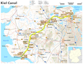 Map of the Kiel Canal.png 1,814 × 1,407; 1.69 MB
-
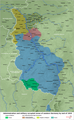
 Occupation in Germany by district, 1925.svg 6,021 × 4,735; 3.85 MB
-
 Ofensiva del Saar2.jpg 1,041 × 764; 227 KB
-
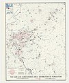
 Population density in Germany by district, 1925.svg 1,512 × 1,179; 4.32 MB
-
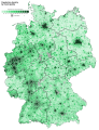 Population density of Germany by municipality.svg 562 × 732; 7.47 MB
-
 Religion in Germany by district, 1925.svg 6,021 × 4,735; 3.68 MB
-
 Samuel John Neele, Germania Antiqua (FL35076540 2549713).jpg 6,110 × 5,123; 43.51 MB
-
 Soviet Zone- Germany Police Organization - DPLA - 8171351128b29df57feefbb775586b61.jpg 4,678 × 4,746; 2.44 MB
-
 Territorial claims against Germany - btv1b531969948.jpg 10,388 × 8,534; 8.33 MB
-
 The Berlin region. LOC 90682667 (cropped).jpg 15,411 × 11,641; 16.96 MB
-
 The Berlin region. LOC 90682667.jpg 15,411 × 23,390; 30.9 MB
-
-
 Western Germany 1923 en.png 1,406 × 2,276; 2.95 MB

.jpg)

%27_(11059105433).jpg)


_-_DPLA_-_8422d84d198842818e2603a7cc3c6656.jpg)


.jpg)


_-_DEU_-_UNOCHA.svg)
_-_DEU_-_UNOCHA.svg)


_100_kms_-_btv1b53196982z.jpg)
_100_kms_-_btv1b53196983d.jpg)


.svg)
.svg)


.jpg)


.jpg)


