Category:English-language SVG maps showing history of Europe
Jump to navigation
Jump to search
Subcategories
This category has only the following subcategory.
Media in category "English-language SVG maps showing history of Europe"
The following 18 files are in this category, out of 18 total.
-
 1795 Holland in the Batavian Republic.svg 1,521 × 1,721; 419 KB
-
 Anachronistic Map of the Balkans (English).svg 1,873 × 1,245; 2.79 MB
-
 Anglo-Saxon Homelands and Settlements.svg 2,000 × 2,000; 2.06 MB
-
 Annexation of the Sudetenland.svg 1,059 × 426; 82 KB
-
 Archeological sites - wine and oil (English).svg 2,466 × 1,208; 253 KB
-
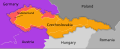
 Carpathian Ruthenia issue, 1938.svg 545 × 385; 116 KB
-
 Europe-blocs-49-89x4-fixed.svg 812 × 509; 695 KB
-
 First Bulgarian Empire.svg 1,122 × 986; 1.03 MB
-
 Geographical distribution of early armorial seals (1110-1160).svg 730 × 585; 248 KB
-
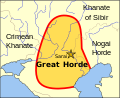 Great Horde.svg 830 × 677; 40 KB
-
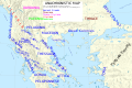
 Greecemap-en.svg 983 × 751; 585 KB
-
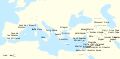
 Iberia 237-206BC-fr.svg 940 × 850; 1.62 MB
-
 June 2023 PMC Wagner Mutiny.svg 800 × 1,100; 1.49 MB
-

-
 Map of the Crown of Aragon.svg 2,317 × 977; 557 KB
-
 OldestCitiesContinuouslyInhabitedInEuropeToPresentDay.svg 1,356 × 1,171; 1.46 MB
-
 Western front 1914-es.svg 2,588 × 2,000; 2.79 MB
-
 WWII in Europe 1939-1941-en.svg 1,256 × 1,259; 175 KB

.svg)

.svg)


.svg)


.svg)


