Category:English-language SVG maps of the United States
Jump to navigation
Jump to search
Countries of the Americas: United States of America
Subcategories
This category has only the following subcategory.
Media in category "English-language SVG maps of the United States"
The following 113 files are in this category, out of 113 total.
-
 100 Mile Footraces in the Contiguous United States, 2011 A.svg 1,150 × 718; 1,018 KB
-
 100 Mile Footraces in the Contiguous United States, 2011.svg 1,153 × 721; 457 KB
-
 113th US Congress House districts color.svg 1,242 × 721; 3.9 MB
-
 1932 electoral map.svg 1,000 × 757; 59 KB
-
 1952DemocraticPresidentialPrimaries.svg 1,020 × 593; 90 KB
-
 1956DemocraticPresidentialPrimaries.svg 1,020 × 593; 90 KB
-
 1980DemocraticPresidentialPrimaries.svg 1,020 × 593; 89 KB
-
 1992DemocraticPresidentialPrimaries.svg 959 × 673; 120 KB
-
 2000 census reapportionment.svg 1,020 × 593; 45 KB
-
 2004US election map.svg 959 × 660; 119 KB
-
 2007NCAAmensBBtourneyteamsbystate.svg 959 × 627; 150 KB
-
 2008 Republican Primary results, by county.svg 555 × 352; 1.67 MB
-
 2008NCAAmensBBtourneyteamsbystate.svg 959 × 627; 149 KB
-
 2009NCAAmensBBtourneyteamsbystate.svg 959 × 627; 149 KB
-
 2010 census reapportionment.svg 1,020 × 593; 29 KB
-
 2010 US Census Hispanic Population by County.svg 852 × 633; 3.09 MB
-
 2010 US Census Percent Change in Hispanic Population by County.svg 835 × 621; 3.15 MB
-
 2010 US rice production.svg 844 × 634; 1.91 MB
-
 2010NCAAmensBBtourneyteamsbystate.svg 959 × 627; 149 KB
-
 2011NCAAmensBBtourneyteamsbystate.svg 959 × 627; 149 KB
-
 2016 Democrat Primary Dates USA w territories.svg 959 × 593; 98 KB
-
 2020 census reapportionment.svg 1,020 × 593; 28 KB
-
 30thStreetStation-overview-en.svg 1,601 × 1,241; 170 KB
-
 322busSC.svg 1,450 × 860; 280 KB
-
 African Americans by state.svg 1,199 × 593; 72 KB
-
 Ahupuaa of Oahu.svg 512 × 405; 181 KB
-
 Alaska map of Köppen climate classification.svg 1,900 × 1,900; 403 KB
-
 American Electric Power Company v. Connecticut plaintiffs.svg 926 × 586; 63 KB
-
 Americans with Arab Ancestry by state.svg 959 × 593; 75 KB
-
 Americans with Hungarian Ancestry by state.svg 959 × 593; 75 KB
-
 Amtrakfreqmap.svg 1,065 × 635; 146 KB
-
 Amtrakfreqmapcolor svg 2023.svg 999 × 595; 171 KB
-
 Amtraksystemmapwithold routes.svg 982 × 595; 160 KB
-
 Andrews County Airport Map.svg 605 × 929; 1.4 MB
-
 Arizona map of Köppen climate classification.svg 1,900 × 1,900; 215 KB
-
 Asian Americans by state.svg 1,199 × 593; 81 KB
-

-
 At-will employment - implied-contract exceptions.svg 959 × 593; 329 KB
-
 At-will employment - public policy exceptions.svg 959 × 593; 329 KB
-
 Atlantic Coast Conference member map 2023-24.svg 1,181 × 731; 2.1 MB
-
 Banning of TikTok on state devices in the United States.svg 959 × 593; 35 KB
-
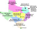
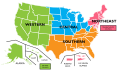 Boy Scouts of America regional division map.svg 675 × 400; 101 KB
-
 Brooklyn census tracts by percent Hispanic, 2020.svg 619 × 409; 489 KB
-
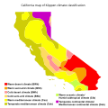 California map of Köppen climate classification.svg 1,900 × 1,900; 204 KB
-
 California-gsusa1.svg 11,845 × 10,536; 513 KB
-
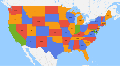
 Census Regions and Division of the United States.svg 942 × 719; 1.27 MB
-
 Contiguous-united-states-with-district-of-columbia-four-color-map.svg 2,500 × 1,374; 1.35 MB
-
 Corn belt.svg 844 × 647; 2.71 MB
-
 Death penalty in the United States.svg 959 × 593; 59 KB
-
 Death penalty statutes in the United States-2011-10-03.svg 1,050 × 600; 188 KB
-
 Death penalty statutes in the United States.svg 1,015 × 593; 116 KB
-
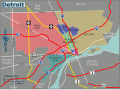 Detroit districts map.svg 639 × 475; 448 KB
-
 Dominican province boundaries United States.svg 905 × 591; 201 KB
-
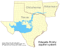 Edwards-Trinity aquifer system v1.svg 821 × 661; 636 KB
-
 ELCA Region2 synods.svg 400 × 496; 179 KB
-
 Electoral College 1908.svg 1,182 × 593; 244 KB
-
 Electoral College 1916.svg 1,182 × 593; 245 KB
-
 Electoral College 1928.svg 1,182 × 593; 242 KB
-
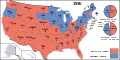
 Electoral College 1932.svg 1,182 × 593; 243 KB
-
 Electoral College 2012.svg 1,020 × 593; 35 KB
-
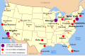
 Essential Air Service Locations.svg 900 × 564; 2.69 MB
-
 Federal Reserve Districts Map.svg 931 × 592; 710 KB
-
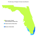 Florida map of Köppen climate classification.svg 1,900 × 1,900; 81 KB
-
 Florida topographic map-en.svg 2,890 × 2,810; 2.51 MB
-
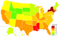 Gini United States by state 2019.svg 512 × 324; 204 KB
-

-
 Idaho map of Köppen climate classification.svg 1,900 × 1,900; 180 KB
-
 Illinois map of Köppen climate classification.svg 1,900 × 1,900; 101 KB
-
 Indiana map of Köppen climate classification.svg 1,900 × 1,900; 105 KB
-
 Indigenous Americans by state.svg 1,199 × 593; 73 KB
-
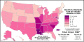 Intentional Homicide Rate by U.S. State.svg 1,199 × 593; 72 KB
-
 Iowa map of Köppen climate classification.svg 1,900 × 1,305; 60 KB
-
 Kansas map of Köppen climate classification.svg 1,900 × 1,305; 98 KB
-
 LGBT Curricular Laws in the United States.svg 959 × 593; 63 KB
-
 Maine map of Köppen climate classification.svg 1,900 × 1,900; 90 KB
-
 Major sports by state.svg 927 × 800; 90 KB
-
 Map of American urban areas by size.svg 904 × 588; 394 KB
-
 Map of collective bargaining legislation.svg 959 × 593; 274 KB
-
 Map of the Community Areas and 'Sides' of the City of Chicago.svg 612 × 792; 2.9 MB
-
 Map of USA with state names 2.svg 955 × 590; 714 KB
-
 Map of USA with state names for Wikinews on March 1 2012.svg 959 × 593; 302 KB
-
 Map of USA with state names WLM.svg 959 × 593; 137 KB
-
 Map of USA with state names.svg 959 × 593; 984 KB
-
 Map-USA-Pensacola.svg 512 × 500; 774 KB
-
 Map-USA-Regions02.svg 556 × 577; 1.29 MB
-
 Metropolitan and Micropolitan Statistical Areas of the United States and Puerto Rico.svg 3,850 × 2,446; 13.43 MB
-
 Michigan map of Köppen climate classification.svg 1,900 × 1,463; 103 KB
-
 Minnesota map of Köppen climate classification.svg 1,900 × 1,900; 113 KB
-
 Missouri Dept of Conservation Regions 2010.svg 660 × 594; 388 KB
-
 Missouri map of Köppen climate classification.svg 1,900 × 1,900; 74 KB
-
 Montana map of Köppen climate classification.svg 1,900 × 1,305; 94 KB
-
 NavajoNation map en.svg 1,729 × 1,554; 193 KB
-
 Nebraska map of Köppen climate classification.svg 1,900 × 1,305; 102 KB
-
 Nevada map of Köppen climate classification.svg 1,900 × 1,900; 193 KB
-
 New Hampshire map of Köppen climate classification.svg 1,900 × 1,900; 77 KB
-
 New Jersey map of Köppen climate classification.svg 1,900 × 1,900; 100 KB
-
 New Mexico map of Köppen climate classification.svg 1,900 × 1,900; 244 KB
-
 New York map of Köppen climate classification.svg 1,900 × 1,900; 86 KB
-
 Non-Hispanic White Americans by state.svg 1,199 × 593; 72 KB
-
 North Carolina map of Köppen climate classification.svg 1,900 × 1,085; 49 KB
-
 North Dakota map of Köppen climate classification.svg 1,900 × 1,305; 135 KB
-
 Ohio map of Köppen climate classification.svg 1,900 × 1,900; 105 KB
-
 Oklahoma map of Köppen climate classification.svg 1,900 × 1,305; 70 KB
-
 Oregon map of Köppen climate classification.svg 1,900 × 1,305; 170 KB
-
 Pennsylvania map of Köppen climate classification.svg 1,900 × 1,305; 63 KB
-
 Texas map of Köppen climate classification.svg 1,900 × 1,900; 118 KB
-
 Texas-gsusa.svg 15,188 × 11,855; 672 KB
-
 U.S. states and territories by population density.svg 959 × 593; 54 KB
-
 United States - Location Map (2013) - USA - UNOCHA.svg 254 × 254; 2.96 MB
-
 United States Census 2020 Population Change by State.svg 512 × 253; 74 KB
-
 United States Map time.gov.svg 1,256 × 790; 1.63 MB
-
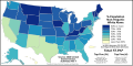
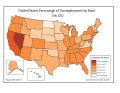 United States Unemployment 2010.svg 792 × 612; 81 KB
-
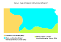
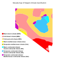
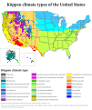 US 50 states Köppen.svg 900 × 1,071; 5.41 MB


.svg)


_-_USA_-_UNOCHA.svg)


