
Category:England photographs taken on 2007-06-26
Constituent countries of the United Kingdom: England · Northern Ireland · Scotland · Wales – British Crown dependencies: Isle of Man

Subcategories
This category has only the following subcategory.
Media in category "England photographs taken on 2007-06-26"
The following 200 files are in this category, out of 446 total.
(previous page) (next page)-
 'The Belts' and flooded field - geograph.org.uk - 479085.jpg 640 × 427; 73 KB
-

-
 A303 underpass, Cholderton - geograph.org.uk - 483942.jpg 640 × 480; 150 KB
-
 A635 road flooded at Darfield Bridge - geograph.org.uk - 480814.jpg 640 × 480; 141 KB
-
 Activeway.jpg 640 × 377; 98 KB
-
 Adelphi Stonework Detail - geograph.org.uk - 477763.jpg 640 × 402; 107 KB
-
 After Bar Brook flooded - geograph.org.uk - 561839.jpg 640 × 428; 138 KB
-
 After the flood river Dearne - geograph.org.uk - 479714.jpg 640 × 427; 74 KB
-
-
 Airedale Shopping Centre - geograph.org.uk - 478371.jpg 640 × 441; 66 KB
-
 Airedale Shopping Centre - geograph.org.uk - 478372.jpg 518 × 640; 66 KB
-
 Albert Hotel - Oakworth Road - geograph.org.uk - 478365.jpg 640 × 490; 62 KB
-
 Amberley Castle3.jpg 640 × 480; 85 KB
-
 Another view of the General Hospital - geograph.org.uk - 477945.jpg 640 × 553; 101 KB
-
-

-
 ASDA Smithdown Road - geograph.org.uk - 478375.jpg 640 × 480; 87 KB
-
 Ashworth Arms Burnley Road - geograph.org.uk - 478078.jpg 640 × 302; 54 KB
-
 Backgardens behind High Street, Eastleigh - geograph.org.uk - 478215.jpg 640 × 427; 142 KB
-
 Barclays Bank - North Street - geograph.org.uk - 478030.jpg 640 × 506; 61 KB
-
 Barley field and Humble Green masts - geograph.org.uk - 477975.jpg 640 × 480; 81 KB
-
 Barn conversion, Chalk Hill Farm - geograph.org.uk - 478405.jpg 640 × 480; 137 KB
-

-
 Belmont British Legion - geograph.org.uk - 478211.jpg 640 × 427; 89 KB
-
 Belmont station, exterior, Down side - geograph.org.uk - 478201.jpg 640 × 427; 69 KB
-
 Belmont station, Surrey - geograph.org.uk - 478121.jpg 640 × 427; 101 KB
-
-
 Beverley Road Nunthorpe - geograph.org.uk - 477691.jpg 640 × 480; 121 KB
-
 Black Horse Pub, Amberley - geograph.org.uk - 484083.jpg 640 × 480; 96 KB
-
 Blenheim Road, Eastleigh - geograph.org.uk - 478200.jpg 640 × 427; 184 KB
-
 Bodmin General Station - geograph.org.uk - 1064475.jpg 640 × 480; 113 KB
-
 Bodmin Public Rooms - geograph.org.uk - 1064189.jpg 640 × 480; 107 KB
-
 Boothferry Golf Club - geograph.org.uk - 591431.jpg 640 × 427; 62 KB
-
 Boothferry Golf Club - geograph.org.uk - 591439.jpg 640 × 427; 51 KB
-
 Bridge and Chimney - geograph.org.uk - 477743.jpg 640 × 341; 71 KB
-
 Bridges at Belmont, Surrey - geograph.org.uk - 478166.jpg 640 × 427; 107 KB
-
 Bridleway, Boscombe Down - geograph.org.uk - 479006.jpg 640 × 480; 149 KB
-
 Broadwell - geograph.org.uk - 478031.jpg 640 × 480; 105 KB
-
 Buildings on Station Hill, Eastleigh - geograph.org.uk - 478146.jpg 640 × 532; 173 KB
-
 Burnley Mill Chimneys - geograph.org.uk - 477739.jpg 640 × 322; 73 KB
-
 Burnley Road Crawshawbooth - geograph.org.uk - 478053.jpg 640 × 392; 80 KB
-
 Burstwick Drain Footbridge - geograph.org.uk - 479439.jpg 640 × 480; 150 KB
-
 Butcher Bridge and Foot Bridge June 2007 - geograph.org.uk - 722280.jpg 1,737 × 1,308; 2.24 MB
-
 Car park in Clowes Wood - geograph.org.uk - 480030.jpg 640 × 480; 78 KB
-
 Cattle below Beacon Hill - geograph.org.uk - 483939.jpg 640 × 480; 143 KB
-

-

-
 Cavendish Street - geograph.org.uk - 478393.jpg 635 × 640; 54 KB
-
-
 Chapel Rock - geograph.org.uk - 1060795.jpg 640 × 428; 48 KB
-
 Church of All Saints, Marazion - geograph.org.uk - 484592.jpg 640 × 480; 74 KB
-
-
 Cliffe Castle - geograph.org.uk - 478061.jpg 640 × 453; 69 KB
-
 Clifton viaduct - geograph.org.uk - 479799.jpg 640 × 427; 44 KB
-

-
 Common Blue near Bullpot Farm - geograph.org.uk - 485219.jpg 640 × 480; 93 KB
-

-
 Cottage garden - geograph.org.uk - 690562.jpg 640 × 480; 137 KB
-
 Cottages at Hawkchurch - geograph.org.uk - 482093.jpg 640 × 430; 81 KB
-
 Craven Heifer Burnley Road - geograph.org.uk - 478071.jpg 640 × 346; 63 KB
-
-
-
 Disused building - geograph.org.uk - 477697.jpg 640 × 480; 125 KB
-
 Disused tips on NW slope of Harland Hill - geograph.org.uk - 477846.jpg 640 × 480; 106 KB
-
 Dove Dale arch - geograph.org.uk - 553716.jpg 640 × 480; 104 KB
-
 Dove Holes - geograph.org.uk - 553725.jpg 640 × 480; 105 KB
-
 Downstream from Scarborough Bridge - geograph.org.uk - 482238.jpg 640 × 478; 142 KB
-
 East of Beacon Hill - geograph.org.uk - 478833.jpg 640 × 480; 197 KB
-
 East of Beacon Hill - geograph.org.uk - 483936.jpg 640 × 480; 141 KB
-
 Eastleigh Railway Institute, Romsey Road - geograph.org.uk - 478154.jpg 640 × 423; 194 KB
-
 All Saints' Church, Eastleigh - geograph.org.uk - 478934.jpg 640 × 453; 158 KB
-
 Entrance and gatehouse to Strode Park - geograph.org.uk - 478775.jpg 640 × 480; 54 KB
-

-

-
 Environmental Stewardship Scheme - geograph.org.uk - 481233.jpg 640 × 480; 104 KB
-
 Farm buildings at Home Farm - geograph.org.uk - 478280.jpg 640 × 480; 71 KB
-
 Farmland, Allington - geograph.org.uk - 478974.jpg 640 × 480; 138 KB
-
 Farmland, Amesbury - geograph.org.uk - 483983.jpg 640 × 480; 158 KB
-
 Farmland, Cholderton - geograph.org.uk - 478846.jpg 640 × 480; 145 KB
-
 Farmland, Newton Tony - geograph.org.uk - 478931.jpg 640 × 480; 150 KB
-
 Farmland, Newton Tony - geograph.org.uk - 478964.jpg 640 × 480; 116 KB
-
 Farmland, Newton Tony - geograph.org.uk - 483981.jpg 640 × 480; 162 KB
-
 Farmland, Newton Tony - geograph.org.uk - 483982.jpg 640 × 480; 176 KB
-
 Field of flax, Newton Tony - geograph.org.uk - 478941.jpg 640 × 480; 158 KB
-
 Flood Casualties - geograph.org.uk - 722710.jpg 1,737 × 1,308; 2.49 MB
-
 Flood Victims June 2007 - geograph.org.uk - 722757.jpg 1,737 × 1,308; 2.71 MB
-
 Flooding June 2007 - geograph.org.uk - 722301.jpg 1,697 × 1,308; 2.48 MB
-
 Floods - the day after - geograph.org.uk - 798678.jpg 640 × 480; 152 KB
-
 Floods June 2007 - geograph.org.uk - 722723.jpg 1,737 × 1,308; 2.25 MB
-
 Floods June 2007 - geograph.org.uk - 722743.jpg 1,737 × 1,308; 2.4 MB
-
 Footpath north - geograph.org.uk - 478043.jpg 640 × 480; 96 KB
-
 Fork in the bridleway - geograph.org.uk - 477634.jpg 640 × 480; 158 KB
-
 Former Military Camp Bodmin Cornwall - geograph.org.uk - 1062817.jpg 640 × 480; 77 KB
-
 Former Sefton Cinema, Smithdown Road - geograph.org.uk - 478369.jpg 640 × 480; 93 KB
-
 Foss near the barrier.jpg 640 × 478; 151 KB
-
 Gated field entrance - geograph.org.uk - 478439.jpg 640 × 480; 71 KB
-
 Gated private road near Bullockstone - geograph.org.uk - 478762.jpg 640 × 480; 66 KB
-
 GR4 Tornado over Sussex Farm - geograph.org.uk - 481485.jpg 640 × 480; 39 KB
-
 Grape Lane - geograph.org.uk - 482240.jpg 478 × 640; 143 KB
-
 Grassed Square Queen Victoria Road - geograph.org.uk - 477917.jpg 640 × 480; 165 KB
-
 Great Farm Road Eastleigh - geograph.org.uk - 478305.jpg 640 × 427; 131 KB
-
 Gypsy Corner on Radfall Road - geograph.org.uk - 480533.jpg 640 × 480; 71 KB
-
 Hanley British Legion Hall - geograph.org.uk - 480492.jpg 640 × 489; 130 KB
-
 Hawkchurch Bridleway 44 - geograph.org.uk - 482037.jpg 480 × 640; 139 KB
-
 Hellidon - geograph.org.uk - 478077.jpg 640 × 480; 108 KB
-
 Heworth Holme - geograph.org.uk - 477657.jpg 640 × 480; 140 KB
-
 Holy Trinity, Wavertree - geograph.org.uk - 477822.jpg 640 × 480; 104 KB
-

-
 Houses at Coverfields, Hanley Swan.jpg 640 × 480; 111 KB
-
 Houses at Richmond's Green - geograph.org.uk - 478046.jpg 640 × 480; 102 KB
-
 Houses on Church Street - geograph.org.uk - 481251.jpg 640 × 480; 119 KB
-
 Houses on Church Street - geograph.org.uk - 481255.jpg 640 × 480; 93 KB
-

-
 Ilam Hall 02.jpg 640 × 480; 52 KB
-
 Ilam Rock, Dove Dale - geograph.org.uk - 553722.jpg 640 × 480; 90 KB
-
 Ilam School Building - geograph.org.uk - 553742.jpg 640 × 480; 67 KB
-
 Junction Cam Road and Bands Lane - geograph.org.uk - 481010.jpg 640 × 480; 135 KB
-
 Junction of Romsey Road and Leigh Road - geograph.org.uk - 478269.jpg 640 × 427; 143 KB
-
 Friends' Meeting House - Skipton Road - geograph.org.uk - 478020.jpg 640 × 445; 62 KB
-

-
 Keighley College - North Street - geograph.org.uk - 477929.jpg 640 × 360; 44 KB
-
 Keighley Library - North Street - geograph.org.uk - 477923.jpg 640 × 384; 35 KB
-

-
-
 Lake View Park - geograph.org.uk - 477831.jpg 640 × 480; 95 KB
-
 Leasowe Castle-by-Alexander-P-Kapp.jpg 480 × 640; 179 KB
-
 Leasowe Castle2.jpg 640 × 480; 159 KB
-
 Leaving Belmont Station, Surrey - geograph.org.uk - 478140.jpg 640 × 427; 120 KB
-
 Left to Birmingham, right to Hereford - geograph.org.uk - 665326.jpg 640 × 426; 100 KB
-
 Lodge, Leasowe Castle (1)-by-Alexander-P-Kapp.jpg 480 × 640; 157 KB
-
 Lodge, Leasowe Castle-by-Alexander-P-Kapp.jpg 480 × 640; 194 KB
-

-
 Looking E along Lower Herne Road - geograph.org.uk - 478275.jpg 640 × 480; 41 KB
-
 Looking into Benny Hill Close, Eastleigh - geograph.org.uk - 478298.jpg 640 × 429; 162 KB
-

-
 Looking to Logan Rock - geograph.org.uk - 1216706.jpg 640 × 480; 81 KB
-

-
 Mansfield Woodhouse Bandstand - geograph.org.uk - 477699.jpg 480 × 640; 131 KB
-
 Market Street - geograph.org.uk - 657493.jpg 629 × 458; 63 KB
-
 Market Street, Eastleigh - geograph.org.uk - 478183.jpg 640 × 427; 158 KB
-
 Marton Shops - geograph.org.uk - 477695.jpg 640 × 480; 141 KB
-
 Marygate - geograph.org.uk - 482239.jpg 640 × 478; 137 KB
-
 Mast and trig point, Beacon Hill - geograph.org.uk - 478821.jpg 480 × 640; 116 KB
-

-
-
 Metal graveyard (again) - geograph.org.uk - 477997.jpg 640 × 480; 149 KB
-
 Metal graveyard - geograph.org.uk - 477983.jpg 640 × 480; 141 KB
-

-
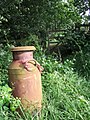 Milk churn - geograph.org.uk - 482042.jpg 480 × 640; 142 KB
-
 Mill stone at Penny Hill Mill - geograph.org.uk - 478290.jpg 640 × 427; 138 KB
-
 Mill wheel at Milldale - geograph.org.uk - 553736.jpg 640 × 480; 92 KB
-
 Milldale, Dove Dale - geograph.org.uk - 553730.jpg 640 × 480; 88 KB
-
 Millennium Car Park - geograph.org.uk - 477732.jpg 640 × 480; 134 KB
-

-
 Natland as seen from the Helm - geograph.org.uk - 483854.jpg 480 × 640; 91 KB
-
 Nether Hornpot Lane - geograph.org.uk - 482241.jpg 478 × 640; 115 KB
-
 New road works^ - geograph.org.uk - 479017.jpg 640 × 480; 70 KB
-
 Newley - geograph.org.uk - 478251.jpg 640 × 427; 247 KB
-

-
-
 Oil-seed rape, Amesbury - geograph.org.uk - 478968.jpg 640 × 480; 147 KB
-
 Old County Court Buildings - geograph.org.uk - 477724.jpg 640 × 380; 69 KB
-
 Old Driving Range - geograph.org.uk - 583458.jpg 640 × 427; 73 KB
-
 Old House on Church Street - geograph.org.uk - 481256.jpg 640 × 480; 97 KB
-
 Old Thatched Cottages - geograph.org.uk - 484076.jpg 640 × 480; 110 KB
-
 Opium poppies - geograph.org.uk - 479000.jpg 427 × 640; 166 KB
-
 Park House Motel and the A338 - geograph.org.uk - 478890.jpg 640 × 480; 124 KB
-
 Park Place, Herne - geograph.org.uk - 478434.jpg 640 × 480; 71 KB
-
 Park Plaza, Hayes Way, Heath Hayes - geograph.org.uk - 478052.jpg 640 × 480; 74 KB
-
 Partridge by the hedge - geograph.org.uk - 482111.jpg 480 × 640; 148 KB
-
 Pasture beneath Beacon Hill - geograph.org.uk - 483927.jpg 640 × 480; 124 KB
-

-

-
 Penny Hill Mill.jpg 640 × 427; 113 KB
-
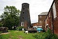
 Penny Hill windmill - geograph.org.uk - 478278.jpg 640 × 427; 96 KB
-
 Penny Hill windmill - geograph.org.uk - 478293.jpg 427 × 640; 110 KB
-
 Penny Hill windmill - geograph.org.uk - 478297.jpg 640 × 427; 98 KB
-

-
 Pheasant Inn, Casterton - geograph.org.uk - 477909.jpg 640 × 480; 92 KB
-
 Pill box on the hillside - geograph.org.uk - 479063.jpg 640 × 480; 62 KB
-
-
 Pluto Road, Eastleigh - geograph.org.uk - 480244.jpg 640 × 427; 160 KB
-
 Ponsmere Hotel - geograph.org.uk - 1060790.jpg 640 × 428; 43 KB
-
 Poppies, Amesbury - geograph.org.uk - 478983.jpg 640 × 480; 168 KB
-
 Poppy crop - geograph.org.uk - 479018.jpg 640 × 427; 128 KB
-
 Poppy heads - geograph.org.uk - 479007.jpg 427 × 640; 150 KB
-
 Poppy seed heads - geograph.org.uk - 479025.jpg 640 × 427; 151 KB
-

-

-
 Priory Rd - Flooded - geograph.org.uk - 546180.jpg 640 × 480; 86 KB
-

-
-
 Public conveniences, Praa Sands - geograph.org.uk - 484541.jpg 640 × 480; 74 KB
-

-
 Reindeer - geograph.org.uk - 477754.jpg 640 × 475; 99 KB
-
 Reindeer Brickwork Detail - geograph.org.uk - 477894.jpg 640 × 480; 123 KB
-
 Reindeer with Adelphi in Background - geograph.org.uk - 477758.jpg 640 × 480; 90 KB
-
 Ripening barley near Rickland Farm - geograph.org.uk - 478022.jpg 640 × 480; 113 KB
-
 River Dove, Dove Dale - geograph.org.uk - 553709.jpg 640 × 480; 77 KB
-
 River Leen - Salmon ladder - geograph.org.uk - 801854.jpg 640 × 480; 122 KB


-by-Alexander-P-Kapp.jpg)


_-_geograph.org.uk_-_477997.jpg)


