Category:Enceinte de Placey
Jump to navigation
Jump to search
| Object location | | View all coordinates using: OpenStreetMap |
|---|
|
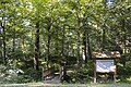
This building is inscrit au titre des monuments historiques de la France. It is indexed in the base Mérimée, a database of architectural heritage maintained by the French Ministry of Culture, under the reference PA00135332
|
 | |||||
| Upload media | |||||
| Instance of | |||||
|---|---|---|---|---|---|
| Location | Placey, canton of Audeux, Doubs, Bourgogne-Franche-Comté, Metropolitan France, France | ||||
| Street address |
| ||||
| Heritage designation |
| ||||
 | |||||
Media in category "Enceinte de Placey"
The following 15 files are in this category, out of 15 total.
-
 Le chatelard - Motte castrale de Placey 01.JPG 3,648 × 2,736; 2.36 MB
-
 Le chatelard - Motte castrale de Placey 02.JPG 3,648 × 2,736; 2.4 MB
-
 Le chatelard - Motte castrale de Placey 03.JPG 3,648 × 2,736; 2.43 MB
-
 Placey (Doubs) Motte féodale hdsr 1Ds MkIII 0892.jpg 5,616 × 3,744; 11.5 MB
-
 Placey (Doubs) Motte féodale hdsr 1Ds MkIII 0894.jpg 3,744 × 5,616; 10.78 MB
-
 Placey (Doubs) Motte féodale hdsr 1Ds MkIII 0895.jpg 5,616 × 3,744; 10.81 MB
-
 Placey (Doubs) Motte féodale hdsr 1Ds MkIII 0896.jpg 5,457 × 3,638; 11.83 MB
-
 Placey (Doubs) Motte féodale hdsr 1Ds MkIII 0897.jpg 3,744 × 5,616; 12.47 MB
-
 Placey (Doubs) Motte féodale hdsr 1Ds MkIII 0907.jpg 5,616 × 3,744; 12.18 MB
-
 Placey (Doubs) Motte féodale hdsr 1Ds MkIII 0908.jpg 5,616 × 3,744; 14.32 MB
-
 Placey (Doubs) Motte féodale hdsr 1Ds MkIII 0909.jpg 5,616 × 3,744; 10.81 MB
-
 Placey (Doubs) Motte féodale hdsr 1Ds MkIII 0910.jpg 3,744 × 5,616; 11.49 MB
-
 Placey, l'enceinte féodale (2).jpg 6,016 × 4,000; 3.89 MB
-
 Placey, l'enceinte féodale (3).jpg 5,718 × 3,802; 3.35 MB
-
 Placey, l'enceinte féodale.jpg 5,849 × 3,889; 3.07 MB


_Motte_f%C3%A9odale_hdsr_1Ds_MkIII_0892.jpg)
_Motte_f%C3%A9odale_hdsr_1Ds_MkIII_0894.jpg)
_Motte_f%C3%A9odale_hdsr_1Ds_MkIII_0895.jpg)
_Motte_f%C3%A9odale_hdsr_1Ds_MkIII_0896.jpg)
_Motte_f%C3%A9odale_hdsr_1Ds_MkIII_0897.jpg)
_Motte_f%C3%A9odale_hdsr_1Ds_MkIII_0907.jpg)
_Motte_f%C3%A9odale_hdsr_1Ds_MkIII_0908.jpg)
_Motte_f%C3%A9odale_hdsr_1Ds_MkIII_0909.jpg)
_Motte_f%C3%A9odale_hdsr_1Ds_MkIII_0910.jpg)
.jpg)
.jpg)
