Category:Emstunnel
Jump to navigation
Jump to search
| Object location | | View all coordinates using: OpenStreetMap |
|---|
architectural structure  | |||||
| Upload media | |||||
| Instance of | |||||
|---|---|---|---|---|---|
| Location | Jemgum, Leer, Lower Saxony, Germany | ||||
| Carries | |||||
| Inception |
| ||||
| Date of official opening |
| ||||
 | |||||
Subcategories
This category has only the following subcategory.
A
Media in category "Emstunnel"
The following 21 files are in this category, out of 21 total.
-
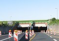 Emstunnel 01.jpg 776 × 541; 183 KB
-
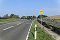
 Emstunneleinfahrt - panoramio.jpg 2,830 × 1,113; 453 KB
-
 Jemgum - Emstunnel (Soltborg) 01 ies.jpg 5,616 × 3,744; 18.03 MB
-
 Jemgum - Emstunnel (Soltborg) 02ies.jpg 5,616 × 3,744; 18.63 MB
-
 Jemgum - Emstunnel (Soltborg) 03 ies.jpg 5,616 × 3,744; 18.33 MB
-
 Jemgum - Emstunnel (Soltborg) 04 ies.jpg 5,616 × 3,744; 18.18 MB
-
 Jemgum - Emstunnel (Soltborg) 05 ies.jpg 5,616 × 3,743; 19.44 MB
-
 Jemgum - Soltborg + Emstunnel 01 ies.jpg 5,616 × 3,744; 24.72 MB
-
 Jemgum - Soltborg + Emstunnel 02 ies.jpg 5,616 × 3,744; 28.52 MB
-
 Jemgum - Soltborg + Emstunnel 03 ies.jpg 5,616 × 3,744; 26.47 MB
-
 Jemgum - Soltborg + Emstunnel 04 ies.jpg 5,616 × 3,744; 23.39 MB
-
 Jemgum - Soltborg + Emstunnel 05 ies.jpg 5,616 × 3,744; 18.44 MB
-
 Jemgum - Soltborg + Emstunnel 06 ies.jpg 5,616 × 3,744; 22.09 MB
-
 Leer - A31 - Emstunnel (Deich) 01 ies.jpg 5,616 × 3,744; 20.82 MB
-
 Leer - A31 - Emstunnel (Deich) 02 ies.jpg 5,616 × 3,744; 19.25 MB
-
 Leer - A31 - Emstunnel (Deichstraße) 01 ies.jpg 5,616 × 3,744; 16.54 MB
-
 Leer - A31 - Emstunnel (Deichstraße) 02 ies.jpg 5,616 × 3,744; 17.78 MB
-
 Leer - A31 - Emstunnel (Deichstraße) 03 ies.jpg 5,616 × 3,744; 15.73 MB
-
 Leer - A31 - Emstunnel (Deichstraße) 04 ies.jpg 5,616 × 3,744; 15.96 MB
-
 Leer - Deichstraße + A31 - Emstunnel (Deich) 01 ies.jpg 5,616 × 3,744; 19.07 MB
-
 Leer - Harderwykensteg - Brunnenstraße - 39 09 ies.jpg 5,616 × 3,744; 16.59 MB
_01_ies.jpg)
_02ies.jpg)
_03_ies.jpg)
_04_ies.jpg)
_05_ies.jpg)


_01_ies.jpg)
_02_ies.jpg)
_01_ies.jpg)
_02_ies.jpg)
_03_ies.jpg)
_04_ies.jpg)
_01_ies.jpg)
