Category:Emmaus-Kapelle (Stetten im Remstal)
Jump to navigation
Jump to search
| Object location | | View all coordinates using: OpenStreetMap |
|---|
 | |||||
| Upload media | |||||
| Instance of | |||||
|---|---|---|---|---|---|
| Part of | |||||
| Location | Kernen im Remstal, Rems-Murr, Stuttgart Government Region, Baden-Württemberg, Germany | ||||
 | |||||
Media in category "Emmaus-Kapelle (Stetten im Remstal)"
The following 3 files are in this category, out of 3 total.
-
 Diakonie Stetten Aussegnungshalle (2).jpg 3,648 × 2,736; 1.78 MB
-
 Diakonie Stetten Aussegnungshalle.jpg 3,648 × 2,736; 2.18 MB
-
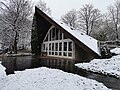 Emmaus-Kapelle Stetten (Winter).jpg 3,648 × 2,736; 4.14 MB
.jpg)
.jpg)