Category:Emathia
Jump to navigation
Jump to search
ancient region of northern Greece | |||||
| Upload media | |||||
| Instance of | |||||
|---|---|---|---|---|---|
| Culture | |||||
 | |||||
English: Emathia in origin is the Greek term for the country around the central plain of Macedonia. Until modern times it was a lake or a bay of the Thermaic Gulf, with the states or districts around it peripherally. Moving in from Upper Macedonia the Macedonians took it over state by state replacing the former population and calling it Lower Macedonia. Eventually the term came to refer to the entire country of geopolitical Macedon. Emathia was generally used by poetry. It differed from the term Macedon by refering also to the country when it was still pre-Macedonian palaeo-Balkan states, although the word is from proto-Greek and not from the other languages of the Balkans. The category contains subcategories relevant to the features and peoples of Emathia.
Subcategories
This category has the following 4 subcategories, out of 4 total.
B
S
T
Media in category "Emathia"
The following 20 files are in this category, out of 20 total.
-
"Macedonia, epirus et achaia. " (22065786899).jpg 3,720 × 3,102; 1.87 MB
-
Beroia location.jpg 516 × 567; 47 KB
-
Bisaltia (Calcídica).png 2,000 × 1,365; 914 KB
-
Bottema’s reconstructions of the growth of the Thessaloniki Plain.png 1,278 × 958; 1.23 MB
-
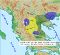
Growth of the ancient Greek Kingdom of Macedon (English)v3.svg 547 × 505; 510 KB
-
Loudias.jpg 6,016 × 4,000; 5.32 MB
-
Macedonia and the Aegean World c.200 el.png 750 × 599; 385 KB
-
Macedonian Kingdom.jpg 1,226 × 832; 671 KB
-
Map of the ancient Greek Kingdom of Macedon (with settlements) (English).svg 1,453 × 960; 2.55 MB
-
Map of the ancient Greek Kingdom of Macedon (without settlements) (English).svg 1,453 × 960; 2.48 MB
-
Map of the ancient kingdom of Macedon (Spanish).svg 2,000 × 1,365; 1.47 MB
-
Map of the Paeonian Tribes (English).svg 1,621 × 1,186; 2.49 MB
-
Nea Nikomedeia Excavation of an Early Neolithic house.png 804 × 538; 935 KB
-
Parc Axios wiki.png 891 × 1,007; 673 KB
-
Partial Tribal ethnes Map prior to the expansion of Macedon (English).svg 517 × 340; 2.76 MB
-
PieriaPieresExpulsionMapb.jpg 605 × 494; 293 KB
-
RomanConquests - Greece.png 1,448 × 991; 1.08 MB
-
Topographic map of Macedonia (Greece).svg 802 × 570; 3.38 MB


