Category:Elvington, North Yorkshire
Jump to navigation
Jump to search
village and civil parish in North Yorkshire, England, UK | |||||
| Upload media | |||||
| Instance of | |||||
|---|---|---|---|---|---|
| Location | City of York, North Yorkshire, Yorkshire and the Humber, England | ||||
| Population |
| ||||
 | |||||
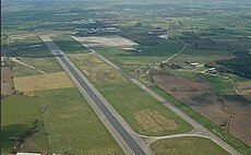
English: Elvington is a village and civil parish situated approximately south-east of York, England, on the B1228 York-Howden road. According to the 2001 census the parish had a population of 1,212. The River Derwent forms part of the parish boundary and an ancient stone bridge connects Elvington with Sutton upon Derwent.
Nederlands: Elvington, North Yorkshire is een plaats in het bestuurlijke gebied York, in het Engelse graafschap North Yorkshire. De plaats telt 1212 inwoners.
Subcategories
This category has the following 12 subcategories, out of 12 total.
B
C
- Cheesecake Farm, Elvington (10 F)
E
- Elvington Lane (22 F)
F
- Fields in Elvington CP (32 F)
M
- Main Street, Elvington (3 F)
R
S
- Sutton Bridge, Yorkshire (6 F)
Y
Media in category "Elvington, North Yorkshire"
The following 53 files are in this category, out of 53 total.
-
A farm track to the north of Wheldrake - geograph.org.uk - 2277573.jpg 800 × 600; 212 KB
-
B1228 towards York - geograph.org.uk - 2359373.jpg 1,600 × 1,200; 481 KB
-
Boats on River Derwent - geograph.org.uk - 722875.jpg 1,744 × 1,308; 1.12 MB
-
Cottage Inscription - geograph.org.uk - 2749213.jpg 435 × 1,024; 114 KB
-
Cottage on the corner of Church Lane Elvington - geograph.org.uk - 2749189.jpg 1,024 × 768; 180 KB
-
Cows Grazing - geograph.org.uk - 1347739.jpg 640 × 480; 74 KB
-
Dauby Lane - geograph.org.uk - 5354258.jpg 640 × 427; 205 KB
-
Dauby Lane and footpath sign - geograph.org.uk - 5354377.jpg 640 × 427; 255 KB
-
Downstream on the Derwent - geograph.org.uk - 482398.jpg 478 × 640; 123 KB
-
Holy Trinity Church, Elvington - geograph.org.uk - 224358.jpg 284 × 431; 19 KB
-
Elvington - geograph.org.uk - 109042.jpg 640 × 426; 140 KB
-
Elvington Harriers - small.png 217 × 274; 210 KB
-
Elvington Lock - geograph.org.uk - 1580576.jpg 640 × 480; 76 KB
-
Elvington Lock - geograph.org.uk - 6167346.jpg 1,024 × 768; 250 KB
-
Elvington Ordnance Survey Trig Pillar - geograph.org.uk - 3846936.jpg 1,024 × 680; 207 KB
-
Elvington Primary School - geograph.org.uk - 353999.jpg 640 × 480; 48 KB
-
Elvington Village - geograph.org.uk - 1347815.jpg 640 × 480; 101 KB
-
Elvington Village Green with Maypole - geograph.org.uk - 5850452.jpg 663 × 446; 119 KB
-
Entrance to Elvington Industrial Estate - geograph.org.uk - 4105011.jpg 800 × 600; 152 KB
-
Entrance to Grange Farm - geograph.org.uk - 6236437.jpg 1,024 × 768; 143 KB
-
Entrance to recreation ground, Elvington - geograph.org.uk - 2359369.jpg 1,600 × 1,200; 467 KB
-
Farm track to Grey Leys Farm - geograph.org.uk - 4077778.jpg 1,600 × 1,064; 734 KB
-
Field with trig point - geograph.org.uk - 5626192.jpg 1,500 × 1,125; 1.75 MB
-
Fishing lake at Heeling Bottoms - geograph.org.uk - 6850623.jpg 5,184 × 3,888; 5.56 MB
-
Flatford - geograph.org.uk - 482396.jpg 640 × 478; 131 KB
-
Floods at Sutton upon Derwent - geograph.org.uk - 3280061.jpg 1,024 × 768; 145 KB
-
Gated farm track, Elvington - geograph.org.uk - 2359366.jpg 1,600 × 1,200; 422 KB
-
Intake at the water treatment works near Elvington - geograph.org.uk - 3931515.jpg 1,600 × 1,200; 494 KB
-
Lock keeper's cottage, Elvington Lock - geograph.org.uk - 5411913.jpg 640 × 624; 458 KB
-
Old Guide Stone by Dauby Lane, Elvington (geograph 6083912).jpg 480 × 640; 374 KB
-
Road towards Broad Oak Farm - geograph.org.uk - 5354388.jpg 640 × 427; 190 KB
-
Service station on the B1228 - geograph.org.uk - 2359375.jpg 1,600 × 1,200; 280 KB
-
Small Elvington Harriers logo.jpg 217 × 274; 38 KB
-
Snow covered green - geograph.org.uk - 2202063.jpg 640 × 480; 270 KB
-
Sutton Lock, River Derwent - geograph.org.uk - 139101.jpg 640 × 480; 133 KB
-
The lane to Grey Leys Farm - geograph.org.uk - 4026798.jpg 1,600 × 1,200; 812 KB
-
The river at Sutton on Derwent - geograph.org.uk - 3543593.jpg 3,240 × 4,320; 1.76 MB
-
The River Derwent at Elvington - geograph.org.uk - 108165.jpg 640 × 480; 84 KB
-
The Village Green, Elvington - geograph.org.uk - 2749186.jpg 1,024 × 768; 166 KB
-
The Village Store, Elvington - geograph.org.uk - 2749228.jpg 1,024 × 768; 149 KB
-
Track to Grange Farm - geograph.org.uk - 2359390.jpg 1,600 × 1,200; 346 KB
-
Upstream from Sutton Bridge - geograph.org.uk - 482399.jpg 640 × 478; 121 KB
-
West House farm - geograph.org.uk - 1347737.jpg 640 × 480; 72 KB
-
Wheldrake Lake and windmill - geograph.org.uk - 2361414.jpg 1,600 × 1,178; 450 KB
-
White House Grove, Elvington - geograph.org.uk - 2359367.jpg 1,600 × 1,200; 288 KB
-
Windpump, Elvington Brickyard - geograph.org.uk - 1039734.jpg 480 × 640; 81 KB
-
Windpump, Elvington Brickyard - geograph.org.uk - 1039737.jpg 480 × 640; 102 KB
-
York- Elvington Hall Swimming Pool.jpg 3,501 × 2,310; 7.22 MB
-
Elvington - geograph.org.uk - 482397.jpg 478 × 640; 145 KB
-
Elvington industrial estate - geograph.org.uk - 482394.jpg 640 × 478; 127 KB
-
Elvington Village Green - geograph.org.uk - 107808.jpg 480 × 640; 139 KB


