Category:Eltringham
Jump to navigation
Jump to search
English: Eltringham is a hamlet in the civil parish of Prudhoe, in the county of Northumberland, England.
settlement and former civil parish in Northumberland, England | |||||
| Upload media | |||||
| Instance of |
| ||||
|---|---|---|---|---|---|
| Location | Prudhoe, Northumberland, North East England, England | ||||
 | |||||
Media in category "Eltringham"
The following 20 files are in this category, out of 20 total.
-
 Eltringham byway east of Oakwood - geograph.org.uk - 2601362.jpg 1,024 × 768; 355 KB
-
 Eltringham Farm - geograph.org.uk - 2601416.jpg 1,024 × 768; 317 KB
-
 Eltringham Farm - geograph.org.uk - 2601511.jpg 1,024 × 768; 294 KB
-
 Eltringham Farm - geograph.org.uk - 2601567.jpg 1,024 × 768; 337 KB
-
 Eltringham House from the west - geograph.org.uk - 2601606.jpg 1,024 × 769; 270 KB
-
 Eltringham Wood - geograph.org.uk - 2599534.jpg 1,024 × 768; 406 KB
-
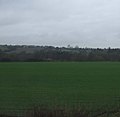 Farmland near Eltringham - geograph.org.uk - 3434589.jpg 640 × 625; 32 KB
-
 Field of Barley, Eltringham - geograph.org.uk - 3526363.jpg 3,264 × 2,448; 3.83 MB
-
 Footpath heading East to Eltringham House - geograph.org.uk - 3858555.jpg 3,264 × 2,448; 3.05 MB
-
 Footpath looking West near Eltringham House - geograph.org.uk - 3852545.jpg 3,264 × 2,448; 4.57 MB
-
 Level Crossing on Railway - geograph.org.uk - 235864.jpg 640 × 480; 116 KB
-
 Looking East on the Track at Eltringham - geograph.org.uk - 3852516.jpg 3,264 × 2,448; 4.77 MB
-

-
 Meadow east of Eltringham Wood - geograph.org.uk - 2599566.jpg 1,024 × 768; 240 KB
-
 Railway on river wall below Eltringham - geograph.org.uk - 3696636.jpg 1,024 × 768; 273 KB
-
 Railway on river wall below Eltringham - geograph.org.uk - 3696655.jpg 1,024 × 768; 270 KB
-
 Railway river wall below Eltringham Scar - geograph.org.uk - 3700901.jpg 1,024 × 768; 305 KB
-
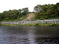 River Tyne below Eltringham Scar - geograph.org.uk - 3696942.jpg 1,024 × 768; 282 KB
-

-
 Track west of Eltringham Farm - geograph.org.uk - 2601785.jpg 1,024 × 768; 304 KB


