Category:Elstronwick
Jump to navigation
Jump to search
English: Elstronwick is a village and civil parish in the East Riding of Yorkshire, England, in an area known as Holderness. It is situated approximately 3.5 miles (5.6 km) north east of the town of Hedon and 1.5 miles (2.4 km) north west of the village of Burton Pidsea.
village in the East Riding of Yorkshire, England, United Kingdom  | |||||
| Upload media | |||||
| Instance of | |||||
|---|---|---|---|---|---|
| Location | East Riding of Yorkshire, Yorkshire and the Humber, England | ||||
| Population |
| ||||
 | |||||
Subcategories
This category has the following 4 subcategories, out of 4 total.
D
- Danthorpe (14 F)
L
- Lelley Windmill (13 F)
Media in category "Elstronwick"
The following 132 files are in this category, out of 132 total.
-
 11,000V Power Lines - geograph.org.uk - 45483.jpg 640 × 475; 62 KB
-
 A Bridleway off Lelley Road - geograph.org.uk - 2073263.jpg 800 × 600; 208 KB
-
 Alongside Nuttles Drain - geograph.org.uk - 5623372.jpg 1,024 × 768; 186 KB
-
 An animal feed mill at Daisy Hill - geograph.org.uk - 2073352.jpg 800 × 600; 187 KB
-
 Back Lane Elstronwick.jpg 640 × 458; 91 KB
-
 Back lane to Elstronwick - geograph.org.uk - 2100579.jpg 800 × 600; 324 KB
-
 Back Lane, Elstronwick - geograph.org.uk - 2063100.jpg 800 × 600; 215 KB
-
 Back Lane, Elstronwick - geograph.org.uk - 4666187.jpg 640 × 510; 452 KB
-
 Back Lane, Elstronwick - geograph.org.uk - 6797853.jpg 1,024 × 666; 197 KB
-
 Bales near Lelley - geograph.org.uk - 4666218.jpg 640 × 456; 466 KB
-
 Barn near Yew Tree Farm, Elstronwick - geograph.org.uk - 6372655.jpg 640 × 480; 74 KB
-
 Barn on Newfield Lane - geograph.org.uk - 6619854.jpg 1,600 × 1,065; 714 KB
-
 Bown Hill, Elstronwick - geograph.org.uk - 329904.jpg 640 × 480; 101 KB
-
 Bown Hill, near Elstronwick - geograph.org.uk - 5078512.jpg 640 × 458; 177 KB
-
 Bownhill Lane at Lelleyfield House - geograph.org.uk - 6487308.jpg 1,024 × 768; 210 KB
-
 Braemere, Elstronwick - geograph.org.uk - 329834.jpg 640 × 481; 99 KB
-
 Bridge Farm - geograph.org.uk - 71893.jpg 640 × 480; 86 KB
-
 Bridleway at Highfield Farm, Elstronwick - geograph.org.uk - 6620735.jpg 1,600 × 1,065; 427 KB
-
 Bridleway to Sproatley - geograph.org.uk - 5479493.jpg 1,024 × 768; 224 KB
-
 Brownhill Lane off Fieldend Lane - geograph.org.uk - 6619861.jpg 1,600 × 1,065; 462 KB
-
 Brownhill Lane towards Elstronwick - geograph.org.uk - 2211146.jpg 800 × 600; 208 KB
-
 Burton Pidsea Drain - geograph.org.uk - 6372661.jpg 800 × 600; 148 KB
-

-
 Chopped Rapeseed Crop - geograph.org.uk - 1968703.jpg 3,648 × 2,736; 4.55 MB
-
 Cold corner - geograph.org.uk - 5623421.jpg 1,024 × 768; 207 KB
-
 Cottages near Elstronwick - geograph.org.uk - 6797861.jpg 1,024 × 640; 203 KB
-
 Daisy Hill, Elstronwick - geograph.org.uk - 329840.jpg 640 × 439; 69 KB
-
 Daisy Hill, near Burstwick - geograph.org.uk - 5078514.jpg 640 × 480; 184 KB
-
 Danthorpe cottages - geograph.org.uk - 4666176.jpg 640 × 457; 467 KB
-
 Danthorpe Hall driveway - geograph.org.uk - 4666140.jpg 480 × 640; 467 KB
-
 Danthorpe Road towards Danthorpe - geograph.org.uk - 2100571.jpg 800 × 600; 215 KB
-

-
 Derelict Lelley Mill from bridleway through fields - geograph.org.uk - 6239621.jpg 4,600 × 3,444; 5.64 MB
-
 Driveway on Back Lane, Elstronwick - geograph.org.uk - 6372153.jpg 4,432 × 3,148; 5.02 MB
-

-

-
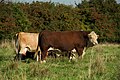 Elstronwick cattle - geograph.org.uk - 4666239.jpg 640 × 427; 498 KB
-
 Elstronwick Grange - geograph.org.uk - 329924.jpg 640 × 462; 148 KB
-
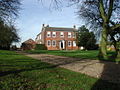 Elstronwick House.jpg 640 × 481; 122 KB
-
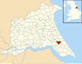 Elstronwick UK parish locator map.svg 1,425 × 1,107; 1.68 MB
-
 Elstronwick Village - geograph.org.uk - 45474.jpg 640 × 480; 110 KB
-
 Entering Danthorpe - geograph.org.uk - 6372644.jpg 800 × 600; 113 KB
-
 Entering Danthorpe on Southfield Lane - geograph.org.uk - 4982599.jpg 5,184 × 3,888; 7.38 MB
-
 Entering Elstronwick - geograph.org.uk - 6372649.jpg 800 × 547; 100 KB
-
 Farm road by Daisy Hill Cottages - geograph.org.uk - 6487305.jpg 1,024 × 768; 180 KB
-
 Farm track (bridleway), Danthorpe - geograph.org.uk - 6372647.jpg 800 × 510; 190 KB
-
 Farm-Factory - geograph.org.uk - 15394.jpg 640 × 356; 59 KB
-
 Field and hedgerow near Willow Toft - geograph.org.uk - 5621752.jpg 1,024 × 768; 197 KB
-
 Field edge near Willow Toft - geograph.org.uk - 5621758.jpg 1,024 × 768; 210 KB
-
 Field near Danthorpe Hall - geograph.org.uk - 5621749.jpg 1,024 × 768; 203 KB
-
 Field of oilseed rape and Lelleyfield House - geograph.org.uk - 5621815.jpg 1,024 × 756; 160 KB
-
 Field of oilseed rape at Elstronwick - geograph.org.uk - 5621812.jpg 1,024 × 768; 224 KB
-
 Field path towards Humbleton - geograph.org.uk - 6793855.jpg 1,024 × 768; 151 KB
-
 Fieldend Lane, near Burton Pidsea - geograph.org.uk - 5078509.jpg 640 × 473; 170 KB
-
 Footbridge over Southfield Drain, Elstronwick closed - geograph.org.uk - 6620720.jpg 1,600 × 1,065; 763 KB
-
 Footbridge over Southfield Drain, Elstronwick closed - geograph.org.uk - 6620723.jpg 1,600 × 1,065; 826 KB
-
 Footbridge over Southfield Drain, Elstronwick closed - geograph.org.uk - 6620728.jpg 1,600 × 1,065; 1,022 KB
-
 Footbridge, Burton Pidsea Drain - geograph.org.uk - 6503080.jpg 1,024 × 768; 281 KB
-
 Footpath to Burton Pidsea - geograph.org.uk - 2459111.jpg 3,648 × 2,528; 3.43 MB
-
 Fox Covert Drain - geograph.org.uk - 6793852.jpg 1,024 × 768; 179 KB
-
 Front Lane, Elstronwick - geograph.org.uk - 2063090.jpg 800 × 600; 204 KB
-
 Front Lane, Elstronwick - geograph.org.uk - 4666196.jpg 640 × 480; 450 KB
-
 Front Lane, Elstronwick - geograph.org.uk - 5621829.jpg 1,024 × 768; 200 KB
-
 Front Lane, Elstronwick - geograph.org.uk - 5624207.jpg 1,024 × 768; 141 KB
-
 Front Lane, Elstronwick - geograph.org.uk - 6619893.jpg 1,600 × 1,065; 663 KB
-
 Geese at Lelley Grange - geograph.org.uk - 4666224.jpg 640 × 465; 416 KB
-
 Honeypots Lane sign, Elstronwick - geograph.org.uk - 6619891.jpg 1,600 × 1,065; 658 KB
-
 Honeypots Lane towards Elstronwick - geograph.org.uk - 6619870.jpg 1,600 × 1,069; 663 KB
-
 Honeypots Lane, Elstronwick - geograph.org.uk - 6619888.jpg 1,600 × 1,065; 555 KB
-
 House on Back Lane, Elstronwick - geograph.org.uk - 6372155.jpg 4,360 × 3,012; 2.93 MB
-
 House on Back Lane, Elstronwick - geograph.org.uk - 6620109.jpg 1,600 × 1,065; 762 KB
-
 Houses on Front Lane, Elstronwick - geograph.org.uk - 6372652.jpg 640 × 425; 70 KB
-
 Humbleton Beck - geograph.org.uk - 273479.jpg 640 × 447; 119 KB
-
 Humbleton Beck - geograph.org.uk - 273566.jpg 480 × 640; 153 KB
-
 Humbleton Moor - geograph.org.uk - 448262.jpg 640 × 447; 94 KB
-
 Humbleton Road, Lelley - geograph.org.uk - 6366604.jpg 640 × 482; 118 KB
-
 Humbleton Road, Lelley - geograph.org.uk - 6366607.jpg 4,692 × 3,072; 3.64 MB
-
 Lelley Balk - geograph.org.uk - 2434926.jpg 3,648 × 2,736; 3.28 MB
-
 Lelley Balk - geograph.org.uk - 5621519.jpg 1,024 × 768; 234 KB
-
 Lelley Balk - geograph.org.uk - 5621558.jpg 1,024 × 768; 174 KB
-
 Lelley Croft off White's Close Lane - geograph.org.uk - 6619858.jpg 1,600 × 1,065; 524 KB
-
 Lelley Dike Farm - geograph.org.uk - 5624203.jpg 1,024 × 768; 109 KB
-
 Lelley Grange on White's Close Lane - geograph.org.uk - 6619856.jpg 1,600 × 1,065; 916 KB
-
 Lelley Grange, Elstronwick - geograph.org.uk - 329909.jpg 640 × 408; 82 KB
-
 Lelley Mill - geograph.org.uk - 6487316.jpg 1,024 × 768; 184 KB
-
 Lelley Mill from bridleway through fields to Newfield Lane - geograph.org.uk - 6239599.jpg 3,065 × 2,299; 2.43 MB
-
 Lelley village - geograph.org.uk - 6487322.jpg 1,024 × 768; 147 KB
-
 Lelleyfield House on Brownhill Lane - geograph.org.uk - 6619865.jpg 1,600 × 1,065; 579 KB
-
 Looking down Lelley Road towards Lelley - geograph.org.uk - 2073277.jpg 800 × 600; 211 KB
-
 Looking east towards Stock Dove Shaw - geograph.org.uk - 2745937.jpg 800 × 600; 106 KB
-

-
 Methodist Church on Front Lane, Elstronwick - geograph.org.uk - 6620690.jpg 1,600 × 1,065; 689 KB
-
 Methodist church, Elstronwick - geograph.org.uk - 5624229.jpg 1,024 × 768; 174 KB
-
 Mill View Offices, near Burstwick - geograph.org.uk - 5078517.jpg 640 × 470; 178 KB
-
 Millennium beacon at Elstronwick - geograph.org.uk - 5624225.jpg 1,024 × 768; 225 KB
-
 Newfield Road, Lelley - geograph.org.uk - 2073307.jpg 800 × 600; 310 KB
-
 North Field - geograph.org.uk - 5621553.jpg 1,024 × 768; 134 KB
-
 Nuttles Drain - geograph.org.uk - 5621517.jpg 1,024 × 768; 310 KB
-
 Paddocks and stabling at Elstronwick - geograph.org.uk - 6487312.jpg 1,024 × 768; 203 KB
-
 Ploughing near Humbleton - geograph.org.uk - 4666237.jpg 640 × 455; 408 KB
-
 Power down the line. - geograph.org.uk - 15393.jpg 640 × 480; 59 KB
-
 Power line and oilseed rape - geograph.org.uk - 5621818.jpg 1,024 × 768; 148 KB
-
 Power through the Field - geograph.org.uk - 4947023.jpg 2,535 × 1,769; 968 KB
-
 Primitive Methodist Church Elstronwick.JPG 2,272 × 1,704; 970 KB
-
 Private E R postbox at Elstronwick House - geograph.org.uk - 6620079.jpg 1,065 × 1,600; 620 KB
-
 Pylons across Danthorpe Road - geograph.org.uk - 6797842.jpg 1,024 × 715; 108 KB
-
 Road junction near Elstronwick. - geograph.org.uk - 15392.jpg 640 × 480; 85 KB
-
 Road Roller reg 877 FKR on Front Lane, Elstronwick - geograph.org.uk - 6620098.jpg 1,600 × 1,065; 854 KB
-
 Road sign on Southfield Road, Elstronwick - geograph.org.uk - 6620083.jpg 1,600 × 1,065; 670 KB
-
 Roll of Honour, Humbleton Road, Lelley - geograph.org.uk - 6366602.jpg 5,184 × 3,888; 5.88 MB
-
 Rural Scene^ Near Burton Pidsea - geograph.org.uk - 5078511.jpg 640 × 480; 197 KB
-
 Southfield Drain, Elstronwick - geograph.org.uk - 329933.jpg 471 × 640; 141 KB
-
 Southfield Lane, Danthorpe - geograph.org.uk - 6620738.jpg 1,600 × 1,065; 727 KB
-
 Southfield Road - geograph.org.uk - 5656443.jpg 1,024 × 768; 181 KB
-
 Southfield Road leading to Elstronwick - geograph.org.uk - 2211152.jpg 800 × 600; 202 KB
-
 Southfield Road, Elstronwick - geograph.org.uk - 6797858.jpg 1,024 × 679; 104 KB
-
 St Lawrence Church, Elstronwick - geograph.org.uk - 6620699.jpg 1,600 × 1,065; 820 KB
-
 Ten Pound Plantation - geograph.org.uk - 273560.jpg 640 × 480; 104 KB
-
 The end of Front Lane, Elstronwick - geograph.org.uk - 5621742.jpg 1,024 × 768; 290 KB
-
 The entrance to North Park Farm - geograph.org.uk - 2073324.jpg 800 × 600; 306 KB
-
 The former Hope and Anchor public house, Elstronwick - geograph.org.uk - 6620092.jpg 1,600 × 1,065; 493 KB
-
 The road to Owstwick - geograph.org.uk - 2100586.jpg 800 × 600; 319 KB
-
 The Smithy on Front Lane, Elstronwick - geograph.org.uk - 6620112.jpg 1,600 × 1,065; 842 KB
-
 Track and bridleway through cornfields to Newfield Lane - geograph.org.uk - 6239627.jpg 4,596 × 3,440; 6.81 MB
-
 Tracks in the Wheat - geograph.org.uk - 1968722.jpg 2,736 × 3,648; 3.46 MB
-
 Trees near Humbleton Grange - geograph.org.uk - 4447694.jpg 3,133 × 2,647; 2.08 MB
-
 Vicarage Farm seen from Southfield Lane - geograph.org.uk - 5656447.jpg 1,024 × 768; 116 KB
-
 View from Daisy Hill - geograph.org.uk - 5656439.jpg 1,024 × 768; 132 KB
-
 Westhill Farm - geograph.org.uk - 5621820.jpg 1,024 × 768; 190 KB
-
 Willow Toft Farm from footpath to Burton Pidsea - geograph.org.uk - 2707909.jpg 3,264 × 2,448; 1.83 MB
-
 Yew Tree Farm, Elstronwick - geograph.org.uk - 329884.jpg 640 × 439; 108 KB
-
 Yew Tree Farm, Elstronwick - geograph.org.uk - 6372656.jpg 640 × 421; 74 KB


,_Danthorpe_-_geograph.org.uk_-_6372647.jpg)


