Category:Elsted, West Sussex
Jump to navigation
Jump to search
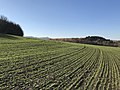
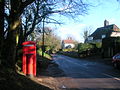
English: Elsted is a village in the Chichester district of West Sussex, England. It lies within the civil parish of Elsted and Treyford. The village is on the Midhurst to South Harting Road 4.5 miles (7.2 km) west of Midhurst.
village in West Sussex, England, UK  | |||||
| Upload media | |||||
| Instance of |
| ||||
|---|---|---|---|---|---|
| Location | Elsted and Treyford, Chichester, West Sussex, South East England, England | ||||
 | |||||
Subcategories
This category has the following 2 subcategories, out of 2 total.
P
Media in category "Elsted, West Sussex"
The following 60 files are in this category, out of 60 total.
-
 Approach to Elsted from the south - geograph.org.uk - 3190648.jpg 4,000 × 3,000; 3.44 MB
-
 Bench Mark, Elsted - geograph.org.uk - 2877889.jpg 480 × 640; 134 KB
-
 Bench Mark, Elsted Inn - geograph.org.uk - 2877899.jpg 640 × 480; 72 KB
-
 Byway joins lane south of Elsted - geograph.org.uk - 2690107.jpg 1,024 × 768; 263 KB
-
 Church Farm, Elsted - geograph.org.uk - 1532220.jpg 640 × 480; 92 KB
-
 Communications centre, Elsted - geograph.org.uk - 1340372.jpg 640 × 480; 139 KB
-
 Contoured Planting (geograph 5983096).jpg 1,600 × 1,200; 625 KB
-
 Cross dykes on Pen Hill - geograph.org.uk - 684174.jpg 640 × 480; 122 KB
-
 Elsted Cricket.jpg 2,888 × 948; 834 KB
-
 Elsted3.JPG 1,280 × 960; 516 KB
-
 Field with trees east of Elsted - geograph.org.uk - 2691098.jpg 1,024 × 768; 264 KB
-
 Footbridge at Lower Elsted - geograph.org.uk - 2691161.jpg 768 × 1,024; 221 KB
-
 Footpath sign, Elsted - geograph.org.uk - 1340408.jpg 640 × 480; 178 KB
-

-
 Footpath to Elsted (geograph 5983095).jpg 1,600 × 1,200; 607 KB
-
 Footpath, Elsted - geograph.org.uk - 1340415.jpg 640 × 480; 206 KB
-
 Fungi growing at the roadside - geograph.org.uk - 73253.jpg 640 × 426; 155 KB
-
 House and signpost at Elsted crossroads - geograph.org.uk - 2690124.jpg 1,024 × 768; 196 KB
-
 Millpond Bottom - geograph.org.uk - 687692.jpg 640 × 480; 119 KB
-

-
 New House Farm - geograph.org.uk - 341391.jpg 640 × 427; 31 KB
-
 Outbuilding at Rother Farm - geograph.org.uk - 778786.jpg 640 × 480; 140 KB
-
 Restricted byway going north to Elsted - geograph.org.uk - 2690097.jpg 768 × 1,024; 336 KB
-

-
 Sign for the Three Horseshoes, Elsted - geograph.org.uk - 2877896.jpg 640 × 480; 111 KB
-

-
 South Downs Way, above Mount Sinai - geograph.org.uk - 688281.jpg 640 × 480; 167 KB
-
 South Downs Way, Pen Hill - geograph.org.uk - 684196.jpg 640 × 348; 89 KB
-
 South Downs Way, Pen Hill - geograph.org.uk - 684201.jpg 640 × 480; 96 KB
-
 South Downs Way, Pen Hill - geograph.org.uk - 684294.jpg 640 × 480; 167 KB
-
 South Downs Way, Pen Hill - geograph.org.uk - 684306.jpg 640 × 480; 169 KB
-
 The centre of Elsted^ - geograph.org.uk - 341376.jpg 640 × 469; 64 KB
-
 The Pub Garden - geograph.org.uk - 2862243.jpg 3,072 × 2,048; 4.37 MB
-
 The road into Elsted from the south - geograph.org.uk - 2690112.jpg 1,024 × 768; 312 KB
-
 The sign at "The Three Horseshoes" public house - geograph.org.uk - 2690126.jpg 768 × 1,024; 124 KB
-
 The Three Horseshoes, Elsted - geograph.org.uk - 2877894.jpg 640 × 481; 74 KB
-
 Track between properties in Elsted - geograph.org.uk - 2690134.jpg 768 × 1,024; 220 KB
-
 Tree trunk, Elsted - geograph.org.uk - 1340422.jpg 480 × 640; 185 KB
-
 Trees and new lake near Elsted - geograph.org.uk - 2691092.jpg 1,024 × 768; 170 KB
-
 Village centre, Elsted - geograph.org.uk - 2874222.jpg 640 × 480; 85 KB
-
 Wall, Elsted - geograph.org.uk - 2877885.jpg 640 × 480; 79 KB
-

-
 Elsted Village Hall - geograph.org.uk - 341384.jpg 640 × 461; 59 KB
-
 Farmland East of Elsted - geograph.org.uk - 73248.jpg 640 × 452; 73 KB
-
 Fields below Elsted - geograph.org.uk - 287083.jpg 640 × 480; 76 KB
-
 Footbridge - geograph.org.uk - 341372.jpg 640 × 480; 98 KB
-
 Footpath east of Pen Hill - geograph.org.uk - 688340.jpg 640 × 524; 140 KB
-
 Homemead, Didling - geograph.org.uk - 357498.jpg 640 × 480; 153 KB
-
 Looking across farmland to Elsted Rough - geograph.org.uk - 73251.jpg 640 × 426; 109 KB
-
 Manor Farm - geograph.org.uk - 341380.jpg 640 × 426; 36 KB
-
 Manor Farm - geograph.org.uk - 341395.jpg 640 × 427; 32 KB
-
 Pen Hill - geograph.org.uk - 45434.jpg 640 × 428; 73 KB
-

-
 Pointing the way, Treyford - geograph.org.uk - 358426.jpg 640 × 480; 160 KB
-
 Pointing the way, Treyford - geograph.org.uk - 358430.jpg 640 × 480; 157 KB
-
 The Hassocks - geograph.org.uk - 341369.jpg 640 × 480; 62 KB
-
 The Nanny State comes to the country - geograph.org.uk - 341403.jpg 480 × 640; 89 KB
-
 Track on Treyford Hill - geograph.org.uk - 684184.jpg 640 × 358; 45 KB
-
 Western slope ofTreyford Hill - geograph.org.uk - 160383.jpg 640 × 445; 52 KB
-
 Westfield Hanger - geograph.org.uk - 341389.jpg 640 × 427; 35 KB


.jpg)


.jpg)


