Category:Elphin, Highland
Jump to navigation
Jump to search
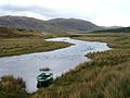
English: Elphin ( Gaelic: Ailbhinn) is a crofting township in Assynt, Sutherland, in north-west Scotland. It lies about 15 miles north of Ullapool. It has a tearoom, a rare breeds farm, and several bed and breakfasts. The local school, Assynt Primary, closed in 2001, and since 2006 the building has been leased to the Assynt Foundation.
human settlement in Highland, Scotland, UK  | |||||
| Upload media | |||||
| Instance of | |||||
|---|---|---|---|---|---|
| Location |
| ||||
 | |||||
Subcategories
This category has the following 2 subcategories, out of 2 total.
K
L
- Lochan an Ais (32 F)
Media in category "Elphin, Highland"
The following 51 files are in this category, out of 51 total.
-
 "Calm" Cam Loch - geograph.org.uk - 312902.jpg 640 × 480; 56 KB
-
 A835 looking north - geograph.org.uk - 741345.jpg 640 × 480; 78 KB
-
 A835 looking south - geograph.org.uk - 741346.jpg 640 × 480; 72 KB
-
 By Elphin Tearoom - geograph.org.uk - 904896.jpg 640 × 456; 208 KB
-
 Cemetery wall, Elphin - geograph.org.uk - 1150085.jpg 640 × 480; 159 KB
-
 Elphin - geograph.org.uk - 956679.jpg 640 × 480; 69 KB
-
 Elphin Burial Ground - geograph.org.uk - 312438.jpg 607 × 640; 95 KB
-
 Elphin Hatchery - geograph.org.uk - 988627.jpg 640 × 425; 203 KB
-
 Elphin Tearoom - geograph.org.uk - 904894.jpg 640 × 480; 182 KB
-
 Former Assynt Primary School Elphin - geograph.org.uk - 825919.jpg 640 × 406; 164 KB
-
 Iron house, Elphin - geograph.org.uk - 1270045.jpg 640 × 480; 78 KB
-
 Lochan an Ais - geograph.org.uk - 607158.jpg 640 × 480; 65 KB
-
 Ordnance Survey One-Inch Sheet 13 Loch Inver & Loch Assynt, Published 1959.jpg 7,750 × 9,218; 10.28 MB
-
 Suilven - geograph.org.uk - 3016.jpg 503 × 313; 115 KB
-
 Suilven and Canisp Hills - geograph.org.uk - 120827.jpg 640 × 480; 65 KB
-

-

-
 Abhainn a Chnocain below Elphin - geograph.org.uk - 1446461.jpg 640 × 480; 90 KB
-
 Above Ledmore - geograph.org.uk - 1144631.jpg 640 × 480; 86 KB
-
 Across Can Loch to Suilven - geograph.org.uk - 827007.jpg 640 × 480; 56 KB
-
 Bay on Cam Loch - geograph.org.uk - 826436.jpg 640 × 480; 66 KB
-

-
 Bogs, Elphin - geograph.org.uk - 1412913.jpg 640 × 359; 61 KB
-
 Cairn Near Summit of Cul Mor - geograph.org.uk - 648516.jpg 640 × 480; 86 KB
-
 Cairn, Na Cnuic Liatha - geograph.org.uk - 224108.jpg 640 × 480; 220 KB
-
 Cam Loch shoreline - geograph.org.uk - 737083.jpg 640 × 405; 59 KB
-
 Cam Loch shoreline - geograph.org.uk - 737097.jpg 1,000 × 662; 295 KB
-
 Caving Club hut in Elphin - geograph.org.uk - 1446657.jpg 640 × 480; 75 KB
-
 Cemetery at Elphin, Highland - geograph.org.uk - 61936.jpg 640 × 341; 57 KB
-
 Cul Mor over Ledmor River and Elphin - geograph.org.uk - 628173.jpg 640 × 345; 49 KB
-
 Elphin - geograph.org.uk - 7251.jpg 640 × 374; 139 KB
-
 Field System - geograph.org.uk - 494603.jpg 640 × 427; 80 KB
-
 From Creag a`Chaise towards Suilven - geograph.org.uk - 665291.jpg 640 × 480; 61 KB
-
 Ledmore River and A835, Assynt - geograph.org.uk - 72860.jpg 640 × 480; 77 KB
-
 Lochan Fhionnlaidh - geograph.org.uk - 224113.jpg 640 × 480; 178 KB
-
 Lochan, Cul Mor - geograph.org.uk - 224095.jpg 640 × 480; 250 KB
-
 Looking at Knockan Rock - geograph.org.uk - 120853.jpg 640 × 480; 86 KB
-
 Looking at Suilven from Knockan - geograph.org.uk - 120851.jpg 640 × 480; 84 KB
-

-

-

-
 Looking towards Knockan from Elphin - geograph.org.uk - 120847.jpg 640 × 480; 67 KB
-
 Path in Drumrunie Forest - geograph.org.uk - 29298.jpg 640 × 437; 78 KB
-
 Steep mountain slope - geograph.org.uk - 418433.jpg 640 × 357; 72 KB
-
 Suilven and Canisp over Cam Loch - geograph.org.uk - 628172.jpg 640 × 480; 82 KB
-
 Suilven from above Loch na Claise - geograph.org.uk - 430241.jpg 640 × 480; 99 KB
-
 Summit Cairn, Creag nan Calman - geograph.org.uk - 224082.jpg 640 × 480; 185 KB
-
 Summit, Meallan Diomhain - geograph.org.uk - 224099.jpg 640 × 480; 205 KB
-
 The last bend before you come Knockan - geograph.org.uk - 120849.jpg 640 × 480; 88 KB
-

-
 Top of Meall na Braclaich - geograph.org.uk - 665299.jpg 640 × 480; 76 KB


