Category:Elorn
Jump to navigation
Jump to search
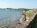
English: The Élorn (in Breton - Elorn, without the accent) is a 56 km long river in Brittany, France. Its source is in the monts d'Arrée, 1.5km NNE of Le Tuchenn Kador, and it then runs through several small towns such as Sizun and Landivisiau before flowing out into the roadstead of Brest. This river is the birhplace of the legendary Dragon of the Élorn. The maritime part of the river stops at Landerneau, where the pont de Rohan blocks seaborne ships from sailing any further upstream. The river also crosses the château de la Roche-Maurice and many abandoned mills, and on the banks of its maritime part are several family properties belonging to families in Brest (Park an Coat, le Frout, Beau Repos, le Petit Manoir de Poul ar Velin). At low tide the mud is met, at high tide the sea flows over the countryside.
Français : L'Élorn est un fleuve côtier du département du Finistère dans la région Bretagne, qui se jette dans la Mer Celtique (Océan Atlantique). C'est l'un des derniers cours d'eau français où la pêche du saumon est encore possible, malgré la pollution récurrente dont (comme l'ensemble des rivières bretonnes) elle est l'objet.
river in France  | |||||
| Upload media | |||||
| Instance of | |||||
|---|---|---|---|---|---|
| Location |
| ||||
| Length |
| ||||
| Mouth of the watercourse | |||||
| Drainage basin |
| ||||
| Tributary |
| ||||
 | |||||
Subcategories
This category has the following 6 subcategories, out of 6 total.
Media in category "Elorn"
The following 29 files are in this category, out of 29 total.
-
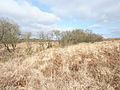
 064 Le bassin amont de l'Elorn.JPG 3,072 × 2,304; 1.59 MB
-
 065 L' Elorn près de sa source.JPG 2,304 × 3,072; 3.06 MB
-
 066 Saules marquant le tracé de l'Elorn amont.JPG 3,072 × 2,304; 3.51 MB
-
 290 Landivisiau.jpg 3,640 × 2,543; 3.69 MB
-
 293 Landivisiau.jpg 3,333 × 2,308; 3.88 MB
-
 Berge de l'Elorn-GUIPAVAS.jpg 3,072 × 2,304; 2.99 MB
-
 Btv1b10107378z Bords de l'Elorn.jpg 3,000 × 2,529; 795 KB
-
 Elorn Plougastel Pont Iroise.jpg 3,968 × 1,501; 2.36 MB
-
 Elorn.png 902 × 486; 769 KB
-
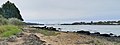
 Estuaire de l'Elorn.jpg 4,608 × 2,939; 5.6 MB
-
 Eugène Boudin - Embouchure de l'Elorn aux environs de Brest.jpg 2,105 × 1,277; 1.32 MB
-

-
 L'Elorn à SIZUN.jpg 4,288 × 2,848; 6.09 MB
-
 L'embouchure de l'Elorn dans la région de Brest.jpg 1,039 × 614; 147 KB
-
 La forest-landerneau (4).jpg 1,600 × 1,200; 692 KB
-
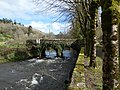 La Roche-Maurice - Pont sur l'Elorn à Pont-Christ.jpeg 3,456 × 2,592; 5.29 MB
-
-
 La Roche-Maurice - Église de Pont-Christ - Façade ouest.jpeg 2,592 × 3,456; 5.38 MB
-
 La Roche-Maurice Le vieux pont sur l'Elorn.jpg 996 × 631; 440 KB
-
 La Roche-Maurice vue des bords de l'Elorn.jpg 701 × 517; 179 KB
-
 Le Relecq Kerhuon ciel (2).JPG 2,560 × 1,920; 3 MB
-
 Loperhet - Le Vern - Grève - Panorama sur l'Elorn.jpg 4,448 × 656; 1.31 MB
-
 Loperhet - Le Vern - Grève - Vue sur La Forest-Landerneau.jpg 4,128 × 2,322; 3.43 MB
-
 Penfoul sand carrier 2.jpg 800 × 601; 125 KB
-
 Plougastel-Daoulas Le passage côté Plougastel et à l'arrière-plan côté relecq.jpg 3,072 × 2,304; 4.52 MB
-
 Plougastel-Daoulas Le passage vu de Kerhuon.jpg 3,072 × 2,304; 1.55 MB
-
 Plougastel-Daoulas Un des rochers dominant l'Elorn.jpg 2,304 × 3,072; 3.47 MB
-
 Port Passage Plougastel.jpg 3,961 × 1,981; 2.4 MB
-
 Rive droite de l'Elorn-RELECQ KERHUON.jpg 7,717 × 2,622; 5.97 MB


.jpg)


.JPG)


