Category:Ellestraat 12, Elburg
Jump to navigation
Jump to search
| Object location | | View all coordinates using: OpenStreetMap |
|---|
 | |||||
| Upload media | |||||
| Instance of |
| ||||
|---|---|---|---|---|---|
| Location | Elburg, Gelderland, Netherlands | ||||
| Street address |
| ||||
| Located on street |
| ||||
| Heritage designation |
| ||||
 | |||||
|
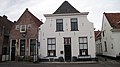
This is a category about rijksmonument number 14731
|
| Address |
|
Media in category "Ellestraat 12, Elburg"
The following 3 files are in this category, out of 3 total.
-
 Elburg- Ellestraat 12.JPG 3,840 × 2,160; 2.04 MB
-
 Vesting Elburg - Vischpoortstraat - Ellestraat - Vischpoort - Winter February 2021.jpg 3,976 × 2,652; 5.41 MB
-
 Voorgevel - Elburg - 20068922 - RCE.jpg 822 × 1,200; 189 KB

