Category:Electorate maps of New Zealand
Jump to navigation
Jump to search
voting district for elections to the New Zealand Parliament | |||||
| Upload media | |||||
| Subclass of | |||||
|---|---|---|---|---|---|
| Location |
| ||||
| |||||
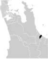
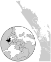
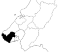
This category is for location maps for New Zealand parliamentary electorates.
Subcategories
This category has the following 3 subcategories, out of 3 total.
Media in category "Electorate maps of New Zealand"
The following 75 files are in this category, out of 75 total.
-
Miramar electorate, 1993.png 166 × 147; 2 KB
-
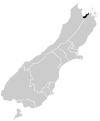
Nelson electorate 2008.png 300 × 416; 8 KB
-
Nelson electorate, 2014.svg 665 × 800; 552 KB
-
New plymouth electorate 2008.png 300 × 416; 8 KB
-
New Plymouth electorate, 2014.svg 666 × 800; 549 KB
-
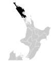
Northland electorate 2008.png 300 × 416; 7 KB
-
Northland electorate, 2014.svg 666 × 800; 549 KB
-
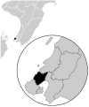
Ohariu electorate 2008.png 270 × 276; 5 KB
-
Ohariu electorate, 2014.svg 666 × 800; 605 KB
-
Onslow electorate, 1993.png 166 × 147; 3 KB
-
Otaki electorate 2008.png 300 × 416; 8 KB
-
Otaki electorate, 2014.svg 666 × 800; 549 KB
-
Palmerston north electorate 2008.png 300 × 416; 8 KB
-
Palmerston North electorate, 2014.svg 666 × 800; 549 KB
-
Pencarrow electorate, 1993.png 166 × 147; 3 KB
-
Porirua electorate, 1993.png 166 × 147; 3 KB
-
Port hills electorate 2008.png 363 × 381; 6 KB
-
Port Hills electorate, 2014.svg 665 × 800; 579 KB
-
Rangitata electorate 2008.png 300 × 416; 7 KB
-
Rangitata electorate, 2014.svg 665 × 800; 552 KB
-
Rangitikei electorate 2008.png 300 × 416; 8 KB
-
Rangitikei electorate, 2014.svg 666 × 800; 549 KB
-
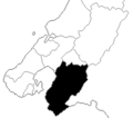
Rimutaka electorate 2008.png 270 × 276; 5 KB
-
Rimutaka electorate, 2014.svg 666 × 800; 605 KB
-
Rongotai electorate 2008.png 270 × 276; 5 KB
-
Rongotai electorate, 2014.svg 666 × 800; 619 KB
-
Roskill electorate, 1993.png 166 × 187; 4 KB
-
Rotorua electorate 2008.png 300 × 416; 8 KB
-
Rotorua electorate, 2014.svg 666 × 800; 549 KB
-
Selwyn electorate 2008.png 300 × 416; 8 KB
-
Selwyn electorate, 2014.svg 665 × 800; 552 KB
-
Tamaki 1990-93.png 166 × 187; 4 KB
-
Tamaki electorate 2008.png 270 × 272; 5 KB
-
Tamaki electorate, 2014.svg 666 × 800; 783 KB
-
Tamaki makaurau electorate 2008.png 400 × 504; 7 KB
-
Tamaki Makaurau electorate, 2014.svg 584 × 836; 406 KB
-
Taranaki king country electorate 2008.png 300 × 416; 8 KB
-
Taranaki-King Country electorate, 2014.svg 666 × 800; 549 KB
-
Taupo electorate 2008.png 300 × 416; 8 KB
-
Taupo electorate, 2014.svg 666 × 800; 549 KB
-
Tauranga electorate 2008.png 300 × 416; 8 KB
-
Tauranga electorate, 2014.svg 666 × 800; 549 KB
-
Te atatu electorate 2008.png 270 × 272; 5 KB
-
Te Atatu electorate, 2014.svg 666 × 800; 783 KB
-
Te tai hauauru electorate 2008.png 496 × 625; 7 KB
-
Te Tai Hauauru electorate, 2014.svg 744 × 1,052; 310 KB
-
Te tai tokerau electorate 2008.png 496 × 625; 8 KB
-
Te Tai Tokerau electorate, 2014.svg 584 × 836; 310 KB
-
Te tai tonga electorate 2008.png 400 × 504; 6 KB
-
Te Tai Tonga electorate, 2014.svg 744 × 1,052; 310 KB
-
Upper Harbour electorate, 2014.svg 666 × 800; 783 KB
-
Waiariki electorate 2008.png 496 × 625; 7 KB
-
Waiariki electorate, 2014.svg 744 × 1,052; 310 KB
-
Waikato electorate 2008.png 300 × 416; 8 KB
-
Waikato electorate, 2014.svg 666 × 800; 549 KB
-
Waimakariri electorate 2008.png 300 × 416; 8 KB
-
Waimakariri electorate, 2014.svg 665 × 800; 552 KB
-
Wairarapa electorate 2008.png 300 × 416; 7 KB
-
Wairarapa electorate, 2014.svg 666 × 800; 549 KB
-
Waitakere electorate 2008.png 270 × 272; 5 KB
-
Waitaki electorate 2008.png 300 × 416; 8 KB
-
Waitaki electorate, 2014.svg 665 × 800; 552 KB
-
Wellington Central 1990-1993.png 166 × 147; 2 KB
-
Wellington central electorate 2008.png 270 × 276; 5 KB
-
Wellington Central electorate, 2014.svg 666 × 800; 605 KB
-
Wellington-Karori electorate, 1993.png 166 × 147; 3 KB
-
West coast tasman electorate 2008.png 300 × 416; 8 KB
-
West Coast-Tasman electorate, 2014.svg 665 × 800; 552 KB
-
Western Hutt electorate, 1993.png 166 × 147; 3 KB
-
Whanganui electorate 2008.png 300 × 416; 8 KB
-
Whanganui electorate, 2014.svg 666 × 800; 549 KB
-
Whangarei electorate 2008.png 300 × 416; 8 KB
-
Whangarei electorate, 2014.svg 666 × 800; 549 KB
-
Wigram electorate 2008.png 363 × 381; 6 KB
-
Wigram electorate, 2014.svg 665 × 800; 579 KB


