Category:Election maps of the Outer Hebrides
Jump to navigation
Jump to search
Council areas (municipalities) of Scotland: Aberdeen · Aberdeenshire · Angus · Dundee · East Lothian · East Renfrewshire · Edinburgh · Fife · Glasgow · North Lanarkshire · Outer Hebrides · Orkney Islands · Shetland Islands · West Lothian
Media in category "Election maps of the Outer Hebrides"
The following 8 files are in this category, out of 8 total.
-
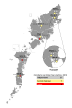
 2007 Comhairle nan Eilean Siar election, parties.svg 512 × 768; 638 KB
-
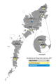
 2012 Comhairle nan Eilean Siar election, parties.svg 512 × 768; 660 KB
-
 2017 Comhairle nan Eilean Siar election, incumbency.svg 512 × 768; 662 KB
-
 2017 Comhairle nan Eilean Siar election, parties.svg 512 × 768; 651 KB
-
 2022 Comhairle nan Eilean Siar election, incumbency.svg 512 × 768; 408 KB
-
 2022 Comhairle nan Eilean Siar election, parties.svg 512 × 768; 419 KB
-
 Comhairle nan Eilean Siar election, 1999.svg 1,083 × 1,424; 3.82 MB
-
 Comhairle nan Eilean Siar election, 2003.svg 1,083 × 1,424; 3.82 MB


