Category:Election maps of the Isle of Wight
Jump to navigation
Jump to search
This category contains election maps for the ceremonial county of the Isle of Wight.
Media in category "Election maps of the Isle of Wight"
The following 6 files are in this category, out of 6 total.
-
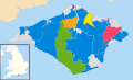
 Hampshire and Isle of Wight UK PCC election 2024.svg 619 × 652; 553 KB
-
 Isle of Wight UK local election 2013 map.svg 1,425 × 868; 881 KB
-
 Isle of Wight UK local election 2017 map.svg 1,425 × 868; 883 KB
-
 Isle of Wight UK local election 2021 map.svg 1,425 × 868; 1.74 MB
-
 Isle of Wight UK ward map 2021 (blank).svg 1,425 × 868; 1.74 MB
-
 Isle of Wight wards 2009.svg 1,425 × 868; 881 KB


.svg)