Category:Election maps of the City of York
Jump to navigation
Jump to search
Media in category "Election maps of the City of York"
The following 18 files are in this category, out of 18 total.
-
 2007 City of York Council elections.png 1,195 × 1,118; 194 KB
-
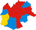
 2015 City of York Council Election Results Map.png 3,120 × 1,588; 449 KB
-
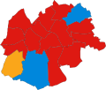
 2019 City of York Council Election Results Map.png 3,120 × 1,588; 432 KB
-
 2023 City of York Council Election Results Map.svg 1,052 × 744; 388 KB
-
 2023 City of York Council Election Results.svg 1,422 × 1,390; 557 KB
-
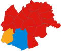
 City of York Council election 2011 map.svg 1,376 × 1,345; 383 KB
-
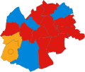
 City of York Council election 2015 map.svg 1,516 × 1,483; 468 KB
-
 City of York Council election 2019 map.svg 1,516 × 1,483; 507 KB
-
 YORK (49911033952).png 2,160 × 1,080; 355 KB
-
 York UK ward map 1980.svg 701 × 594; 46 KB
-
 York UK ward map 1982.svg 701 × 594; 46 KB
-
 York UK ward map 1983.svg 701 × 594; 46 KB
-
 York UK ward map 1984.svg 701 × 594; 46 KB
-
 York UK ward map 1986.svg 701 × 594; 46 KB
-
 York UK ward map 1987.svg 701 × 594; 46 KB
-
 York UK ward map 1988.svg 701 × 594; 46 KB
-
 York UK ward map 1990.svg 701 × 594; 46 KB
-
 York UK ward map 1991.svg 701 × 594; 46 KB


.png)


