Category:Election maps of Westminster
Jump to navigation
Jump to search
Media in category "Election maps of Westminster"
The following 8 files are in this category, out of 8 total.
-
 2010 Westminster Borough Council Election Results Map.svg 1,100 × 1,000; 131 KB
-
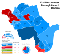 2014 Westminster Borough Council Election Results Map.svg 1,100 × 1,000; 127 KB
-
 2018 Westminster Borough Council Election Results Map.svg 1,100 × 1,000; 118 KB
-
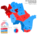 2022 Westminster Borough Council Election Results Map.svg 1,100 × 1,000; 158 KB
-
 Westminster (42140588745).png 1,916 × 1,268; 118 KB
-
 Westminster London UK local election 2010 map.svg 1,357 × 1,266; 262 KB
-
 Westminster London UK local election 2014 map.svg 1,357 × 1,266; 261 KB
-
 Westminster London UK local election 2018 map.svg 1,357 × 1,266; 260 KB


.png)


