Category:Election maps of Upper Austria
Jump to navigation
Jump to search
States of Austria:  Burgenland ·
  Carinthia ·
  Lower Austria ·
  Salzburg ·
  Styria ·
  Tyrol ·
  Upper Austria ·
  Vienna ·
  Vorarlberg
Deutsch: Karten von Oberösterreich zu Wahlrergebnissen.
English: Maps of Upper Austria showing election results.
Media in category "Election maps of Upper Austria"
The following 6 files are in this category, out of 6 total.
-
Landtagswahlkreise Oberösterreich.svg 363 × 341; 56 KB
-
Bürgermeisterparteien in OÖ 2015.png 2,338 × 1,653; 189 KB
-
Gemeindekarte OÖ.PNG 590 × 505; 33 KB
-
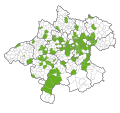
Grüne Gemeindegruppen Oberösterreich.svg 363 × 341; 152 KB
-
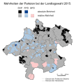
Landtagswahlkarte Oberösterreich 2015.svg 736 × 812; 421 KB
-
Landtagswahlkarte Oberösterreich 2021.svg 737 × 812; 240 KB


