Category:Election maps of Southampton
Jump to navigation
Jump to search
Media in category "Election maps of Southampton"
The following 19 files are in this category, out of 19 total.
-
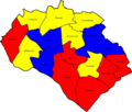
 SOUTHAMPTON (43193615082).png 1,200 × 1,000; 195 KB
-
 Southampton 2006 election map.png 564 × 480; 49 KB
-
 Southampton 2007 election map.png 564 × 480; 47 KB
-
 Southampton 2008 election map.png 564 × 480; 45 KB
-
 Southampton UK local election 2002 map.svg 1,425 × 1,226; 270 KB
-
 Southampton UK local election 2003 map.svg 1,425 × 1,226; 269 KB
-
 Southampton UK local election 2004 map.svg 1,425 × 1,226; 269 KB
-
 Southampton UK local election 2010 map.svg 1,425 × 1,226; 269 KB
-
 Southampton UK local election 2011 map.svg 1,425 × 1,226; 269 KB
-
 Southampton UK local election 2012 map.svg 1,425 × 1,226; 271 KB
-
 Southampton UK local election 2014 map.svg 1,425 × 1,226; 268 KB
-
 Southampton UK local election 2015 map.svg 1,425 × 1,226; 269 KB
-
 Southampton UK local election 2016 map.svg 1,425 × 1,226; 269 KB
-
 Southampton UK local election 2018 map.svg 1,425 × 1,226; 268 KB
-
 Southampton UK local election 2019 map.svg 1,425 × 1,226; 271 KB
-
 Southampton UK local election 2021 map.svg 1,425 × 1,226; 270 KB
-
 Southampton UK local election 2022 map.svg 1,425 × 1,226; 270 KB
-
 Southampton UK ward map 2023.svg 577 × 490; 120 KB
-
 Southampton UK ward map 2024.svg 615 × 523; 113 KB
.png)


