
Category:Election maps of Pennsylvania
States of the United States: Alabama · Alaska · Arizona · Arkansas · California · Colorado · Connecticut · Delaware · Florida · Georgia · Hawaii · Idaho · Illinois · Indiana · Iowa · Kansas · Kentucky · Louisiana · Maine · Maryland · Massachusetts · Michigan · Minnesota · Mississippi · Missouri · Montana · Nebraska · Nevada · New Hampshire · New Jersey · New Mexico · New York · North Carolina · North Dakota · Ohio · Oklahoma · Oregon · Pennsylvania · Rhode Island · South Carolina · South Dakota · Tennessee · Texas · Utah · Vermont · Virginia · Washington · West Virginia · Wisconsin · Wyoming – Washington, D.C.
American Samoa · Guam · Northern Mariana Islands · Puerto Rico · United States Virgin Islands
American Samoa · Guam · Northern Mariana Islands · Puerto Rico · United States Virgin Islands
Subcategories
This category has the following 15 subcategories, out of 15 total.
Media in category "Election maps of Pennsylvania"
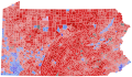
The following 18 files are in this category, out of 18 total.
-
 1976 Pennsylvania Treasurer General Election.svg 794 × 472; 288 KB
-
 1980 Pennsylvania Treasurer General Election.svg 794 × 472; 288 KB
-
 1986 PA Gov.svg 810 × 471; 1.85 MB
-

-
 2000 Pennsylvania State Senate election.svg 800 × 505; 2.6 MB
-
 2009 Pennsylvania Supreme Court election.svg 744 × 443; 165 KB
-
 2017 Pennsylvania Supreme Court election.svg 744 × 443; 165 KB
-
 2020 PA Presidential State Patrols Map.svg 818 × 479; 204 KB
-
 2021 Pennsylvania Judge of the Superior Court Election.svg 744 × 443; 165 KB
-
 2024 pa pres sd.svg 810 × 471; 2.13 MB
-
 PA manderson.svg 1,052 × 744; 684 KB
-
 PA US Senate 2000 By Precinct.svg 810 × 471; 24.99 MB
-
 Pennsylvania County Flips 2016.svg 744 × 443; 288 KB
-
 Pennsylvania U.S. Senate Democratic primary, 2012.svg 810 × 471; 50 KB
-
 Pennsylvania U.S. Senate Republican primary, 2012.svg 810 × 471; 50 KB
-
 Sample Map.png 1,374 × 862; 216 KB
-
 Sdacvfdfsadfsafdsa.svg 307 × 177; 1.12 MB
-
 Sdfasdfafdsa.svg 744 × 443; 142 KB


