Category:Election maps of Occitanie
Jump to navigation
Jump to search
Administrative regions and territorial collectivity of Metropolitan France (‡ since start of 2016):
Auvergne-Rhône-Alpes‡ · Bourgogne-Franche-Comté‡ · Brittany · Centre-Val de Loire · Corsica · Grand Est‡ · Hauts-de-France‡ · Île-de-France · Normandy‡ · New Aquitaine‡ · Occitania‡ · Pays de la Loire · Provence-Alpes-Côte d'Azur
Former administrative regions of Metropolitan France (until end of 2015):
Franche-Comté
Overseas departments and regions: Guadeloupe · Martinique · French Guiana · Réunion · Mayotte
Overseas collectivities: Saint Barthélemy · Saint-Martin · Saint Pierre and Miquelon · French Polynesia · Wallis and Futuna
Sui generis territories: New Caledonia

Media in category "Election maps of Occitanie"
The following 8 files are in this category, out of 8 total.
-
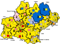 1T Législatives 2017 Occitanie.svg 973 × 714; 178 KB
-
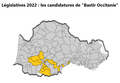
 Bastir Occitanie, PNO et POC, législatives 2017.jpg 2,531 × 1,756; 786 KB
-
 Députés sortants d'Occitanie en 2017.svg 973 × 714; 166 KB
-
 Législatives 2017 Résistons.png 1,013 × 703; 300 KB
-
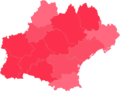
 Législatives 2022 Résistons.png 1,013 × 703; 266 KB
-
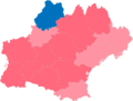
 Législatives 2022.png 1,013 × 703; 271 KB
-
 Résultats premier tour régionales 2021 Occitanie.png 597 × 453; 46 KB
-
 Résultats second tour régionales 2021 Occitanie.png 597 × 453; 49 KB


