Category:Election maps of Northamptonshire
Jump to navigation
Jump to search
This category contains election maps for the ceremonial county of Northamptonshire.
Media in category "Election maps of Northamptonshire"
The following 74 files are in this category, out of 74 total.
-
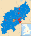
 2021 Northamptonshire PFCC Election.svg 110 × 123; 128 KB
-
 Corby UK local election 1976 map.svg 1,425 × 1,244; 224 KB
-
 Corby UK local election 1979 map.svg 1,425 × 1,244; 224 KB
-
 Corby UK local election 1983 map.svg 1,425 × 1,244; 224 KB
-
 Corby UK local election 1987 map.svg 1,425 × 1,244; 224 KB
-
 Corby UK local election 1991 map.svg 1,425 × 1,244; 224 KB
-
 Corby UK local election 1995 map.svg 1,425 × 1,244; 224 KB
-
 Corby UK local election 1999 map.svg 1,425 × 1,244; 228 KB
-
 Corby UK local election 2003 map.svg 1,425 × 1,244; 228 KB
-
 Corby UK local election 2007 map.svg 1,425 × 1,244; 233 KB
-
 Corby UK local election 2011 map.svg 1,425 × 1,244; 233 KB
-
 Corby UK local election 2015 map.svg 1,425 × 1,244; 279 KB
-
 Daventry (42140583485).png 1,448 × 1,134; 125 KB
-
 East Northamptonshire UK local election 1979 map.svg 957 × 1,396; 562 KB
-
 East Northamptonshire UK local election 1983 map.svg 957 × 1,396; 561 KB
-
 East Northamptonshire UK local election 1987 map.svg 957 × 1,396; 561 KB
-
 East Northamptonshire UK local election 1991 map.svg 957 × 1,396; 561 KB
-
 East Northamptonshire UK local election 1995 map.svg 957 × 1,396; 560 KB
-
 East Northamptonshire UK local election 1999 map.svg 957 × 1,396; 540 KB
-
 East Northamptonshire UK local election 2003 map.svg 957 × 1,396; 539 KB
-
 East Northamptonshire UK local election 2007 map.svg 869 × 1,266; 598 KB
-
 East Northamptonshire UK local election 2011 map.svg 869 × 1,266; 598 KB
-
 East Northamptonshire UK ward map 1979 to 1999.svg 957 × 1,396; 560 KB
-
 East Northamptonshire UK ward map 1999 to 2007.svg 957 × 1,396; 539 KB
-
 East Northamptonshire UK ward map 2010 (blank).svg 869 × 1,266; 595 KB
-
 Kettering UK local election 2007 map.svg 1,206 × 1,266; 372 KB
-
 Kettering UK local election 2011 map.svg 1,206 × 1,266; 372 KB
-
 Kettering UK local election 2015 map.svg 1,206 × 1,266; 372 KB
-
 Kettering UK ward map 2010 (blank).svg 1,206 × 1,266; 371 KB
-
 KetteringBC2003elections.png 636 × 741; 13 KB
-
 North Northamptonshire UK local election 2021.svg 688 × 902; 566 KB
-
 Northampton UK local election 1999 map.svg 1,385 × 1,266; 199 KB
-
 Northampton UK local election 2003 map.svg 1,385 × 1,266; 199 KB
-
 Northampton UK local election 2007 map.svg 1,385 × 1,266; 199 KB
-
 Northampton UK local election 2011 map.svg 1,385 × 1,266; 256 KB
-
 Northampton UK local election 2015 map.svg 1,385 × 1,266; 256 KB
-
 Northampton UK ward map 2010 (blank).svg 1,385 × 1,266; 198 KB
-
 Northampton UK ward map 2011 (blank).svg 1,385 × 1,266; 256 KB
-
 Northamptonshire UK local election 2001 map.svg 1,106 × 1,266; 1.52 MB
-
 Northamptonshire UK local election 2005 map.svg 1,106 × 1,266; 1.52 MB
-
 Northamptonshire UK local election 2009 map.svg 1,106 × 1,266; 1.52 MB
-
 Northamptonshire UK local election 2013 map.svg 1,106 × 1,266; 1.18 MB
-
 Northamptonshire UK local election 2017 map.svg 1,106 × 1,266; 1.17 MB
-
 NorthamptonshireParliamentaryConstituency1885Results.svg 1,853 × 1,755; 54 KB
-
 NorthamptonshireParliamentaryConstituency1886Results.svg 1,853 × 1,755; 54 KB
-
 NorthamptonshireParliamentaryConstituency1892Results.svg 1,853 × 1,755; 54 KB
-
 NorthamptonshireParliamentaryConstituency1895Results.svg 1,853 × 1,755; 54 KB
-
 NorthamptonshireParliamentaryConstituency1900Results.svg 1,853 × 1,754; 54 KB
-
 NorthamptonshireParliamentaryConstituency1906Results.svg 1,853 × 1,755; 54 KB
-
 NorthamptonshireParliamentaryConstituency1910Results.svg 1,853 × 1,754; 54 KB
-
 NorthamptonshireParliamentaryConstituency1918Results.svg 1,982 × 1,898; 51 KB
-
 NorthamptonshireParliamentaryConstituency1922Results.svg 1,982 × 1,898; 51 KB
-
 NorthamptonshireParliamentaryConstituency1923Results.svg 1,982 × 1,898; 51 KB
-
 NorthamptonshireParliamentaryConstituency1924Results.svg 1,982 × 1,898; 51 KB
-
 NorthamptonshireParliamentaryConstituency1929Results.svg 1,982 × 1,898; 51 KB
-
 NorthamptonshireParliamentaryConstituency1931Results.svg 1,982 × 1,898; 51 KB
-
 NorthamptonshireParliamentaryConstituency1945Results.svg 1,982 × 1,898; 51 KB
-
 NorthamptonshireParliamentaryConstituency1950Results.svg 1,353 × 1,295; 17 KB
-
 NorthamptonshireParliamentaryConstituency1959Results.svg 1,353 × 1,295; 17 KB
-
 NorthamptonshireParliamentaryConstituency1974FResults.svg 1,134 × 1,231; 13 KB
-
 NorthamptonshireParliamentaryConstituency2005Results2.png 189 × 211; 25 KB
-
 NorthamptonshireParliamentaryConstituency2010Results2.png 212 × 238; 27 KB
-
 NorthamptonshireParliamentaryConstituency2024Results.svg 281 × 314; 61 KB
-
 NorthantsParliamentaryConstituency1979Results.svg 1,134 × 1,231; 13 KB
-
 South Northamptonshire UK ward map 2010 (blank).svg 1,425 × 1,106; 764 KB
-
 Wellingborough UK local election 1999 map.svg 1,041 × 1,266; 306 KB
-
 Wellingborough UK local election 2003 map.svg 1,041 × 1,266; 306 KB
-
 Wellingborough UK local election 2007 map.svg 1,041 × 1,266; 306 KB
-
 Wellingborough UK local election 2011 map.svg 1,041 × 1,266; 305 KB
-
 Wellingborough UK local election 2015 map.svg 1,041 × 1,266; 369 KB
-
 Wellingborough UK ward map 2010 (blank).svg 1,041 × 1,266; 305 KB
-
 Wellingborough UK ward map 2011 (blank).svg 1,041 × 1,266; 298 KB
-
 Wellingborough UK ward map 2015 (blank).svg 1,041 × 1,266; 369 KB
-
 West Northamptonshire UK local election 2021.svg 830 × 1,077; 784 KB


.png)


.svg)
.svg)
.svg)
.svg)
.svg)
.svg)
.svg)
.svg)