Category:Election maps of Mizoram
Jump to navigation
Jump to search
States of India: Andhra Pradesh · Arunachal Pradesh · Assam · Bihar · Chhattisgarh · Goa · Gujarat · Haryana · Himachal Pradesh · Jharkhand · Karnataka · Kerala · Madhya Pradesh · Maharashtra · Manipur · Meghalaya · Mizoram · Nagaland · Odisha · Punjab · Rajasthan · Sikkim · Tamil Nadu · Telangana · Tripura · Uttar Pradesh · Uttarakhand · West Bengal
Union territories: Andaman and Nicobar Islands · Chandigarh · Dadra and Nagar Haveli and Daman and Diu · Delhi · Jammu and Kashmir · Puducherry
Former states of India: Jammu and Kashmir ·
Former union territories:
Union territories: Andaman and Nicobar Islands · Chandigarh · Dadra and Nagar Haveli and Daman and Diu · Delhi · Jammu and Kashmir · Puducherry
Former states of India: Jammu and Kashmir ·
Former union territories:
Media in category "Election maps of Mizoram"
The following 7 files are in this category, out of 7 total.
-
 2008 Mizoram election result.svg 657 × 791; 221 KB
-
 2013 Mizoram election result.svg 657 × 791; 221 KB
-
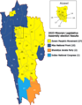 2023 Mizoram Legislative Assembly election results.png 564 × 724; 126 KB
-
 2024 Lok Sabha Mizoram NDA.svg 638 × 768; 521 KB
-
 2024 Lok Sabha Mizoram Result Map.svg 638 × 768; 328 KB
-
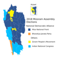 Mizoram Assembly election 2018.png 793 × 809; 114 KB
-
 Mizoram Lok Sabha election result 2019.png 720 × 866; 50 KB


