Category:Election maps of Merseyside
Jump to navigation
Jump to search
This category contains election maps for the ceremonial county of Merseyside.
Subcategories
This category has the following 6 subcategories, out of 6 total.
K
- Election maps of Knowsley (10 F)
L
- Election maps of Liverpool (45 F)
- Liverpool Council Wards (11 F)
S
- Election maps of Sefton (9 F)
- Election maps of St Helens (12 F)
W
- Election maps of Wirral (47 F)
Media in category "Election maps of Merseyside"
The following 13 files are in this category, out of 13 total.
-
 1973 Merseyside County Council election result map.jpg 2,100 × 2,287; 333 KB
-
 1977 Merseyside County Council election result map.jpg 2,100 × 2,287; 342 KB
-
 1981 Merseyside County Council election result map.jpg 2,100 × 2,287; 330 KB
-
 Knowsley UK ward map 2010 (blank).svg 932 × 1,306; 301 KB
-
 Knowsley UK ward map 2016 (blank).svg 932 × 1,306; 267 KB
-
 Liverpool City Council Wards.png 389 × 514; 13 KB
-
 Liverpool City Region mayoral results, 2017.svg 1,131 × 1,198; 28 KB
-
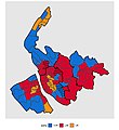
 Merseyside Local Election Results Map 2018.svg 1,231 × 1,305; 4.07 MB
-
 MerseysideParliamentaryConstituency2005Results2.png 215 × 230; 28 KB
-
 MerseysideParliamentaryConstituency2010Results2.png 215 × 221; 28 KB
-
 MerseysideParliamentaryConstituency2015Results2.png 215 × 221; 28 KB
-
 MerseysideParliamentaryConstituency2017Results2.png 215 × 221; 28 KB
-
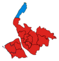
 MerseysideParliamentaryConstituency2024Results.svg 280 × 359; 61 KB


.svg)
.svg)