Category:Election maps of Devon
Jump to navigation
Jump to search
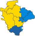
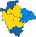
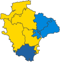
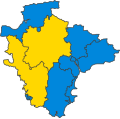
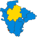
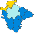
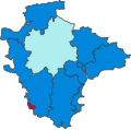
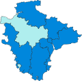
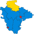
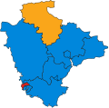
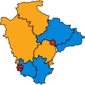
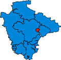
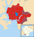
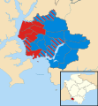
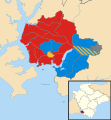
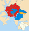
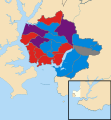
This category contains election maps for the ceremonial county of Devon (including the unitary authorities of Plymouth and Torbay).
Media in category "Election maps of Devon"
The following 133 files are in this category, out of 133 total.
-
1906 Devon & Cornwall.png 369 × 286; 6 KB
-
2019 Teignbridge District Council election.svg 2,658 × 1,570; 747 KB
-
2019 Torbay Council election results.svg 1,629 × 1,513; 1.05 MB
-
2019 Torridge District Council election.svg 1,913 × 1,443; 689 KB
-
2023 Teignbridge District Council election.svg 2,658 × 1,570; 161 KB
-
2023 Torridge District Council election.svg 1,913 × 1,443; 635 KB
-
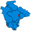
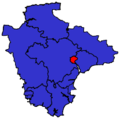
Devon 2017 general election results.png 207 × 206; 30 KB
-
Devon County Council election 2009 map.svg 1,292 × 1,187; 2.07 MB
-
Devon County Council election 2013 map.svg 1,292 × 1,187; 2.07 MB
-
Devon UK local election 2017 map.svg 1,292 × 1,187; 2.03 MB
-
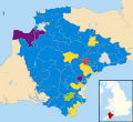
Devon UK local election 2021 corrected.svg 1,292 × 1,187; 2 MB
-
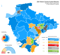
Devon UK local election 2021 gradient map.svg 1,292 × 1,187; 1.16 MB
-
DevonParliamentaryConstituenciesNumbered2005.png 1,000 × 995; 109 KB
-
DevonParliamentaryConstituency1885Results.svg 1,834 × 1,870; 97 KB
-
DevonParliamentaryConstituency1886Results.svg 1,833 × 1,870; 97 KB
-
DevonParliamentaryConstituency1892Results.svg 1,834 × 1,870; 97 KB
-
DevonParliamentaryConstituency1895Results.svg 1,834 × 1,870; 97 KB
-
DevonParliamentaryConstituency1900Results.svg 1,833 × 1,870; 97 KB
-
DevonParliamentaryConstituency1906Results.svg 1,833 × 1,870; 97 KB
-
DevonParliamentaryConstituency1910DResults.svg 1,833 × 1,870; 97 KB
-
DevonParliamentaryConstituency1910JResults.svg 1,833 × 1,870; 97 KB
-
DevonParliamentaryConstituency1918Results.svg 1,899 × 1,869; 109 KB
-
DevonParliamentaryConstituency1922Results.svg 1,900 × 1,869; 109 KB
-
DevonParliamentaryConstituency1923Results.svg 1,899 × 1,869; 109 KB
-
DevonParliamentaryConstituency1924Results.svg 1,899 × 1,869; 109 KB
-
DevonParliamentaryConstituency1929Results.svg 1,899 × 1,869; 109 KB
-
DevonParliamentaryConstituency1931Results.svg 1,899 × 1,869; 109 KB
-
DevonParliamentaryConstituency1935Results.svg 1,900 × 1,869; 109 KB
-
DevonParliamentaryConstituency1945Results.svg 1,900 × 1,869; 109 KB
-
DevonParliamentaryConstituency1950Results.svg 150 × 148; 128 KB
-
DevonParliamentaryConstituency1951Results.svg 150 × 148; 128 KB
-
DevonParliamentaryConstituency1955Results.svg 150 × 148; 48 KB
-
DevonParliamentaryConstituency1959Results.svg 150 × 148; 48 KB
-
DevonParliamentaryConstituency1964Results.svg 150 × 148; 48 KB
-
DevonParliamentaryConstituency1966Results.svg 150 × 148; 48 KB
-
DevonParliamentaryConstituency1970Results.svg 150 × 148; 48 KB
-
DevonParliamentaryConstituency1974Results.svg 149 × 150; 31 KB
-
DevonParliamentaryConstituency1979Results.svg 149 × 150; 31 KB
-
DevonParliamentaryConstituency1987Results.svg 116 × 115; 12 KB
-
DevonParliamentaryConstituency1992Results.svg 116 × 115; 13 KB
-
DevonParliamentaryConstituency1997Results.png 200 × 199; 15 KB
-
DevonParliamentaryConstituency1997Results.svg 200 × 199; 15 KB
-
DevonParliamentaryConstituency2001Results.png 200 × 199; 15 KB
-
DevonParliamentaryConstituency2001Results.svg 200 × 199; 15 KB
-
DevonParliamentaryConstituency2005Results.svg 200 × 199; 15 KB
-
DevonParliamentaryConstituency2010Results.svg 201 × 200; 79 KB
-
DevonParliamentaryConstituency2015Results.png 207 × 206; 31 KB
-
DevonParliamentaryConstituency2015Results.svg 201 × 200; 79 KB
-
DevonParliamentaryConstituency2015Results2.png 207 × 206; 32 KB
-
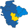
DevonParliamentaryConstituency2017Results.svg 201 × 200; 79 KB
-
DevonParliamentaryConstituency2024Results.svg 527 × 525; 183 KB
-
East Devon UK ward map 2019.svg 703 × 473; 648 KB
-
East Devon UK ward map 2023.svg 703 × 473; 648 KB
-
Exeter (42993274422).png 1,326 × 986; 109 KB
-
Exeter City Council Wards, October 2015.svg 934 × 1,187; 275 KB
-
Exeter UK local election 2000 map.svg 934 × 1,187; 273 KB
-
Exeter UK local election 2002 map.svg 934 × 1,187; 272 KB
-
Exeter UK local election 2003 map.svg 934 × 1,187; 272 KB
-
Exeter UK local election 2004 map.svg 934 × 1,187; 272 KB
-
Exeter UK local election 2006 map.svg 934 × 1,187; 272 KB
-
Exeter UK local election 2007 map.svg 934 × 1,187; 272 KB
-
Exeter UK local election 2008 map.svg 934 × 1,187; 272 KB
-
Exeter UK local election 2010 map.svg 934 × 1,187; 272 KB
-
Exeter UK local election 2011 map.svg 934 × 1,187; 272 KB
-
Exeter UK local election 2012 map.svg 934 × 1,187; 272 KB
-
Exeter UK local election 2014 map.svg 934 × 1,187; 272 KB
-
Exeter UK local election 2015 map.svg 934 × 1,187; 272 KB
-
Exeter UK local election 2016 map.svg 934 × 1,187; 254 KB
-
Exeter UK local election 2018 map.svg 934 × 1,187; 256 KB
-
Exeter UK local election 2019 map.svg 934 × 1,187; 254 KB
-
Exeter UK local election 2021 map.svg 934 × 1,187; 255 KB
-
Exeter UK ward map 2022.svg 934 × 1,187; 255 KB
-
Exeter UK ward map 2023.svg 934 × 1,187; 254 KB
-
Exeter UK ward map 2024.svg 934 × 1,187; 254 KB
-
Exeter wards political composition map February 2017.svg 934 × 1,187; 260 KB
-
Majority votes (PCC election 2024).png 4,765 × 6,618; 692 KB
-
Majority votes broken down into local authorities.png 4,800 × 3,560; 602 KB
-
Mid Devon UK ward map 2023.svg 689 × 455; 639 KB
-
North Devon UK local election 2003 map.svg 1,375 × 1,187; 1,010 KB
-
North Devon UK local election 2007 map.svg 1,375 × 1,187; 1,010 KB
-
North Devon UK local election 2011 map.svg 1,375 × 1,187; 1,010 KB
-
North Devon UK local election 2015 map.svg 1,375 × 1,187; 1.06 MB
-
North Devon UK ward map 2019.svg 699 × 620; 748 KB
-
North Devon UK ward map 2023.svg 699 × 620; 748 KB
-
Plymouth (42140586585).png 2,086 × 1,416; 135 KB
-
Plymouth City Council election 1979 map.svg 1,100 × 1,187; 649 KB
-
Plymouth City Council election 1983 map.svg 1,100 × 1,187; 649 KB
-
Plymouth City Council election 1987 map.svg 1,100 × 1,187; 649 KB
-
Plymouth City Council election 1991 map.svg 1,100 × 1,187; 649 KB
-
Plymouth City Council election 1995 map.svg 1,100 × 1,187; 649 KB
-
Plymouth City Council election 1997 map.svg 1,100 × 1,187; 649 KB
-
Plymouth City Council election 2000 map.svg 1,100 × 1,187; 649 KB
-
Plymouth City Council election 2003 map.svg 1,100 × 1,187; 613 KB
-
Plymouth City Council election 2004 map.svg 1,100 × 1,187; 611 KB
-
Plymouth City Council election 2006 map.svg 1,100 × 1,187; 612 KB
-
Plymouth City Council election 2007 map.svg 1,100 × 1,187; 612 KB
-
Plymouth City Council election 2008 map.svg 1,100 × 1,187; 611 KB
-
Plymouth City Council election 2010 map.svg 1,100 × 1,187; 612 KB
-
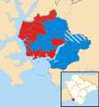
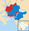
Plymouth City council election 2011 map.svg 512 × 552; 244 KB
-
Plymouth City Council election 2011 map.svg 1,100 × 1,187; 613 KB
-
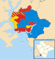
Plymouth City council election 2012 map.svg 1,100 × 1,187; 344 KB
-
Plymouth City Council election 2014 map.svg 1,100 × 1,187; 429 KB
-
Plymouth City Council election 2015 map.svg 1,100 × 1,187; 614 KB
-
Plymouth City Council election 2016 map.svg 1,100 × 1,187; 612 KB
-
Plymouth City Council election 2018 map.svg 1,100 × 1,187; 613 KB
-
Plymouth City Council election 2019 map.svg 1,100 × 1,187; 614 KB
-
Plymouth City Council election 2021 gradient map.svg 1,100 × 1,187; 210 KB
-
Plymouth City Council election 2021 map.svg 512 × 552; 391 KB
-
Plymouth City Council election 2021 mapfix.svg 1,100 × 1,187; 614 KB
-
Plymouth City Council election 2022 map.svg 512 × 552; 368 KB
-
Plymouth City Council election 2023 map.svg 512 × 552; 444 KB
-
Plymouth City Council election 2024 map.svg 512 × 552; 315 KB
-
Plymouth UK local election 2010 map.svg 1,100 × 1,187; 615 KB
-
Plymouth UK political composition map.svg 1,100 × 1,187; 615 KB
-
South Hams District Council wards as April 2011.svg 1,425 × 1,084; 1.11 MB
-
South Hams District Council wards, 1999.svg 1,425 × 1,084; 1.11 MB
-
South Hams District Council wards, 2003.svg 1,425 × 1,084; 1.11 MB
-
South Hams District Council wards, 2007.svg 1,425 × 1,084; 1.11 MB
-
South Hams District Council wards, 2019.svg 1,425 × 1,084; 1.08 MB
-
South Hams District Council wards, February 2017.svg 1,425 × 1,084; 648 KB
-
South Hams District Council wards, May 2011.svg 1,425 × 1,084; 1.11 MB
-
South Hams District Council wards, May 2015.svg 1,425 × 1,084; 1.08 MB
-
South Hams UK ward map 2023.svg 1,425 × 1,084; 1.08 MB
-
The Devon (District Boundaries) Order 1987, Change Map.gif 644 × 911; 65 KB
-
Torbay Council election 2011 map.svg 950 × 1,187; 479 KB
-
Torbay Council election 2015 map.svg 950 × 1,187; 479 KB
-
Torbay Council wards.svg 1,577 × 1,497; 1.01 MB
-
Torbay UK ward map 2023.svg 533 × 706; 394 KB
-
Torridge UK local election 2003 map.svg 1,034 × 1,187; 1.01 MB
-
Torridge UK local election 2007 map.svg 1,034 × 1,187; 1.01 MB
-
Torridge UK local election 2011 map.svg 1,034 × 1,187; 1.01 MB
-
Torridge UK local election 2015 map.svg 1,034 × 1,187; 1.01 MB
-
West Devon UK ward map 2023.svg 618 × 712; 615 KB


