Category:El Tintal
Jump to navigation
Jump to search
Maya archaeological site  Vista des de la piràmide principal d'El Tintal, mirant cap al lloc veí d'El Mirador | |||||
| Upload media | |||||
| Instance of | |||||
|---|---|---|---|---|---|
| Culture | |||||
| Location | Petén Department, Guatemala | ||||
 | |||||
Media in category "El Tintal"
The following 19 files are in this category, out of 19 total.
-
 Archaeological Excavation At El Tintal Guatemala.jpg 4,000 × 3,000; 6.8 MB
-
 Drone Photography At El Tintal Guatemala.jpg 2,448 × 3,264; 5.99 MB
-
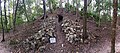
 El Tintal 1.jpg 2,048 × 1,291; 385 KB
-
 El Tintal Mano De León Complex Lidar Map PAET.jpg 3,600 × 3,600; 6.13 MB
-
 El Tintal Plateau Lidar Map PAET.jpg 3,594 × 3,594; 8.53 MB
-
 El Tintal Plateau Perspective Lidar PAET.jpg 4,452 × 2,504; 3.48 MB
-
 El Tintal Structure 14N-IIA.jpg 6,938 × 3,054; 6.8 MB
-
 El Tintal Structure 14N-P1 Kubul.jpg 4,178 × 3,133; 6.71 MB
-
 El Tintal Tropical Forest Canopy View.jpg 4,177 × 3,133; 7.67 MB
-
 Maya Ruins - (greg-willis.com) - panoramio.jpg 800 × 533; 297 KB
-
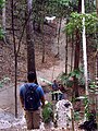
 On the Trail to Tintal - (greg-willis.com) - panoramio.jpg 800 × 533; 304 KB
-
 Pre-classic ceramics in Tintal (3265899809).jpg 1,000 × 667; 218 KB
-
 Ruins with Looters Trench - (greg-willis.com) - panoramio.jpg 800 × 533; 254 KB
-

-
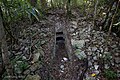
 Tintal Ballcourt - (greg-willis.com) - panoramio.jpg 800 × 533; 287 KB
-
 Tintal Camp - (greg-willis.com) - panoramio.jpg 800 × 533; 210 KB
-
 Tintal North Pyramid Stairs - (greg-willis.com) - panoramio.jpg 533 × 770; 303 KB
-
 Trail between Nakbe and La Florida - (greg-willis.com) - panoramio.jpg 800 × 533; 230 KB
-
 View from South Pyramid - (greg-willis.com) - panoramio.jpg 800 × 533; 209 KB


_-_panoramio.jpg)
_-_panoramio.jpg)
.jpg)
_-_panoramio.jpg)
.jpg)
_-_panoramio.jpg)
_-_panoramio.jpg)
_-_panoramio.jpg)
_-_panoramio.jpg)
_-_panoramio.jpg)