Category:El Castellar (Torres de Berrellén)
Jump to navigation
Jump to search
Español: El Castellar (Torres de Berrellén) (Zaragoza)
This is a category about a monument listed in the Spanish heritage register of Bienes de Interés Cultural under the reference 1-INM-ZAR-015-262-003. |
| Object location | | View all coordinates using: OpenStreetMap |
|---|
 | |||||
| Upload media | |||||
| Instance of | |||||
|---|---|---|---|---|---|
| Location | Torres de Berrellén, Zaragoza Province, Aragon, Spain | ||||
| Heritage designation | |||||
 | |||||
Media in category "El Castellar (Torres de Berrellén)"
The following 4 files are in this category, out of 4 total.
-
 El Ebro desde El Castellar.jpg 1,600 × 1,062; 271 KB
-
 Ermita de El Castellar.JPG 5,184 × 3,456; 8.44 MB
-
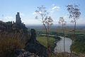
 Ruinas de El Castellar.jpg 4,288 × 3,216; 6.67 MB
-
 Visión general del castillo.jpg 4,288 × 3,216; 6.81 MB


