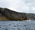
Category:Eilean Mhealasta
Jump to navigation
Jump to search
island in Outer Hebrides, Scotland, UK | |||||
| Upload media | |||||
| Instance of | |||||
|---|---|---|---|---|---|
| Part of | |||||
| Location | Outer Hebrides, Scotland | ||||
| Located in or next to body of water | |||||
| Area |
| ||||
 | |||||
English: Eilean Mhealasta is an island in the council area of the Outer Hebrides, Scotland.
Media in category "Eilean Mhealasta"
The following 15 files are in this category, out of 15 total.
-
Cairn on Rubha Buaile Linnis - geograph.org.uk - 1525307.jpg 640 × 480; 77 KB
-
Druim na Sgatha - geograph.org.uk - 3683320.jpg 2,560 × 1,920; 3.16 MB
-
Eastern Coast Of Eilean Mealasta - geograph.org.uk - 3683328.jpg 2,560 × 1,439; 1.75 MB
-
Eilean Mhealasta - geograph.org.uk - 3668948.jpg 2,560 × 1,920; 2.81 MB
-
Eilean Mhealasta - geograph.org.uk - 3668974.jpg 2,560 × 1,920; 2.97 MB
-
Laimhrig na Seoraid Mealista Island - geograph.org.uk - 916904.jpg 640 × 481; 45 KB
-
Looking south from Mealasta - geograph.org.uk - 4752829.jpg 640 × 480; 140 KB
-
Mealasta Island.svg 1,083 × 1,424; 2.36 MB
-
Mhealasta beach - geograph.org.uk - 840361.jpg 640 × 426; 52 KB
-
Rubha Leacach - geograph.org.uk - 4597600.jpg 640 × 480; 91 KB
-
Rubha Loisgte - geograph.org.uk - 4597602.jpg 640 × 546; 93 KB
-
Sgeir Ghlas na Roinne - geograph.org.uk - 4597599.jpg 640 × 451; 88 KB
-
South from Buaile Fainis - geograph.org.uk - 1456606.jpg 640 × 480; 61 KB
-
Spindle - geograph.org.uk - 2575258.jpg 640 × 480; 84 KB
-
West ridge of Griomabhal - geograph.org.uk - 961069.jpg 640 × 426; 59 KB


