Category:Ehemalige katholische Kirche im Unterdorf (Unterdorf 61.1, Göschenen)
Jump to navigation
Jump to search
| Object location | | View all coordinates using: OpenStreetMap |
|---|
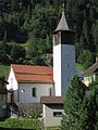
church building in Göschenen in the canton of Uri, Switzerland  | |||||
| Upload media | |||||
| Instance of | |||||
|---|---|---|---|---|---|
| Part of | |||||
| Location | Göschenen, Uri, Switzerland | ||||
| Street address |
| ||||
| Heritage designation | |||||
 | |||||
Media in category "Ehemalige katholische Kirche im Unterdorf (Unterdorf 61.1, Göschenen)"
This category contains only the following file.
-
 Göschenen alte Kirche.JPG 2,112 × 2,816; 1.85 MB