Category:Ehemalige Papierfabrik (Worblaufenstrasse 144, Ittigen)
Jump to navigation
Jump to search
| Object location | | View all coordinates using: OpenStreetMap |
|---|
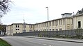
industrial building in Ittigen in the canton of Bern, Switzerland .jpg) | |||||
| Upload media | |||||
| Instance of | |||||
|---|---|---|---|---|---|
| Part of | |||||
| Location | Worblaufen, Ittigen, Bern-Mittelland administrative district, Bernese Mittelland administrative region, Bern, Switzerland | ||||
| Street address |
| ||||
| Heritage designation |
| ||||
| Inception |
| ||||
 | |||||
Media in category "Ehemalige Papierfabrik (Worblaufenstrasse 144, Ittigen)"
The following 2 files are in this category, out of 2 total.
-
 Papierfabrik Worblaufenstr 144 (cropped).jpg 1,512 × 849; 1.11 MB
-
 Papierfabrik Worblaufenstr 144.jpg 2,533 × 1,424; 3.1 MB
