Category:Ehemalige Klingental-Kaserne mit Klingentalkirche
Jump to navigation
Jump to search
| Object location | | View all coordinates using: OpenStreetMap |
|---|
 | |||||
| Upload media | |||||
| Instance of | |||||
|---|---|---|---|---|---|
| Location |
| ||||
| Street address |
| ||||
| Operator | |||||
| Heritage designation | |||||
| official website | |||||
 | |||||
Media in category "Ehemalige Klingental-Kaserne mit Klingentalkirche"
The following 19 files are in this category, out of 19 total.
-
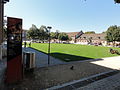 Basel 2012-09-16 Batch (125).JPG 3,648 × 2,736; 3.96 MB
-
 Basel 2012-09-16 Batch (126).JPG 3,648 × 2,736; 4.37 MB
-
 Basilea (125).jpg 4,080 × 3,072; 4.96 MB
-
 Basilea (126).jpg 4,080 × 3,072; 5.36 MB
-
 Basilea (127).jpg 4,080 × 3,072; 5.74 MB
-
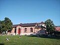
 Basilea (187).jpg 4,080 × 3,072; 4.51 MB
-
 Basilea (188).jpg 4,080 × 3,072; 4.32 MB
-
 Basilea (189).jpg 4,080 × 3,072; 3.75 MB
-
 Basilea (190).jpg 4,080 × 3,072; 3.29 MB
-
 Basilea (191).jpg 4,080 × 3,072; 5.42 MB
-
 Basilea (192).jpg 4,080 × 3,072; 5.45 MB
-
 DS Stadt Frankfurt 1832 01.jpg 743 × 534; 70 KB
-
 Eine Moschee in der Nähe von der Kaserne Basel- Bild von 2024.jpg 3,024 × 4,032; 3.23 MB
-
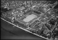 ETH-BIB-Basel, Kaserne-LBS H1-010441.tif 6,717 × 4,689; 90.3 MB
-
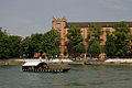
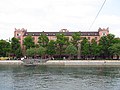 Kaserne Basel vom Rhein aus.jpg 4,000 × 3,000; 4 MB
-
 Kaserne Basel.JPG 3,264 × 2,448; 1.49 MB
-
 Picswiss BS-54-01.jpg 500 × 333; 52 KB
-
 Picswiss BS-54-03.jpg 502 × 333; 47 KB
-
 Picswiss BS-54-05.jpg 500 × 333; 55 KB
.JPG)
.JPG)
.jpg)
.jpg)
.jpg)
.jpg)
.jpg)
.jpg)
.jpg)
.jpg)
.jpg)


