Category:Egremont Ferry
Jump to navigation
Jump to search
| Object location | | View all coordinates using: OpenStreetMap |
|---|
Former site of the ferry terminal between Egremont and Liverpool, which closed in 1946.
Subcategories
This category has the following 4 subcategories, out of 4 total.
Media in category "Egremont Ferry"
The following 6 files are in this category, out of 6 total.
-
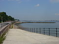
 Benkid77 Promenade, Wallasey 4 090809.JPG 3,648 × 2,736; 3.6 MB
-
 Benkid77 Wirral Maritime Heritage Trail plaque, Egremont 090809.JPG 3,648 × 2,736; 3.54 MB
-
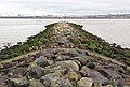 Breakwater at Egremont Ferry.jpg 4,995 × 3,390; 21.38 MB
-
 Groyne, Egremont-by-E-Pollock.jpg 640 × 480; 63 KB
-
 Slipway and breakwater from Egremont Promenade-by-Sue-Adair.jpg 640 × 480; 58 KB
-
 Slipway, Egremont, Wallasey (geograph 4549725).jpg 1,024 × 683; 208 KB


.jpg)