Category:Eglwys Fach
Jump to navigation
Jump to search
village in Wales  | |||||
| Upload media | |||||
| Pronunciation audio | |||||
|---|---|---|---|---|---|
| Instance of | |||||
| Location | Ceredigion, Wales | ||||
 | |||||
Subcategories
This category has the following 2 subcategories, out of 2 total.
E
- St Michael's Church, Eglwys Fach (10 F)
G
- Gogarth railway station (2 F)
Media in category "Eglwys Fach"
The following 39 files are in this category, out of 39 total.
-
 Afon Llyfnant.jpg 640 × 480; 86 KB
-
 Cambrian line at Ynyshir - geograph.org.uk - 583505.jpg 1,000 × 750; 402 KB
-
 Eglwys Fach - geograph.org.uk - 4060728.jpg 3,600 × 2,400; 4.13 MB
-
 Esgair Foel-ddu - geograph.org.uk - 562123.jpg 640 × 429; 79 KB
-
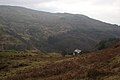
 Hillside near Eglwys Fach - geograph.org.uk - 34375.jpg 640 × 480; 147 KB
-
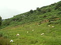
 Pasture near Melindwr, Eglwys Fach - geograph.org.uk - 34377.jpg 640 × 480; 28 KB
-
 Railway bridge near Dovey Junction - geograph.org.uk - 1439416.jpg 640 × 337; 238 KB
-
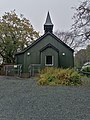 The Church Hall.jpg 3,000 × 4,000; 6.36 MB
-
 The Dyfi at high tide - geograph.org.uk - 583512.jpg 1,000 × 750; 193 KB
-
 Tin tabernacle at Eglwys Fach, from the west - geograph.org.uk - 2283721.jpg 1,600 × 1,200; 924 KB
-
 Tin tabernacle in Eglwys Fach, from SW - geograph.org.uk - 2283710.jpg 1,600 × 1,200; 975 KB
-
 Towards Dovey Junction - geograph.org.uk - 580996.jpg 480 × 640; 85 KB
-
 Ynys Crossing - geograph.org.uk - 218444.jpg 1,024 × 768; 508 KB
-
 Ynyshir (1).jpg 4,000 × 3,000; 4.76 MB
-
 Above the falls, Furnace - geograph.org.uk - 741194.jpg 640 × 427; 144 KB
-
 Buddle circles, Ystrad Einion mine - geograph.org.uk - 576532.jpg 480 × 640; 119 KB
-
 Bwlch Einion - geograph.org.uk - 645804.jpg 640 × 427; 61 KB
-
 Bwlch-y-maen - geograph.org.uk - 646795.jpg 640 × 427; 53 KB
-
 Coed Cymerau to the sea - geograph.org.uk - 565829.jpg 640 × 427; 124 KB
-
 Cottages in Cwmerau - geograph.org.uk - 646731.jpg 640 × 427; 91 KB
-
 Cultivation north east of Blaeneinion - geograph.org.uk - 557419.jpg 800 × 480; 169 KB
-
 Cwmerau - geograph.org.uk - 565840.jpg 640 × 427; 124 KB
-
 Deep adit, Ystrad Einion mine - geograph.org.uk - 576515.jpg 480 × 640; 110 KB
-
 Dol Goch - geograph.org.uk - 645793.jpg 640 × 427; 46 KB
-
 Dynyn - geograph.org.uk - 646773.jpg 640 × 427; 70 KB
-
 Field above Tyn-y-garth - geograph.org.uk - 568293.jpg 640 × 480; 53 KB
-
 Footpath from Dynyn - geograph.org.uk - 646784.jpg 640 × 427; 51 KB
-
 Forestry south of Blaeneinion - geograph.org.uk - 557441.jpg 800 × 600; 180 KB
-
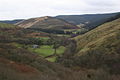
 Lower slopes - geograph.org.uk - 568309.jpg 640 × 480; 65 KB
-
 Melindwr Farm - geograph.org.uk - 646682.jpg 640 × 427; 55 KB
-
 Melindwr Farm - geograph.org.uk - 646690.jpg 640 × 427; 79 KB
-
 Melindwr, Eglwys Fach - geograph.org.uk - 646101.jpg 640 × 427; 96 KB
-
 Pasture north east of Blaeneinion - geograph.org.uk - 557411.jpg 800 × 600; 131 KB
-
 Ponds at RSPB Ynyshir - geograph.org.uk - 583486.jpg 640 × 480; 81 KB
-
 Ponds at RSPB Ynyshir - geograph.org.uk - 653151.jpg 640 × 480; 73 KB
-
 Powder magazine, Ystrad Einion mine - geograph.org.uk - 576540.jpg 480 × 640; 148 KB
-
 Salt marsh at Dovey Junction - geograph.org.uk - 581004.jpg 640 × 480; 78 KB
-
 Track south of Blaeneinion - geograph.org.uk - 557437.jpg 800 × 600; 214 KB
-
 Ystrad Einion Mine - geograph.org.uk - 23495.jpg 640 × 480; 201 KB


.jpg)


