Category:Eggborough
Jump to navigation
Jump to search
village in North Yorkshire, England, UK  Eggborough village, avec la cheminée de la centrale électrique en arrière-plan | |||||
| Upload media | |||||
| Instance of | |||||
|---|---|---|---|---|---|
| Location | Selby, North Yorkshire, Yorkshire and the Humber, England | ||||
| Population |
| ||||
 | |||||
Media in category "Eggborough"
The following 166 files are in this category, out of 166 total.
-
 A play area down Syamore Road - geograph.org.uk - 2155379.jpg 800 × 600; 258 KB
-
 A ^ C Canal toward Whitley Locks - geograph.org.uk - 2561564.jpg 3,264 × 2,448; 1.57 MB
-
 A19 at A645 roundabout, Eggborough - geograph.org.uk - 5921292.jpg 1,024 × 716; 132 KB
-
 A19 towards Selby - geograph.org.uk - 2476711.jpg 1,600 × 1,200; 426 KB
-
 A19, Whitley Bridge - geograph.org.uk - 2743606.jpg 1,280 × 853; 185 KB
-
 A645 towards Knottingley - geograph.org.uk - 2475943.jpg 1,600 × 1,200; 331 KB
-
 Air Liquide and Eggborough Power Station - geograph.org.uk - 5776378.jpg 640 × 427; 220 KB
-
 Air Liquide plant, Eggborough - geograph.org.uk - 5593890.jpg 640 × 480; 54 KB
-
 Arable field, Eggborough Ings - geograph.org.uk - 4805124.jpg 1,024 × 768; 157 KB
-
 Bowmans flour mill, Whitley Bridge - geograph.org.uk - 2868151.jpg 640 × 480; 67 KB
-
 Bowmans Flour Mill, Whitley Bridge - geograph.org.uk - 2926650.jpg 640 × 480; 55 KB
-
 Bungalow on Weeland Road - geograph.org.uk - 2475721.jpg 1,600 × 1,200; 364 KB
-
 Chimney pots with a difference - geograph.org.uk - 2750097.jpg 1,280 × 1,022; 118 KB
-
 Closing the gates - geograph.org.uk - 3794257.jpg 1,280 × 933; 469 KB
-

-
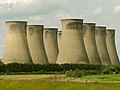
 Cooling towers - geograph.org.uk - 5776375.jpg 427 × 640; 185 KB
-
 Cooling Towers at Eggborough Power Station - geograph.org.uk - 6226886.jpg 1,065 × 1,600; 378 KB
-
 Cooling towers of Eggborough Power Station, 1995 - geograph.org.uk - 5066484.jpg 2,391 × 1,598; 3.98 MB
-
 Crop boundary, on the western edge of Eggborough - geograph.org.uk - 4801912.jpg 1,024 × 768; 173 KB
-
 Croysdale Terrace, Eggborough - geograph.org.uk - 2868115.jpg 640 × 480; 73 KB
-
 Curves of the Coolers - geograph.org.uk - 6167359.jpg 3,281 × 4,360; 1.94 MB
-
 Ditch with water, west side Kellington Lane - geograph.org.uk - 4801914.jpg 1,024 × 768; 198 KB
-

-
 Eggborough and Drax Power Stations - geograph.org.uk - 2750219.jpg 1,280 × 712; 137 KB
-
 Eggborough cooling towers - geograph.org.uk - 6003681.jpg 1,280 × 887; 234 KB
-
 Eggborough eagles fc badge.jpg 407 × 288; 14 KB
-
 Eggborough glass factory - geograph.org.uk - 2750195.jpg 1,280 × 757; 159 KB
-
 Eggborough glass factory - geograph.org.uk - 2750210.jpg 1,280 × 791; 126 KB
-
 Eggborough Ings - geograph.org.uk - 5776372.jpg 640 × 427; 188 KB
-
 Eggborough Local Police Station - geograph.org.uk - 4116393.jpg 1,600 × 1,100; 562 KB
-
 Eggborough Methodist Church - geograph.org.uk - 2750252.jpg 1,280 × 954; 282 KB
-
 Eggborough Post Office - geograph.org.uk - 2750255.jpg 1,280 × 959; 306 KB
-
-
 Eggborough power - geograph.org.uk - 2748627.jpg 1,024 × 866; 77 KB
-
 Eggborough Power Station - geograph.org.uk - 2743617.jpg 1,280 × 850; 174 KB
-
 Eggborough Power Station - geograph.org.uk - 2750225.jpg 1,280 × 853; 244 KB
-
 Eggborough Power Station - geograph.org.uk - 5066663.jpg 2,333 × 1,465; 2.51 MB
-
 Eggborough Power Station - geograph.org.uk - 5100759.jpg 640 × 480; 65 KB
-
 Eggborough Power Station - geograph.org.uk - 5593902.jpg 480 × 640; 48 KB
-
 Eggborough Power Station - geograph.org.uk - 5595083.jpg 640 × 480; 62 KB
-
 Eggborough Power Station - geograph.org.uk - 6008056.jpg 1,280 × 818; 198 KB
-
 Eggborough Power Station - geograph.org.uk - 6328660.jpg 3,264 × 2,448; 2.43 MB
-
 Eggborough Power Station - geograph.org.uk - 6783531.jpg 1,600 × 1,195; 268 KB
-
 Eggborough Power Station from Roe Lane - geograph.org.uk - 5774488.jpg 640 × 427; 236 KB
-

-

-
 Eggborough Surgery on Selby Road - geograph.org.uk - 2143039.jpg 800 × 600; 201 KB
-
 Eggborough telephone exchange - geograph.org.uk - 2750239.jpg 1,280 × 959; 431 KB
-
 Eggborough.jpg 640 × 427; 79 KB
-
 Emmanuel Church on Weeland Road, Eggborough - geograph.org.uk - 4108556.jpg 1,600 × 1,064; 598 KB
-
 Entrance to Eggborough Quarry - geograph.org.uk - 5593964.jpg 640 × 480; 96 KB
-

-
 Farmland beside Wand Lane - geograph.org.uk - 5776370.jpg 640 × 427; 187 KB
-

-
 Farmland on the western edge of Eggborough - geograph.org.uk - 4801909.jpg 1,024 × 768; 157 KB
-
 Farmland, Eggborough - geograph.org.uk - 2475942.jpg 1,600 × 1,200; 366 KB
-

-

-
 Former road to Eggborough - geograph.org.uk - 5216318.jpg 1,024 × 768; 162 KB
-
 Grain silos at Whitley Bridge - geograph.org.uk - 2868144.jpg 640 × 480; 49 KB
-
 Haddlesey Pump Station - geograph.org.uk - 686048.jpg 640 × 427; 62 KB
-
 Hazel Old Lane - geograph.org.uk - 6008055.jpg 1,280 × 960; 533 KB
-
 Hazel Old Road at Wand Lane - geograph.org.uk - 6226858.jpg 1,600 × 1,065; 661 KB
-
 Heading towards Great Heck - geograph.org.uk - 2143083.jpg 800 × 600; 172 KB
-
 High Eggborough - geograph.org.uk - 3794255.jpg 1,280 × 960; 675 KB
-
 High Eggborough Lane Level Crossing - geograph.org.uk - 1265851.jpg 640 × 480; 77 KB
-
 High Eggborough level crossing - geograph.org.uk - 3794256.jpg 1,280 × 960; 919 KB
-
 High Eggborough level crossing - geograph.org.uk - 3794261.jpg 1,280 × 960; 681 KB
-
 High Eggborough-Goole postbox ref, DN14 107 - geograph.org.uk - 3794253.jpg 1,280 × 960; 844 KB
-
 Horse and Jockey - geograph.org.uk - 1612505.jpg 640 × 426; 59 KB
-
 Horse and Jockey, Eggborough - geograph.org.uk - 4108539.jpg 1,600 × 1,064; 530 KB
-
 House off Weeland Road, Eggborough - geograph.org.uk - 4108548.jpg 1,600 × 1,460; 1.14 MB
-
 Houses on Green Acers, Eggborough - geograph.org.uk - 4116399.jpg 1,600 × 1,064; 398 KB
-
 Houses on Tranmore Lane - geograph.org.uk - 2743626.jpg 1,280 × 842; 277 KB
-
 Hut Green - geograph.org.uk - 2750246.jpg 1,280 × 834; 298 KB
-
 Hut Green Garage - geograph.org.uk - 2750289.jpg 1,280 × 949; 290 KB
-
 Hut Green Roundabout - geograph.org.uk - 1265839.jpg 640 × 480; 41 KB
-
 Ings and Tethering Drain - geograph.org.uk - 2750092.jpg 1,280 × 853; 341 KB
-
 Ings Lane (track) - geograph.org.uk - 2475895.jpg 1,600 × 1,200; 638 KB
-
 Ings Lane heading to Eggborough Ings - geograph.org.uk - 4805113.jpg 1,024 × 768; 154 KB
-
 Ings Lane, footpath to Eggborough Ings - geograph.org.uk - 288796.jpg 640 × 479; 111 KB
-
 Ings Lane, off Wand Lane - geograph.org.uk - 4805101.jpg 1,024 × 768; 169 KB
-
 J J Tech Vans, Gallows Hill - geograph.org.uk - 5595078.jpg 640 × 480; 66 KB
-
 Jolly Miller public house, Eggborough - geograph.org.uk - 3923518.jpg 1,600 × 1,064; 434 KB
-
 Jolly Miller public house, Eggborough - geograph.org.uk - 3923520.jpg 1,054 × 1,600; 325 KB
-

-
 Kellington Lane, Eggborough - geograph.org.uk - 4801907.jpg 1,024 × 683; 93 KB
-
 Kellington Lane, Eggborough - geograph.org.uk - 5998805.jpg 1,280 × 855; 229 KB
-
 Leaving Whitley Lock - geograph.org.uk - 2555151.jpg 3,264 × 2,448; 1.66 MB
-
 Level crossing - High Eggborough Lane - geograph.org.uk - 5065663.jpg 640 × 480; 102 KB
-
 Looking east from Old Whitley Bridge - geograph.org.uk - 2743595.jpg 1,280 × 853; 204 KB
-

-
 M62 nears Moor Lee Lane overbridge - geograph.org.uk - 3687345.jpg 640 × 479; 47 KB
-
 M62 viaduct, Whitley - geograph.org.uk - 4550650.jpg 1,024 × 615; 119 KB
-
 Mill - grain building Whitley Bridge - geograph.org.uk - 844431.jpg 640 × 480; 69 KB
-
 Mill building, Whitley Bridge - geograph.org.uk - 2476707.jpg 1,600 × 1,200; 352 KB
-
 Mill of Masts - geograph.org.uk - 823546.jpg 640 × 427; 48 KB
-
 Modern milestone - geograph.org.uk - 2750273.jpg 1,280 × 952; 344 KB
-
 Moor Lee Lane - geograph.org.uk - 1265889.jpg 640 × 429; 72 KB
-
 Moor Lee Lane - geograph.org.uk - 1265896.jpg 640 × 422; 64 KB
-
 Myrtle Grange Farm, Hensall - geograph.org.uk - 5595080.jpg 640 × 480; 42 KB
-
 Old bridge and new - geograph.org.uk - 3617788.jpg 1,024 × 768; 142 KB
-
 Old Whitley Bridge - geograph.org.uk - 2743587.jpg 1,280 × 853; 183 KB
-
 Paddock fence, east of Selby Road - geograph.org.uk - 4801929.jpg 1,024 × 768; 146 KB
-
 Paddock, north-east of Eggborough - geograph.org.uk - 4801928.jpg 1,024 × 768; 200 KB
-
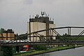
 Pipe Bridge at Whitley Bridge - geograph.org.uk - 2743596.jpg 1,280 × 853; 192 KB
-
 Pipe bridge over the Aire and Calder Navigation - geograph.org.uk - 3617808.jpg 1,024 × 768; 152 KB
-

-
 Railway to Eggborough Power Station - geograph.org.uk - 2750206.jpg 1,280 × 853; 241 KB
-
 Railway to Eggborough Power Station - geograph.org.uk - 5065672.jpg 640 × 480; 104 KB
-
 Redundant Monsters - geograph.org.uk - 6167352.jpg 4,608 × 3,456; 3.05 MB
-
 Ring Bell for Attendant - geograph.org.uk - 2555171.jpg 3,264 × 2,448; 1.95 MB
-
 Roall Pumping Station - geograph.org.uk - 1117941.jpg 640 × 427; 58 KB
-
 Roundabout on the A645, Eggborough - geograph.org.uk - 2475936.jpg 1,600 × 1,200; 385 KB
-
 Ryecroft Gardens - geograph.org.uk - 2750308.jpg 1,280 × 899; 233 KB
-
 Selby Road, Eggborough - geograph.org.uk - 2143027.jpg 800 × 600; 192 KB
-
 Selby Road, Eggborough - geograph.org.uk - 2143043.jpg 800 × 600; 196 KB
-
 Selby Road, Eggborough - geograph.org.uk - 2743629.jpg 1,280 × 853; 269 KB
-
 Silo at Whitley Bridge - geograph.org.uk - 2743585.jpg 1,280 × 850; 154 KB
-
 Silo at Whitley Bridge - geograph.org.uk - 2743599.jpg 1,280 × 847; 240 KB
-
 Silos off Selby Road, Eggborough - geograph.org.uk - 2143050.jpg 800 × 600; 340 KB
-
 Silver Birch on Moor Lea Lane - geograph.org.uk - 5217817.jpg 1,024 × 768; 180 KB
-
 Spar stores - geograph.org.uk - 2750304.jpg 1,280 × 952; 303 KB
-
 Springfield Farm, off the A645 - geograph.org.uk - 288783.jpg 640 × 479; 75 KB
-
 St Gobain glass factory, Eggborough - geograph.org.uk - 5595076.jpg 640 × 480; 77 KB
-

-
 Sugar beet near Eggborough - geograph.org.uk - 5998801.jpg 1,280 × 960; 470 KB
-
 Tabard Road, Eggborough - geograph.org.uk - 4801908.jpg 1,024 × 768; 137 KB
-

-
 The Chestnuts, Hut Green - geograph.org.uk - 2750234.jpg 1,280 × 946; 515 KB
-
 The Horse & Jockey, Hut Green - geograph.org.uk - 2750237.jpg 1,280 × 944; 278 KB
-
 The Horse and Jockey, Eggborough - geograph.org.uk - 2475939.jpg 1,600 × 850; 261 KB
-
 The Horse and Jockey, Hut Green - geograph.org.uk - 3183804.jpg 640 × 427; 118 KB
-
 The Jolly Miller - geograph.org.uk - 3183797.jpg 640 × 427; 133 KB
-
-
 The M62 near Moor Lea Lane Bridge - geograph.org.uk - 3086356.jpg 800 × 600; 89 KB
-
 The northern edge of Eggborough - geograph.org.uk - 4801925.jpg 1,024 × 615; 122 KB
-
 The Old Exchange - geograph.org.uk - 2750280.jpg 1,280 × 949; 294 KB
-
 The Selby Road, heading north out of Eggborough - geograph.org.uk - 4801922.jpg 1,024 × 768; 149 KB
-
 This way to Kellington - geograph.org.uk - 2155367.jpg 800 × 600; 352 KB
-
 Top gates opening, Whitley Lock, Aire ^ Calder - geograph.org.uk - 4550644.jpg 1,024 × 768; 115 KB
-
 Track across Eggborough Ings - geograph.org.uk - 2749766.jpg 1,280 × 842; 223 KB
-
 Track off Kellington Lane - geograph.org.uk - 3617815.jpg 1,024 × 768; 150 KB
-
 Track running south from the A645 - geograph.org.uk - 2475722.jpg 1,600 × 1,200; 590 KB
-
 Track to Eggborough Ings - geograph.org.uk - 2748630.jpg 1,024 × 768; 85 KB
-
 Track to Lock Farm - geograph.org.uk - 2749756.jpg 1,280 × 853; 227 KB
-
 Traffic Calming on Kellington Lane - geograph.org.uk - 1265822.jpg 640 × 408; 49 KB
-
 Traffic calming on Kellington Lane - geograph.org.uk - 3617811.jpg 1,024 × 768; 125 KB
-
 Under the M62 - geograph.org.uk - 2555161.jpg 3,264 × 2,448; 1.04 MB
-
 Vapour from Eggborough's cooling towers - geograph.org.uk - 4805135.jpg 1,024 × 768; 130 KB
-

-
 View south to Eggborough Power Station - geograph.org.uk - 6391708.jpg 5,010 × 3,561; 3.55 MB
-
 Wand Lane and cooling towers - geograph.org.uk - 5776360.jpg 427 × 640; 189 KB
-
 Wand Lane at Eggborough Power Station - geograph.org.uk - 6226863.jpg 1,065 × 1,600; 353 KB
-
 Wand Lane towards Eggborough - geograph.org.uk - 6226862.jpg 1,600 × 1,099; 760 KB
-
 Wand Lane towards the A19 - geograph.org.uk - 2475904.jpg 1,600 × 1,200; 490 KB
-
 Wand Lane towards the A19 - geograph.org.uk - 2475913.jpg 1,600 × 1,200; 364 KB
-
 We can all eat dirt^ - geograph.org.uk - 5998800.jpg 1,280 × 934; 533 KB
-
 Weeland Road Level Crossing - geograph.org.uk - 1265877.jpg 640 × 480; 39 KB
-
 Wentworth Close - geograph.org.uk - 2750247.jpg 1,280 × 950; 371 KB
-

-
 Whitley Bridge level crossing - geograph.org.uk - 3183793.jpg 640 × 427; 145 KB
-
 Whitley Bridge with Old Whitley Bridge beyond. - geograph.org.uk - 2555401.jpg 3,264 × 2,448; 1.81 MB
-
-
 Wind turbine and Eggborough power station - geograph.org.uk - 4021956.jpg 4,096 × 2,941; 2.17 MB
-
 Yew House - geograph.org.uk - 2750286.jpg 1,280 × 960; 275 KB


_-_geograph.org.uk_-_2750264.jpg)


_-_geograph.org.uk_-_2475895.jpg)


_-_geograph.org.uk_-_2750313.jpg)

