Category:Egerton House
Jump to navigation
Jump to search
| Object location | | View all coordinates using: OpenStreetMap |
|---|
house in Egerton, Ashford, Kent, England, UK  | |||||
| Upload media | |||||
| Instance of | |||||
|---|---|---|---|---|---|
| Location | Egerton, Ashford, Kent, South East England, England | ||||
| Heritage designation |
| ||||
 | |||||
Media in category "Egerton House"
The following 8 files are in this category, out of 8 total.
-
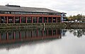
 Birkenhead docks - Egerton House - geograph.org.uk - 470607.jpg 640 × 480; 111 KB
-
 Egerton Dock 2017-3.jpg 4,956 × 3,144; 8.04 MB
-
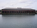
 Egerton House 2017.jpg 4,962 × 2,592; 5.94 MB
-
 Egerton House, Birkenhead (2).JPG 4,320 × 3,240; 3.15 MB
-
 Egerton House, Birkenhead (geograph 2960853).jpg 1,024 × 683; 75 KB
-
 Egerton House, Birkenhead (geograph 2960856).jpg 1,024 × 683; 85 KB
-
 Egerton House, Birkenhead.JPG 4,320 × 3,240; 3.21 MB
-
 Peter Pan programme 1906 Berkhamsted.jpg 750 × 612; 100 KB


.JPG)
.jpg)
.jpg)

