Category:Eewal 59, Leeuwarden
Jump to navigation
Jump to search
| Object location | | View all coordinates using: OpenStreetMap |
|---|
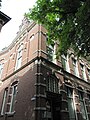
_Eewal_59_hoek_Huygensstraat.jpg) | |||||
| Upload media | |||||
| Instance of | |||||
|---|---|---|---|---|---|
| Location | Leeuwarden, Friesland, Netherlands | ||||
| Street address |
| ||||
| Heritage designation |
| ||||
 | |||||
|
This is a category about rijksmonument number 516485
|
| Address |
|
Media in category "Eewal 59, Leeuwarden"
The following 4 files are in this category, out of 4 total.
-
 Leeuwarden 2 (73) Eewal 59 hoek Huygensstraat.jpg 3,000 × 4,000; 1.28 MB
-
 Overzicht Eewal - Leeuwarden - 20130505 - RCE.jpg 1,190 × 1,200; 309 KB
-
 WLM - mringenoldus - Detail bij kantoorpand met aangebouwde conciërgewoning.jpg 1,024 × 683; 337 KB
-
 WLM - mringenoldus - Kantoorpand met aangebouwde conciërgewoning.jpg 683 × 1,024; 506 KB


