Category:Edmundbyers
Jump to navigation
Jump to search
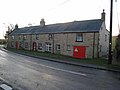
English: Edmundbyers is a village in County Durham, in England. It is situated a few miles to the west of Consett, near Derwent Reservoir.
village in County Durham, United Kingdom  | |||||
| Upload media | |||||
| Instance of | |||||
|---|---|---|---|---|---|
| Location | Edmondbyers, County Durham, North East England, England | ||||
 | |||||
Subcategories
This category has the following 2 subcategories, out of 2 total.
E
P
Media in category "Edmundbyers"
The following 62 files are in this category, out of 62 total.
-
 (Part of) Muggleswick Common - geograph.org.uk - 525865.jpg 640 × 480; 81 KB
-
 Barn - geograph.org.uk - 549720.jpg 640 × 480; 66 KB
-
 Bracken on Middles - geograph.org.uk - 524737.jpg 640 × 480; 114 KB
-

-
 Chimney of secret nuclear bunker - geograph.org.uk - 513846.jpg 480 × 640; 98 KB
-
 Edmondbyers Cross (remains of) - geograph.org.uk - 520953.jpg 640 × 383; 63 KB
-
 Edmondbyers village green (2) - geograph.org.uk - 3314247.jpg 640 × 480; 117 KB
-
 Edmondbyers village green - geograph.org.uk - 3314234.jpg 640 × 480; 68 KB
-

-
 Edmundbyers - geograph.org.uk - 1968305.jpg 3,485 × 1,527; 585 KB
-
 Edmundbyers - geograph.org.uk - 944331.jpg 640 × 427; 144 KB
-
 Edmundbyers village green - geograph.org.uk - 3465081.jpg 4,608 × 3,456; 5.24 MB
-
 Edmundbyers Youth Hostel - geograph.org.uk - 282276.jpg 640 × 480; 54 KB
-
 Edmundbyers Youth Hostel - geograph.org.uk - 3275348.jpg 800 × 526; 51 KB
-
 Farm at Edmundbyers - geograph.org.uk - 3465100.jpg 4,608 × 3,456; 5.49 MB
-
 Heather on Middles - geograph.org.uk - 524731.jpg 640 × 480; 110 KB
-
 Houses north of village green in Edmundbyers - geograph.org.uk - 2163677.jpg 2,000 × 962; 1.53 MB
-
 Limerick Cottage - geograph.org.uk - 1957296.jpg 3,837 × 2,517; 1.22 MB
-
 Limerick Cottage, Edmundbyers - geograph.org.uk - 2413061.jpg 3,264 × 2,448; 2.06 MB
-
 Pastures north of Edmundbyers - geograph.org.uk - 3289909.jpg 640 × 480; 88 KB
-
 Sunrise near Edmundbyers - geograph.org.uk - 897534.jpg 640 × 427; 44 KB
-
 The Punch Bowl at Edmundbyers - geograph.org.uk - 2413029.jpg 3,264 × 2,448; 2.2 MB
-
 The Stanhope road leading out of Edmunbyers - geograph.org.uk - 2413048.jpg 3,264 × 2,448; 1.78 MB
-
 Adam's Cow - geograph.org.uk - 513811.jpg 640 × 480; 111 KB
-
 Allenshields Farm - geograph.org.uk - 513974.jpg 640 × 480; 72 KB
-
 Allenshields Farm - geograph.org.uk - 536664.jpg 640 × 300; 47 KB
-

-
 Atcon Burn - geograph.org.uk - 1446435.jpg 640 × 480; 142 KB
-
 Beautie Sike - geograph.org.uk - 524805.jpg 640 × 480; 128 KB
-
 Bridge over Feldon Burn (2) - geograph.org.uk - 524524.jpg 640 × 480; 126 KB
-
 Bridge over Feldon Burn (3) - geograph.org.uk - 525848.jpg 640 × 480; 132 KB
-
 Bridge over Feldon Burn - geograph.org.uk - 513751.jpg 640 × 480; 113 KB
-
 Buckshott Farm - geograph.org.uk - 505336.jpg 640 × 480; 88 KB
-
 Burn Hope - geograph.org.uk - 513803.jpg 640 × 480; 109 KB
-
 Cross Rigg - geograph.org.uk - 525937.jpg 640 × 480; 86 KB
-
 Disused quarry on Hisehope Flat - geograph.org.uk - 525882.jpg 640 × 480; 101 KB
-
 Farmers track near Harehope Burn. - geograph.org.uk - 497307.jpg 640 × 427; 352 KB
-
 Feldon Burn - geograph.org.uk - 525842.jpg 640 × 480; 133 KB
-
 Feldon Carrs (2) - geograph.org.uk - 525957.jpg 640 × 480; 78 KB
-
 Feldon Carrs (3) - geograph.org.uk - 525958.jpg 640 × 480; 90 KB
-
 Footbridge over Burnhope Burn - geograph.org.uk - 611483.jpg 640 × 480; 107 KB
-
 Footpath on Muggleswick Park - geograph.org.uk - 525968.jpg 640 × 480; 127 KB
-

-
 Green grouse butts on Feldon Plain - geograph.org.uk - 524586.jpg 640 × 480; 111 KB
-
 Grouse butts below Harehope Hill - geograph.org.uk - 525914.jpg 640 × 480; 86 KB
-
 Grouse butts on Muggleswick Common - geograph.org.uk - 525889.jpg 640 × 480; 90 KB
-
 Grouse butts on Muggleswick Park - geograph.org.uk - 513869.jpg 640 × 480; 120 KB
-
 Harehope Hill - geograph.org.uk - 525897.jpg 640 × 480; 119 KB
-
 Hill 443 on Muggleswick Common - geograph.org.uk - 525851.jpg 640 × 480; 89 KB
-
 Middles (2) - geograph.org.uk - 524800.jpg 640 × 480; 99 KB
-
 Middles - geograph.org.uk - 524556.jpg 640 × 480; 100 KB
-
 Middles - geograph.org.uk - 524795.jpg 640 × 480; 90 KB
-
 Muggleswick Common - geograph.org.uk - 513830.jpg 640 × 480; 78 KB
-
 Muggleswick Common - geograph.org.uk - 525904.jpg 640 × 480; 104 KB
-
 Muggleswick Common - geograph.org.uk - 525944.jpg 640 × 480; 104 KB
-
 Old bridge over Harehope Burn - geograph.org.uk - 497315.jpg 618 × 407; 358 KB
-
 River Derwent below the Reservoir - geograph.org.uk - 282286.jpg 640 × 480; 59 KB
-
 Road near Edmundbyers - geograph.org.uk - 497269.jpg 640 × 427; 267 KB
-
 Ruffside Moor - geograph.org.uk - 707892.jpg 640 × 480; 89 KB
-
 Shooting butt at the western Fir Pool - geograph.org.uk - 525919.jpg 640 × 480; 89 KB
-
 The eastern Fir Pool - geograph.org.uk - 525931.jpg 640 × 480; 71 KB
-
 The road to the Derwent Reservoir dam - geograph.org.uk - 282283.jpg 640 × 480; 76 KB
_Muggleswick_Common_-_geograph.org.uk_-_525865.jpg)


_-_geograph.org.uk_-_520953.jpg)
_-_geograph.org.uk_-_3314247.jpg)


_-_geograph.org.uk_-_524524.jpg)
_-_geograph.org.uk_-_525848.jpg)


_-_geograph.org.uk_-_525957.jpg)
_-_geograph.org.uk_-_525958.jpg)


_-_geograph.org.uk_-_524800.jpg)


