Category:Edmondscote Weir, Royal Leamington Spa
Jump to navigation
Jump to search
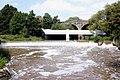
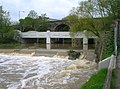
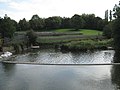
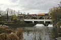
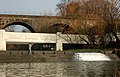
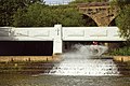
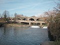
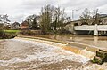
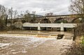
English: The weir downstream of Milverton Viaduct and Princes Bridge is called:
- "Milverton Weir" according to OpenStreetMaps
- "Prince's Drive Weir" according to GoogleMaps
- "Prince's Steps" (likely a local name?)
- "Edmondscote Weir" (assumed official name)
Media in category "Edmondscote Weir, Royal Leamington Spa"
The following 34 files are in this category, out of 34 total.
-
 Bridges and weir, River Leam, Edmondscote - geograph.org.uk - 1722009.jpg 2,000 × 1,333; 284 KB
-
 Bridges over the Leam - geograph.org.uk - 5301816.jpg 640 × 427; 218 KB
-
 Changes along Riverside Walk - geograph.org.uk - 2549968.jpg 640 × 480; 475 KB
-

-

-
 Edmondscote Weir, River Leam - geograph.org.uk - 3856613.jpg 1,280 × 851; 307 KB
-

-

-

-
 Edmondscote weir, River Leam, Leamington Spa - geograph.org.uk - 2928725.jpg 2,000 × 1,480; 304 KB
-
 Engineering work, Edmondscote - geograph.org.uk - 2063374.jpg 640 × 480; 113 KB
-

-

-
-
-

-

-
 Prince's Bridge and weir - geograph.org.uk - 1632979.jpg 640 × 413; 83 KB
-
 Prince's Drive Bridge and Weir - geograph.org.uk - 5301047.jpg 1,600 × 1,200; 397 KB
-
 Prince's Drive bridges and weir - geograph.org.uk - 4778628.jpg 2,000 × 1,333; 1.25 MB
-

-

-
 Princes Steps aka Edmondscote weir - geograph.org.uk - 2007891.jpg 792 × 528; 455 KB
-
 Rail, road, river - geograph.org.uk - 6296840.jpg 1,024 × 768; 325 KB
-

-

-

-
 Sitting on the Weir - geograph.org.uk - 5851601.jpg 5,184 × 3,456; 4.45 MB
-

-

-
 Weir on River Leam - geograph.org.uk - 115796.jpg 640 × 480; 164 KB
-
 Weir on River Leam - geograph.org.uk - 128248.jpg 640 × 480; 177 KB
-
 Weir, River Leam - geograph.org.uk - 5304198.jpg 1,000 × 662; 709 KB
-
 Weir, River Leam - geograph.org.uk - 5304200.jpg 1,000 × 662; 782 KB


_-_geograph.org.uk_-_1632974.jpg)
_-_geograph.org.uk_-_1632976.jpg)


