Category:Edith Weston
Jump to navigation
Jump to search
village in United Kingdom  | |||||
| Upload media | |||||
| Instance of | |||||
|---|---|---|---|---|---|
| Location | Rutland, East Midlands, England | ||||
| Population |
| ||||
| Area |
| ||||
| Said to be the same as | Edith Weston (Wikimedia duplicated page, civil parish) | ||||
 | |||||
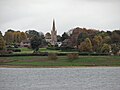
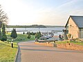
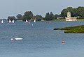
English: Edith Weston is a village and civil parish in the county of Rutland in the East Midlands of England. It is on the south-eastern shore of Rutland Water and is home of the main sailing club with a fishing lodge.
Subcategories
This category has the following 2 subcategories, out of 2 total.
N
- Normanton Church (42 F)
S
Media in category "Edith Weston"
The following 200 files are in this category, out of 267 total.
(previous page) (next page)-
 12 Well Cross, Edith Weston - geograph.org.uk - 4840023.jpg 1,280 × 1,121; 451 KB
-
 17 Well Cross, Edith Weston - geograph.org.uk - 4840043.jpg 1,280 × 960; 255 KB
-
 22 ^ 24 King Edward's Way, Edith Weston - geograph.org.uk - 4840048.jpg 1,280 × 960; 356 KB
-
 3-7 Rectory Lane, Edith Weston - geograph.org.uk - 4839766.jpg 1,280 × 920; 351 KB
-
 41 ^ 43 Weston Road, Edith Weston - geograph.org.uk - 4839774.jpg 1,280 × 970; 425 KB
-
 A copse in the making - geograph.org.uk - 2320729.jpg 1,024 × 768; 211 KB
-
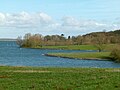
 A glimpse of Rutland Water - geograph.org.uk - 3289602.jpg 2,339 × 1,752; 1.33 MB
-
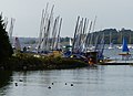
 A mat of masts - geograph.org.uk - 4839806.jpg 1,280 × 1,280; 460 KB
-
 A paddling of ducks on Rutland Water - geograph.org.uk - 3569169.jpg 4,320 × 3,240; 5.67 MB
-
 A quiet cove at Rutland Water - geograph.org.uk - 3569113.jpg 4,320 × 3,240; 5.51 MB
-
 Amenity land by Rutland Water - geograph.org.uk - 6073169.jpg 1,024 × 768; 235 KB
-
-
 Autumn colours at Rutland Water - geograph.org.uk - 5570420.jpg 800 × 519; 141 KB
-
 Bare field, north of the airfield - geograph.org.uk - 2320751.jpg 1,024 × 768; 158 KB
-
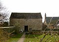 Barn at 22 Well Close, Edith Weston - geograph.org.uk - 4849024.jpg 1,280 × 902; 328 KB
-
 Barns at Jubilee Close - geograph.org.uk - 4849022.jpg 1,280 × 960; 375 KB
-
 Bays on Rutland Water - geograph.org.uk - 4839814.jpg 1,280 × 960; 306 KB
-
 Bench and tree near Edith Weston - geograph.org.uk - 1005196.jpg 458 × 640; 103 KB
-
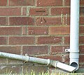 Bench mark, 1 Weston Road, Edith Weston - geograph.org.uk - 4839787.jpg 640 × 573; 148 KB
-
 Bench mark, St Mary's Church, Edith Weston - geograph.org.uk - 4839402.jpg 1,145 × 1,280; 622 KB
-
 Bench mark, The Grange, Edith Weston - geograph.org.uk - 4839948.jpg 1,280 × 960; 450 KB
-
 Bench mark, The Wheatsheaf, Edith Weston - geograph.org.uk - 4839959.jpg 960 × 1,280; 519 KB
-
 Berberis darwinii Flowers - geograph.org.uk - 3907133.jpg 640 × 427; 91 KB
-
 Berwick House, Well Cross, Edith Weston - geograph.org.uk - 4840039.jpg 1,280 × 960; 326 KB
-
 Beside the harbour at Edith Weston - geograph.org.uk - 4049252.jpg 640 × 427; 69 KB
-
 Boats and jetty at Rutland Water - geograph.org.uk - 3569123.jpg 4,320 × 3,240; 5.46 MB
-
 Boats at Rutland Sailing Club - geograph.org.uk - 3288258.jpg 2,703 × 1,817; 1.54 MB
-
 Boats at Rutland Sailing Club - geograph.org.uk - 3288273.jpg 3,210 × 2,091; 2.2 MB
-
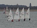
 Boats at Rutland Sailing Club - geograph.org.uk - 5570413.jpg 800 × 534; 105 KB
-
 Boats at Rutland Water Sailing Club - geograph.org.uk - 1005434.jpg 640 × 400; 66 KB
-
 Boats at Rutland Water Sailing Club - geograph.org.uk - 3724693.jpg 1,600 × 1,302; 479 KB
-
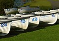
 Boats Moored on the Jetty - geograph.org.uk - 2382493.jpg 1,024 × 768; 157 KB
-
 Boats on Rutland Water - geograph.org.uk - 1005373.jpg 640 × 447; 52 KB
-
 Boats on Rutland Water - geograph.org.uk - 4839801.jpg 1,280 × 759; 218 KB
-

-
 Cafe at Normanton Car Park - geograph.org.uk - 5835705.jpg 3,776 × 2,520; 2.9 MB
-

-
 Church Lane, Edith Weston - geograph.org.uk - 6503462.jpg 4,608 × 3,072; 3.64 MB
-
 Church of St Mary the Virgin, Edith Weston - geograph.org.uk - 5834812.jpg 3,776 × 2,520; 3.5 MB
-
 Church of St Mary, Edith Weston - geograph.org.uk - 4839425.jpg 1,280 × 1,017; 316 KB
-
 Connect four - geograph.org.uk - 2727553.jpg 756 × 567; 209 KB
-
 Construction machinery at Rutland Water - geograph.org.uk - 3724739.jpg 1,600 × 1,081; 494 KB
-
 Cottages on King Edward's Way - geograph.org.uk - 4839967.jpg 1,280 × 960; 341 KB
-
 Cottages, Edith Weston (geograph 7377341).jpg 1,024 × 768; 168 KB
-
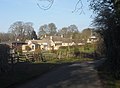
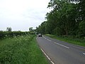
 Country Road - geograph.org.uk - 207204.jpg 640 × 480; 66 KB
-
 Country road - geograph.org.uk - 5511641.jpg 640 × 480; 56 KB
-
 Craft marquees at Rutland Water - geograph.org.uk - 2483354.jpg 640 × 427; 126 KB
-
 Crafty chicken - geograph.org.uk - 2483357.jpg 427 × 640; 148 KB
-
 Crop field towards Rutland Water - geograph.org.uk - 4007584.jpg 640 × 480; 48 KB
-
 Crop field, Edith Weston - geograph.org.uk - 4007608.jpg 640 × 480; 93 KB
-
 Crossroads by Wytchley Warren Farm - geograph.org.uk - 2320712.jpg 1,024 × 768; 106 KB
-
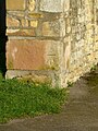
 Datestone, The Grange, Edith Weston - geograph.org.uk - 4839936.jpg 1,280 × 960; 417 KB
-
 Datestone, The Old Rectory - geograph.org.uk - 4839761.jpg 1,280 × 960; 439 KB
-
 Dinghy sailor on Rutland Water - geograph.org.uk - 4839827.jpg 1,280 × 1,280; 408 KB
-
 Doorway, School House, Edith Weston - geograph.org.uk - 4839952.jpg 960 × 1,280; 441 KB
-
 Ducks on Rutland Water - geograph.org.uk - 4839798.jpg 1,280 × 907; 348 KB
-
 Edith Weston 'Post Office' postbox, ref LE15 66 - geograph.org.uk - 4840045.jpg 921 × 1,280; 432 KB
-
 Edith Weston - geograph.org.uk - 3391472.jpg 4,220 × 3,102; 2.33 MB
-
 Edith Weston Cross - geograph.org.uk - 4840018.jpg 1,280 × 960; 520 KB
-
 Edith Weston defibrillator kiosk - geograph.org.uk - 4840046.jpg 1,280 × 932; 578 KB
-
 Edith Weston from afar - geograph.org.uk - 5183173.jpg 1,024 × 768; 985 KB
-
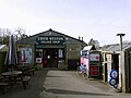 Edith Weston Village Shop - geograph.org.uk - 4849023.jpg 1,280 × 960; 264 KB
-
 Edith Weston, Rutland Water - geograph.org.uk - 4665029.jpg 640 × 426; 101 KB
-
 Edith Weston, Rutland Water - geograph.org.uk - 4665047.jpg 426 × 640; 117 KB
-
 Edith Weston, Rutland Water - geograph.org.uk - 4665054.jpg 426 × 640; 110 KB
-
 Edith Weston, Rutland Water - geograph.org.uk - 4665063.jpg 640 × 426; 105 KB
-
 Edith Weston, Rutland Water - geograph.org.uk - 4665111.jpg 426 × 640; 105 KB
-
 Edith Weston, Rutland, UK - panoramio.jpg 2,576 × 1,920; 1 MB
-
 Empingham Road - geograph.org.uk - 207208.jpg 640 × 391; 58 KB
-
 Empingham Road by Ketton Gorse - geograph.org.uk - 2627973.jpg 4,000 × 3,000; 4.01 MB
-
 Entrance to Rutland Sailing Club - geograph.org.uk - 1005383.jpg 640 × 412; 72 KB
-
 Exposed shoreline of Rutland Water - geograph.org.uk - 1005379.jpg 640 × 472; 95 KB
-
 Farm track near Wytchley Warren Farm - geograph.org.uk - 364880.jpg 640 × 427; 104 KB
-
 Farmland and hedgerow - geograph.org.uk - 4007582.jpg 640 × 480; 57 KB
-
 Farmland south of Manton Road - geograph.org.uk - 3289586.jpg 2,567 × 1,996; 1.18 MB
-
 Farmland, Edith Weston - geograph.org.uk - 4007591.jpg 640 × 480; 63 KB
-
 Fields - geograph.org.uk - 207209.jpg 640 × 480; 90 KB
-
 Fingerpost near Wytchley Warren Farm - geograph.org.uk - 4791897.jpg 1,280 × 960; 324 KB
-

-
 Fishing boats near Edith Weston - geograph.org.uk - 1005217.jpg 640 × 363; 57 KB
-
 Fishing Lodge at Edith Weston, Rutland Water.jpg 640 × 480; 124 KB
-

-
 Former RAF Luffenham airfield - geograph.org.uk - 2999988.jpg 640 × 461; 49 KB
-
 Former RAF Luffenham airfield - geograph.org.uk - 2999989.jpg 640 × 486; 61 KB
-
 Former RAF Luffenham airfield - geograph.org.uk - 2999990.jpg 640 × 486; 66 KB
-
 Former RAF Luffenham airfield - geograph.org.uk - 2999991.jpg 640 × 472; 63 KB
-
 Former RAF Luffenham airfield - geograph.org.uk - 2999992.jpg 640 × 534; 78 KB
-
 Former RAF Luffenham airfield - geograph.org.uk - 2999993.jpg 640 × 490; 80 KB
-
 Former RAF Luffenham airfield - geograph.org.uk - 2999994.jpg 640 × 481; 65 KB
-
 Former RAF Luffenham airfield - geograph.org.uk - 2999995.jpg 640 × 481; 92 KB
-
 Former RAF Luffenham airfield - geograph.org.uk - 2999996.jpg 640 × 485; 88 KB
-
 Former water booster station - geograph.org.uk - 4849011.jpg 1,280 × 960; 368 KB
-
 Forsythia Detail - geograph.org.uk - 3907106.jpg 427 × 640; 94 KB
-
 Grazing near RAF North Luffenham - geograph.org.uk - 4007606.jpg 640 × 480; 50 KB
-
 Hambleton Peninsula, Rutland Water - geograph.org.uk - 34254.jpg 640 × 480; 88 KB
-
 Hambleton Peninsula, Rutland Water - geograph.org.uk - 34310.jpg 640 × 480; 133 KB
-
 Harbourside at Edith Weston - geograph.org.uk - 4049250.jpg 640 × 427; 109 KB
-
 Hire boats, Rutland Water - geograph.org.uk - 4088168.jpg 640 × 416; 198 KB
-
 Holford House, Edith Weston - geograph.org.uk - 4839776.jpg 1,280 × 930; 385 KB
-
-
 Houses at Edith Weston - geograph.org.uk - 3288301.jpg 4,000 × 3,000; 3.57 MB
-
 Houses on Ullswater Avenue - geograph.org.uk - 3288311.jpg 3,656 × 2,614; 3.04 MB
-
 Houses on Weston Road, Edith Weston - geograph.org.uk - 4839791.jpg 1,280 × 769; 311 KB
-
 Houses, Weston Road, Edith Weston (geograph 7375441).jpg 1,024 × 768; 206 KB
-
 How much lower^ - geograph.org.uk - 2727535.jpg 2,048 × 1,536; 1.36 MB
-
 Hurstbourne Cottage, Edith Weston - geograph.org.uk - 4839961.jpg 1,280 × 866; 329 KB
-
 Ice house, Edith Weston - geograph.org.uk - 4839819.jpg 1,280 × 835; 494 KB
-
 It's a sign - geograph.org.uk - 2727572.jpg 1,280 × 960; 587 KB
-
 Ketton Gorse - geograph.org.uk - 2627970.jpg 4,000 × 3,000; 4.26 MB
-
 King Edward's Way, Edith Weston - geograph.org.uk - 946403.jpg 640 × 457; 165 KB
-
 Leaving the pontoon - geograph.org.uk - 2492708.jpg 2,592 × 1,944; 2.27 MB
-
 Lodge Farm on the Hambleton peninsula - geograph.org.uk - 3724671.jpg 1,600 × 1,123; 446 KB
-

-
 Looking towards Wytchley Warren Spinney - geograph.org.uk - 2627976.jpg 4,000 × 3,000; 4.47 MB
-
 Manton Road - geograph.org.uk - 4007593.jpg 640 × 480; 64 KB
-
 Manton Road - geograph.org.uk - 4849012.jpg 1,280 × 960; 437 KB
-
 Manton Road - geograph.org.uk - 5510501.jpg 640 × 480; 68 KB
-
 Manton Road at Edith Weston - geograph.org.uk - 3289574.jpg 2,766 × 2,002; 1.6 MB
-
 Masts at the Rutland Sailing Club - geograph.org.uk - 3288287.jpg 3,893 × 2,831; 3.5 MB
-
 Medieval fishponds, Edith Weston - geograph.org.uk - 4839812.jpg 1,280 × 878; 310 KB
-
 Memorial to the crew of Lancaster PD431 at Edith Weston - geograph.org.uk - 6503461.jpg 4,608 × 3,072; 5.95 MB
-
 Miniature Daffodils - geograph.org.uk - 3907114.jpg 640 × 427; 149 KB
-
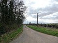
 Minor road towards Edith Weston - geograph.org.uk - 4007580.jpg 640 × 480; 71 KB
-
 Minor road towards Edith Weston - geograph.org.uk - 4007585.jpg 640 × 480; 65 KB
-
 No lottery winners with these numbers^ - geograph.org.uk - 4839929.jpg 1,280 × 894; 349 KB
-
 No Through Road - geograph.org.uk - 2320737.jpg 1,024 × 768; 138 KB
-
 No Through Road past Wytchley Warren Farm - geograph.org.uk - 5836533.jpg 3,776 × 2,520; 3.97 MB
-
 No wind for the sailors - geograph.org.uk - 4724440.jpg 640 × 427; 233 KB
-
 Normanton church - geograph.org.uk - 5139894.jpg 2,000 × 1,345; 203 KB
-
 Normanton Road - geograph.org.uk - 4007611.jpg 640 × 480; 79 KB
-

-
 North Luffenham airfield, aerial 2014 - geograph.org.uk - 4183918.jpg 1,024 × 683; 126 KB
-
 Oilseed rape crop - geograph.org.uk - 4007579.jpg 640 × 480; 59 KB
-
 On Rutland Water near Oakham - geograph.org.uk - 4724322.jpg 640 × 427; 330 KB
-

-
 Path through Berrybut Spinneys - geograph.org.uk - 3724627.jpg 1,420 × 1,600; 1.29 MB
-
 Path through Berrybut Spinneys - geograph.org.uk - 3724646.jpg 1,600 × 1,249; 1.17 MB
-
 Path through Berrybut Spinneys - geograph.org.uk - 5569817.jpg 800 × 694; 280 KB
-
 Perimeter fence, RAF North Luffenham - geograph.org.uk - 4007601.jpg 640 × 480; 108 KB
-
 Picnic area at Rutland Water - geograph.org.uk - 3569195.jpg 4,320 × 3,240; 5.69 MB
-

-
 Pontoon along the south shore of Rutland Water - geograph.org.uk - 3724707.jpg 1,600 × 1,118; 430 KB
-
-
 Public Bridleway – no through route - geograph.org.uk - 4839794.jpg 1,280 × 831; 442 KB
-
 Public conveniences, Normanton Road Car Park, Rutland Water - geograph.org.uk - 5835093.jpg 3,776 × 2,520; 2.88 MB
-
 Puddle View – Some Puddle^ - geograph.org.uk - 4839775.jpg 1,280 × 960; 362 KB
-
 Raining on Hambleton Peninsula - geograph.org.uk - 2911827.jpg 2,448 × 3,264; 6.86 MB
-
 Ranunculus Brazen Hussy - geograph.org.uk - 3907121.jpg 640 × 427; 82 KB
-
 Ranunculus ficaria ‘Brazen Hussy’ - geograph.org.uk - 3907123.jpg 640 × 427; 111 KB
-
 Rise Up^ - geograph.org.uk - 2727562.jpg 1,198 × 899; 393 KB
-
-
 Road to nowhere - geograph.org.uk - 4724488.jpg 640 × 480; 454 KB
-
 Running out - geograph.org.uk - 2727487.jpg 640 × 480; 66 KB
-
 Rutland countryside near Edith Weston - geograph.org.uk - 3289582.jpg 2,413 × 1,823; 1.61 MB
-

-
 Rutland Sailing Club - geograph.org.uk - 1005355.jpg 640 × 432; 67 KB
-
 Rutland Sailing Club - geograph.org.uk - 3288227.jpg 3,187 × 2,091; 1.42 MB
-
 Rutland Sailing Club - geograph.org.uk - 4839810.jpg 1,280 × 853; 414 KB
-
 Rutland Sailing Club, Edith Weston - geograph.org.uk - 5834825.jpg 3,776 × 2,520; 2.87 MB
-
 Rutland Water - 1981 - geograph.org.uk - 2244782.jpg 2,271 × 1,521; 235 KB
-
 Rutland Water - 1981 - geograph.org.uk - 2754342.jpg 2,272 × 1,521; 639 KB
-
 Rutland Water - 1981 - geograph.org.uk - 2754348.jpg 2,272 × 1,521; 408 KB
-
 Rutland Water - 1981 - geograph.org.uk - 2754356.jpg 2,272 × 1,521; 379 KB
-
 Rutland Water - 1981 - geograph.org.uk - 2754359.jpg 2,272 × 1,521; 777 KB
-
 Rutland Water - geograph.org.uk - 1009930.jpg 2,560 × 1,920; 1.12 MB
-
 Rutland Water - geograph.org.uk - 3082403.jpg 1,024 × 768; 118 KB
-
 Rutland Water - geograph.org.uk - 4724428.jpg 640 × 427; 274 KB
-
 Rutland Water - geograph.org.uk - 6168590.jpg 640 × 480; 46 KB
-
 Rutland Water - geograph.org.uk - 6168593.jpg 640 × 480; 54 KB
-
 Rutland Water at Normanton Church - geograph.org.uk - 3288297.jpg 3,176 × 2,180; 2.24 MB
-

-
 Rutland Water Circular Route - geograph.org.uk - 1005391.jpg 598 × 640; 106 KB
-
 Rutland Water Circular Route - geograph.org.uk - 1005467.jpg 640 × 523; 97 KB
-
 Rutland Water cycle trail - geograph.org.uk - 2399394.jpg 640 × 427; 71 KB
-
 Rutland Water from the air - geograph.org.uk - 2192314.jpg 480 × 640; 142 KB
-
 Rutland Water from the south shore - geograph.org.uk - 1006809.jpg 640 × 468; 101 KB
-
 Rutland Water Golf Course - geograph.org.uk - 1006694.jpg 640 × 391; 44 KB
-
 Rutland Water Golf Course - geograph.org.uk - 1006742.jpg 640 × 519; 37 KB
-
 Rutland Water near Edith Weston. - geograph.org.uk - 23607.jpg 640 × 430; 23 KB
-
 Rutland Water Oct09.jpg 3,892 × 2,605; 7.02 MB
-
 Rutland Water Reservoir - 1983 - geograph.org.uk - 3375010.jpg 2,271 × 1,514; 652 KB
-
 Rutland Water Reservoir - 1983 - geograph.org.uk - 3375015.jpg 2,272 × 1,514; 875 KB
-
 Rutland Water Reservoir - 1983 - geograph.org.uk - 3375016.jpg 2,271 × 1,514; 833 KB
-
 Rutland Water sailing club - geograph.org.uk - 3065921.jpg 4,000 × 3,000; 3.29 MB
-
 Rutland Water Sailing Club - geograph.org.uk - 4648696.jpg 4,320 × 2,880; 5 MB
-
 Rutland Water shoreline at Edith Weston - geograph.org.uk - 5570417.jpg 800 × 504; 107 KB
-
 Rutland Water shoreline at Edith Weston - geograph.org.uk - 5570419.jpg 800 × 600; 143 KB
-
 Rutland Water under a cloudy sky - geograph.org.uk - 3082414.jpg 1,024 × 768; 104 KB
-
 Sailing boat and pontoons at Rutland Water - geograph.org.uk - 3724731.jpg 1,600 × 1,264; 597 KB
-
 Sailing boat at Rutland Water - geograph.org.uk - 3724724.jpg 1,600 × 1,218; 412 KB
-
 Sailing boats on Rutland Water - geograph.org.uk - 3724680.jpg 1,600 × 1,144; 391 KB
-
 Sailing boats on Rutland Water - geograph.org.uk - 3724822.jpg 1,600 × 1,173; 552 KB
-
 School House, Edith Weston - geograph.org.uk - 4839954.jpg 1,280 × 928; 370 KB
-
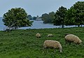 Sheep grazing the shoreline - geograph.org.uk - 3971641.jpg 1,600 × 1,109; 465 KB
-
-
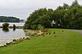
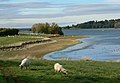
 Sheep on the Rutland Water shoreline - geograph.org.uk - 5570141.jpg 800 × 631; 104 KB
-
 Shoreline of Rutland Water - geograph.org.uk - 5569985.jpg 800 × 525; 89 KB
-
 Site of the village of Witchley - geograph.org.uk - 2627995.jpg 4,000 × 3,000; 3.97 MB
-
 Site of the village of Witchley - geograph.org.uk - 2628221.jpg 4,000 × 3,000; 4.06 MB
-
 South shore of Rutland Water - geograph.org.uk - 2483355.jpg 640 × 427; 109 KB


_-_geograph.org.uk_-_3907138.jpg)


.jpg)


.jpg)


_-_geograph.org.uk_-_5755598.jpg)


