Category:Edenderry, County Down
Jump to navigation
Jump to search
village in County Down, Northern Ireland, UK | |||||
| Upload media | |||||
| Instance of | |||||
|---|---|---|---|---|---|
| Location | Northern Ireland | ||||
 | |||||
English: Edenderry is a small village in County Down, Northern Ireland, a few miles south of Belfast on the eastern banks of the River Lagan. In the 2001 Census it had a population of 252 people. It is situated in the Lisburn City Council area.
Svenska: Edenderry ( iriska: Éadan Doire) är en liten ort i Antrim i Nordirland. 2001 hade Edenderry totalt 252 invånare. Edenderry ligger inom Lisburns stadsdistrikt.
Media in category "Edenderry, County Down"
The following 200 files are in this category, out of 229 total.
(previous page) (next page)-

-
 Apartments, Edenderry near Belfast - geograph.org.uk - 1594040.jpg 640 × 323; 73 KB
-

-
 Art work on the peace line, Cupar Way, Belfast - geograph.org.uk - 5494378.jpg 5,202 × 3,465; 3.64 MB
-

-
 Autumn at Minnowburn 2008 (10) - geograph.org.uk - 1039284.jpg 613 × 371; 91 KB
-
 Autumn at Minnowburn 2008 (4) - geograph.org.uk - 1023348.jpg 640 × 386; 126 KB
-
 Autumn at Minnowburn 2008 (7) - geograph.org.uk - 1039117.jpg 601 × 371; 91 KB
-

-

-

-

-
 Ballycairn Presbyterian Church - geograph.org.uk - 56999.jpg 640 × 480; 94 KB
-
 Belfast, former mill - geograph.org.uk - 5753681.jpg 1,024 × 768; 166 KB
-
 Belfast, Lanark Way - geograph.org.uk - 5476680.jpg 640 × 480; 448 KB
-
 Belfast, McCartan's Fort Bar - geograph.org.uk - 5752828.jpg 1,024 × 759; 150 KB
-
 Belfast, McQuillan Street - geograph.org.uk - 5475239.jpg 640 × 480; 498 KB
-
 Belfast, mural 1) - geograph.org.uk - 5752801.jpg 1,024 × 705; 174 KB
-
 Belfast, mural 8) - geograph.org.uk - 5753665.jpg 1,024 × 762; 173 KB
-
 Bray Street in the Greater Shankill - geograph.org.uk - 4103461.jpg 1,024 × 763; 181 KB
-

-
 Camp Twaddell from the top of Woodvale Road - geograph.org.uk - 4107450.jpg 1,024 × 768; 187 KB
-

-
 Cattle, Lagan towpath, Belfast (6) - geograph.org.uk - 3223958.jpg 640 × 421; 101 KB
-

-

-

-

-
 Clonard Martyrs Memorial Garden, Bombay St - geograph.org.uk - 5858800.jpg 4,608 × 3,456; 3.33 MB
-
 Clonard Martyrs Memorial Garden, Bombay St - geograph.org.uk - 5858801.jpg 4,608 × 3,456; 3.34 MB
-
 Clonard Martyrs Memorial Garden, Bombay St - geograph.org.uk - 5858802.jpg 4,608 × 3,456; 3.36 MB
-
 Corner of Kashmir Road and Clonard Gardens, Belfast - geograph.org.uk - 5493597.jpg 4,480 × 2,753; 2.01 MB
-

-
 Cupar Way peace line wall, Belfast - geograph.org.uk - 5494388.jpg 5,202 × 3,465; 3 MB
-
 Dead tree, Edenderry, Belfast - geograph.org.uk - 1704071.jpg 607 × 366; 101 KB
-
 Debris, River Lagan, Edenderry - geograph.org.uk - 3267505.jpg 640 × 405; 76 KB
-

-

-

-

-

-

-
 Divis murals, Falls Road, Belfast - geograph.org.uk - 5493582.jpg 5,197 × 2,808; 2.75 MB
-

-
 Drain, River Lagan, Edenderry - geograph.org.uk - 3267515.jpg 640 × 369; 98 KB
-
 Dunville Park - geograph.org.uk - 5475229.jpg 640 × 480; 510 KB
-
 Edenderry gospel hall near Belfast - geograph.org.uk - 1452068.jpg 640 × 413; 88 KB
-
 Edenderry Linen Mill, Crumlin Road - geograph.org.uk - 4108181.jpg 1,024 × 741; 171 KB
-
 Edenderry quay near Belfast - geograph.org.uk - 1576146.jpg 640 × 360; 91 KB
-
 Edenderry village near Belfast (2) - geograph.org.uk - 1288805.jpg 640 × 341; 79 KB
-
 Edenderry village near Belfast (3) - geograph.org.uk - 1288852.jpg 640 × 409; 78 KB
-
 Edenderry village near Belfast (4) - geograph.org.uk - 1288894.jpg 586 × 343; 85 KB
-

-
 Enfield Street, Woodvale - geograph.org.uk - 4113947.jpg 1,024 × 764; 203 KB
-
 Entrance to the disused Brookmill Linen Mill - geograph.org.uk - 4108157.jpg 1,024 × 757; 231 KB
-

-
 Fairythorn near Edenderry - geograph.org.uk - 803927.jpg 640 × 386; 99 KB
-
 Fallen ivy near Edenderry, Belfast (2) - geograph.org.uk - 3308746.jpg 586 × 345; 105 KB
-
 Fallen ivy near Edendery, Belfast (1) - geograph.org.uk - 3308729.jpg 640 × 376; 148 KB
-
 Fallen tree near Edenderry - geograph.org.uk - 1555777.jpg 548 × 373; 110 KB
-

-

-

-
 Field and fence near Edenderry, Belfast - geograph.org.uk - 1908661.jpg 627 × 361; 102 KB
-

-
 Field and trees, Edenderry, Belfast - geograph.org.uk - 2278962.jpg 640 × 378; 101 KB
-
 Field near Edenderry, Belfast (6) - geograph.org.uk - 2278945.jpg 640 × 378; 115 KB
-
 Field near Edenderry, Belfast - geograph.org.uk - 1704497.jpg 567 × 380; 113 KB
-
 Field, Edenderry, Belfast - geograph.org.uk - 1704471.jpg 640 × 403; 100 KB
-

-

-

-
 Forfar Street, Belfast - geograph.org.uk - 5702167.jpg 3,968 × 2,230; 2.24 MB
-
 Former bank, Belfast - geograph.org.uk - 6262824.jpg 1,280 × 710; 736 KB
-
 Fungi near Edenderry, Belfast (2012-1) - geograph.org.uk - 3173091.jpg 640 × 397; 105 KB
-

-

-
 Fungi, Edenderry, Belfast (August 2017) - geograph.org.uk - 5500362.jpg 640 × 390; 123 KB
-
 Fungus near Edenderry, Belfast (3) - geograph.org.uk - 2088499.jpg 710 × 492; 132 KB
-
 Fungus near Edenderry, Belfast (3) - geograph.org.uk - 3267454.jpg 640 × 393; 73 KB
-
 Fungus near Edenderry, Belfast (4) - geograph.org.uk - 2088511.jpg 629 × 557; 147 KB
-

-
 Gates of Hillview Retail Park, Crumlin Road - geograph.org.uk - 4110188.jpg 1,024 × 768; 155 KB
-

-

-
 George Floyd mural, Belfast - geograph.org.uk - 6500285.jpg 1,280 × 720; 1.02 MB
-
 Giant butterbur, Edenderry - geograph.org.uk - 1984334.jpg 695 × 396; 126 KB
-
 Golf bell near Edenderry, Belfast - geograph.org.uk - 3173196.jpg 640 × 403; 54 KB
-
 Golf course, Edenderry-Dunmurry (1) - geograph.org.uk - 3267472.jpg 575 × 384; 98 KB
-
 Golf course, Edenderry-Dunmurry (2) - geograph.org.uk - 3267474.jpg 640 × 414; 88 KB
-
 Golf course, Edenderry-Dunmurry (3) - geograph.org.uk - 3267480.jpg 640 × 398; 88 KB
-
 Graffiti, Belfast - geograph.org.uk - 6500288.jpg 1,280 × 720; 949 KB
-

-
 Holy Cross Church in the Ardoyne - geograph.org.uk - 4107909.jpg 1,024 × 761; 200 KB
-
 Holy Cross Church on the Crumlin Road - geograph.org.uk - 4107880.jpg 753 × 1,024; 167 KB
-

-

-

-
 Ivy clad telephone box, Edenderry - geograph.org.uk - 4783675.jpg 640 × 480; 228 KB
-

-
 Karrera Street at the Ardoyne-Woodvale interface - geograph.org.uk - 4107871.jpg 1,024 × 714; 188 KB
-
 Kashmir Bar, Springfield Road, Belfast - geograph.org.uk - 5494346.jpg 5,202 × 3,465; 3.02 MB
-
 Lawnbrook Avenue from Cupar Way - geograph.org.uk - 5494409.jpg 5,202 × 3,465; 3.64 MB
-
 Linen Mill Grove sign, Edenderry - geograph.org.uk - 2848564.jpg 640 × 394; 103 KB
-
 Lock no 4, disused Lagan canal (2) - geograph.org.uk - 1984284.jpg 620 × 415; 137 KB
-

-
 Mary Peters statue, Belfast - geograph.org.uk - 4087380.jpg 640 × 469; 130 KB
-

-
 Meadowsweet near Edenderry - geograph.org.uk - 1984277.jpg 634 × 373; 119 KB
-

-
 Modern housing estate in Ainsworth Avenue - geograph.org.uk - 4113306.jpg 1,024 × 754; 176 KB
-
 Mountain View Tavern on the Shankill Road - geograph.org.uk - 4102172.jpg 1,024 × 768; 121 KB
-
 Mural to Bobby Sands, 49 Falls Road - geograph.org.uk - 5858797.jpg 4,608 × 3,456; 3.4 MB
-
 Narrow pathway, Edenderry - geograph.org.uk - 4783682.jpg 640 × 480; 203 KB
-
 NHS mural, Belfast - geograph.org.uk - 6500281.jpg 1,280 × 720; 904 KB
-

-
 Old gate near Edenderry, Belfast - geograph.org.uk - 2497494.jpg 640 × 427; 157 KB
-
 Old post near Edenderry, Belfast - geograph.org.uk - 1288649.jpg 640 × 415; 131 KB
-
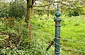
 Old pump, Edenderry, Belfast - geograph.org.uk - 2572975.jpg 634 × 434; 137 KB
-
 Passionist burial plot next to Holy Cross Church - geograph.org.uk - 4108082.jpg 1,024 × 768; 206 KB
-

-

-
 Path along the Lagan - geograph.org.uk - 4782512.jpg 3,264 × 2,448; 3.08 MB
-
 Path near Edenderry (2) - geograph.org.uk - 1948629.jpg 558 × 399; 105 KB
-
 Path near Edenderry - geograph.org.uk - 772933.jpg 640 × 392; 105 KB
-
 Path near the Mary Peters Track, Belfast - geograph.org.uk - 2494063.jpg 640 × 377; 131 KB
-

-

-
 Path, Edenderry, Belfast - geograph.org.uk - 1704135.jpg 596 × 375; 92 KB
-
 Pathway near Gilchrist Bridge - geograph.org.uk - 4783680.jpg 640 × 480; 194 KB
-

-
 Peace line in Bombay St on the Falls side, Belfast - geograph.org.uk - 5494336.jpg 5,202 × 3,465; 3.28 MB
-

-
 Pillar box, Belfast - geograph.org.uk - 6500289.jpg 960 × 1,280; 1.25 MB
-
 Pillar box, Edenderry near Belfast - geograph.org.uk - 1288948.jpg 640 × 416; 97 KB
-
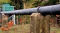 Pipe, Edenderry, Belfast - geograph.org.uk - 2279004.jpg 620 × 341; 92 KB
-
 Purple loosestrife near Edenderry - geograph.org.uk - 1984311.jpg 604 × 598; 104 KB
-

-

-

-

-

-

-
 Rose hips near Edenderry, Belfast - geograph.org.uk - 2088620.jpg 577 × 624; 90 KB
-
 Rosehips, Edenderry, Belfast - geograph.org.uk - 2572996.jpg 638 × 475; 138 KB
-
 Shankill Rest Garden Memorial Book - geograph.org.uk - 4113215.jpg 1,024 × 767; 249 KB
-

-
 Side door at Holy Cross Church - geograph.org.uk - 4108107.jpg 768 × 1,024; 187 KB
-
 Snowberries, Edenderry, Belfasr - geograph.org.uk - 3223851.jpg 640 × 503; 43 KB
-
 Springfield Road barrier, Belfast - geograph.org.uk - 5494360.jpg 5,202 × 3,465; 2.47 MB
-
 St Ellen Works, Edenderry (site of) - geograph.org.uk - 2848464.jpg 640 × 351; 88 KB
-
 St Mathew's CoI church, Woodvale Road - geograph.org.uk - 4102178.jpg 1,024 × 741; 200 KB
-

-

-
 Substation sign, Edenderry, Belfast - geograph.org.uk - 2848551.jpg 640 × 560; 46 KB
-

-

-
 Telephone box, Edenderry, Belfast - geograph.org.uk - 2848518.jpg 640 × 414; 134 KB
-

-

-
 The Brookfield Mill complex on the Crumlin Road - geograph.org.uk - 4110313.jpg 1,024 × 768; 171 KB
-

-
 The Edenderry Lofts - geograph.org.uk - 4110102.jpg 1,024 × 724; 220 KB
-
 The Edenderry Road, Edenderry (4) - geograph.org.uk - 2848426.jpg 640 × 355; 113 KB
-

-

-
 The Eel weir near Edenderry (6) - geograph.org.uk - 3267494.jpg 640 × 396; 87 KB
-

-
 The former Brookfield Linen Mill, Crumlin Road - geograph.org.uk - 4108155.jpg 1,024 × 755; 198 KB
-
 The former Holy Cross School - geograph.org.uk - 4108114.jpg 1,024 × 761; 199 KB
-

-

-
 The interior of Holy Cross Church, Crumlin Road - geograph.org.uk - 4107899.jpg 1,024 × 754; 157 KB
-
 The Lagan towpath near Edenderry (2) - geograph.org.uk - 3267444.jpg 576 × 343; 104 KB
-
 The Lagan towpath near Edenderry - geograph.org.uk - 1948581.jpg 624 × 360; 117 KB
-

-
 The lower end of Enfield Street, Woodvale - geograph.org.uk - 4113957.jpg 1,024 × 768; 219 KB
-
 The Mary Peters Track, Belfast (1) - geograph.org.uk - 2494025.jpg 809 × 453; 116 KB
-
 The Mary Peters Track, Belfast (2) - geograph.org.uk - 2494029.jpg 766 × 424; 105 KB
-
 The Mary Peters Track, Belfast (3) - geograph.org.uk - 2494036.jpg 640 × 345; 78 KB
-

-

-

-
 The northern end of Woodvale Road - geograph.org.uk - 4107357.jpg 1,024 × 699; 161 KB
-
 The Peace Wall, Cupar Way - geograph.org.uk - 5475172.jpg 640 × 480; 525 KB
-
 The President Buchanan Mural on Woodvale Road - geograph.org.uk - 4102212.jpg 768 × 1,024; 133 KB
-

-

-
 The River Lagan, Edenderry, Belfast - geograph.org.uk - 1704481.jpg 640 × 348; 96 KB
-

-
 The Shankill Graveyard - geograph.org.uk - 4113201.jpg 1,024 × 768; 293 KB
-
 The Shankill Woodvale DUP offices - geograph.org.uk - 4102287.jpg 766 × 1,024; 193 KB
-

-

-

-

-
 Thistles near Edenderry - geograph.org.uk - 1984319.jpg 434 × 515; 102 KB
-

-
 Towpath and trees, Edenderry - geograph.org.uk - 1984113.jpg 589 × 375; 121 KB
-

_-_geograph.org.uk_-_4282489.jpg)


_-_geograph.org.uk_-_5500373.jpg)
_-_geograph.org.uk_-_1039284.jpg)
_-_geograph.org.uk_-_1023348.jpg)
_-_geograph.org.uk_-_1039117.jpg)
_-_geograph.org.uk_-_4132830.jpg)
_-_geograph.org.uk_-_4132882.jpg)
_-_geograph.org.uk_-_4132884.jpg)
_-_geograph.org.uk_-_4132886.jpg)


_-_geograph.org.uk_-_5752801.jpg)
_-_geograph.org.uk_-_5753665.jpg)


_-_geograph.org.uk_-_5945821.jpg)
_-_geograph.org.uk_-_3223958.jpg)
_-_geograph.org.uk_-_4179409.jpg)
_-_geograph.org.uk_-_4132906.jpg)
_-_geograph.org.uk_-_4132918.jpg)
_-_geograph.org.uk_-_5858803.jpg)


_-_geograph.org.uk_-_6229286.jpg)
_-_geograph.org.uk_-_5500275.jpg)
_-_geograph.org.uk_-_5500302.jpg)
_-_geograph.org.uk_-_5945774.jpg)
_-_geograph.org.uk_-_5945784.jpg)
_-_geograph.org.uk_-_5945796.jpg)

_-_geograph.org.uk_-_4525760.jpg)


_-_geograph.org.uk_-_1288805.jpg)
_-_geograph.org.uk_-_1288852.jpg)
_-_geograph.org.uk_-_1288894.jpg)
_-_geograph.org.uk_-_4150080.jpg)


_-_geograph.org.uk_-_3308746.jpg)
_-_geograph.org.uk_-_3308729.jpg)

_-_geograph.org.uk_-_4179421.jpg)
_-_geograph.org.uk_-_4526013.jpg)
_-_geograph.org.uk_-_1908683.jpg)

_-_geograph.org.uk_-_5945855.jpg)

_-_geograph.org.uk_-_2278945.jpg)


_-_geograph.org.uk_-_4282461.jpg)
_-_geograph.org.uk_-_4282355.jpg)
_-_geograph.org.uk_-_4282383.jpg)


_-_geograph.org.uk_-_3173091.jpg)
_-_geograph.org.uk_-_3173115.jpg)
_-_geograph.org.uk_-_3173142.jpg)
_-_geograph.org.uk_-_5500362.jpg)
_-_geograph.org.uk_-_2088499.jpg)
_-_geograph.org.uk_-_3267454.jpg)
_-_geograph.org.uk_-_2088511.jpg)
_-_geograph.org.uk_-_6229321.jpg)

_-_geograph.org.uk_-_4525792.jpg)
_-_geograph.org.uk_-_4525997.jpg)


_-_geograph.org.uk_-_3267472.jpg)
_-_geograph.org.uk_-_3267474.jpg)
_-_geograph.org.uk_-_3267480.jpg)


_-_geograph.org.uk_-_4150710.jpg)


_-_geograph.org.uk_-_4849491.jpg)


_-_geograph.org.uk_-_1984284.jpg)
_-_geograph.org.uk_-_5500368.jpg)


_-_geograph.org.uk_-_4849602.jpg)


_-_geograph.org.uk_-_1948629.jpg)


_-_geograph.org.uk_-_4150029.jpg)
_-_geograph.org.uk_-_4150062.jpg)


_-_geograph.org.uk_-_4526034.jpg)


_-_geograph.org.uk_-_2493840.jpg)
_-_geograph.org.uk_-_2493900.jpg)
_-_geograph.org.uk_-_2493952.jpg)
_-_geograph.org.uk_-_4282449.jpg)
_-_geograph.org.uk_-_4849535.jpg)
_-_geograph.org.uk_-_4849543.jpg)


_-_geograph.org.uk_-_4849478.jpg)


_-_geograph.org.uk_-_2848464.jpg)


_-_geograph.org.uk_-_5500331.jpg)
_-_geograph.org.uk_-_5945839.jpg)


_roundabout_-_geograph.org.uk_-_4107461.jpg)


_-_geograph.org.uk_-_2848426.jpg)
_-_geograph.org.uk_-_5945807.jpg)
_-_geograph.org.uk_-_2573026.jpg)
_-_geograph.org.uk_-_3267494.jpg)
_-_geograph.org.uk_-_3308789.jpg)


_Walter_Ambrose_Sterling,_RAF_(aged_14)_-_geograph.org.uk_-_4113556.jpg)


_-_geograph.org.uk_-_3267444.jpg)

_-_geograph.org.uk_-_6229295.jpg)

_-_geograph.org.uk_-_2494025.jpg)
_-_geograph.org.uk_-_2494029.jpg)
_-_geograph.org.uk_-_2494036.jpg)
_-_geograph.org.uk_-_4087420.jpg)
_-_geograph.org.uk_-_4087455.jpg)
_-_geograph.org.uk_-_4087655.jpg)


_-_geograph.org.uk_-_6229413.jpg)
_-_geograph.org.uk_-_2279056.jpg)


_-_geograph.org.uk_-_4282511.jpg)