Category:Economic maps of Bulgaria
Jump to navigation
Jump to search
Subcategories
This category has the following 4 subcategories, out of 4 total.
Media in category "Economic maps of Bulgaria"
The following 15 files are in this category, out of 15 total.
-
 Agriculture in Bulgaria during the National Revival 19th century.png 2,590 × 1,768; 814 KB
-
 Bulgaria Agriculture - Land Use - DPLA - 6e2bd1295f834f9693814ae9663a1ac0.jpg 8,184 × 6,484; 7.23 MB
-
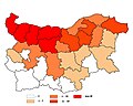
 Bulgaria average monthly wage geographical distribution.svg 2,400 × 1,520; 1.28 MB
-
 Bulgaria export partners.png 1,200 × 1,000; 83 KB
-
 Bulgaria unemployment geographical distribution.svg 2,400 × 1,520; 1.28 MB
-
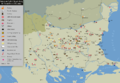
 DVB-T single-frequency network (SFN) Allotments in Bulgaria.png 1,024 × 646; 194 KB
-
 Economy of the Second Bulgarian Empire.png 3,519 × 2,387; 1.38 MB
-
 Industry and Crafts in Bulgaria during the National Revival.png 2,556 × 1,765; 932 KB
-
 Industry of People's Republic of Bulgaria.png 1,646 × 1,270; 946 KB
-
 Osmanlı borçlarını ödeyen ülkeler.png 4,252 × 3,403; 1.02 MB
-
 Rabies cases Bulgaria - 1988 - 2005.JPG 1,600 × 1,280; 146 KB
-
 Vorschlag14 location in Bulgaria.jpg 520 × 350; 120 KB
-
 Vorschlag15 location in Bulgaria.png 520 × 350; 195 KB
-
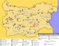
 Weinbauregionen Bulgarien.png 640 × 480; 60 KB
-
 Weinbauregionen Bulgarien.svg 640 × 480; 35 KB


_Allotments_in_Bulgaria.png)


