Category:Eaton Bray
Jump to navigation
Jump to search
village and civil parish in Bedfordshire, UK  | |||||
| Upload media | |||||
| Instance of | |||||
|---|---|---|---|---|---|
| Location | Central Bedfordshire, Bedfordshire, East of England, England | ||||
| Population |
| ||||
| Said to be the same as | Eaton Bray (Wikimedia duplicated page, civil parish) | ||||
| official website | |||||
 | |||||
English: Eaton Bray is a village and civil parish in the English county of Bedfordshire. It is part of an semi-rural area which crosses into the parish of Edlesborough in Buckinghamshire and is around one mile from the Bedfordshire village of Totternhoe.
Nederlands: Eaton Bray is een plaats in het bestuurlijke gebied South Bedfordshire, in het Engelse graafschap Bedfordshire. De plaats telt 3.240 inwoners.
Svenska: Eaton Bray är en by utanför staden Dunstable som ligger ca 5 mil nordost om London. Byn har 3240 invånare och ligger i Bedfordshire.
Subcategories
This category has the following 4 subcategories, out of 4 total.
Media in category "Eaton Bray"
The following 101 files are in this category, out of 101 total.
-
 "Alpacas for Sale" Notice, Eaton Bray - geograph.org.uk - 2423960.jpg 3,072 × 2,304; 1.78 MB
-
 "Barncroft", Eaton Bray - geograph.org.uk - 182654.jpg 640 × 480; 87 KB
-
 Agricultural Building Near Valence-end Farm - geograph.org.uk - 5867405.jpg 1,600 × 1,200; 469 KB
-
 Ancient tractor on an ancient trackway - geograph.org.uk - 5760986.jpg 1,600 × 1,068; 445 KB
-
 B4550 drops steeply down the Chiltern's escarpment - geograph.org.uk - 3615023.jpg 4,320 × 3,240; 5.56 MB
-
 Bison Hill car park, Whipsnade - geograph.org.uk - 5468619.jpg 2,048 × 1,536; 1.53 MB
-
 Blossom by The Nurseries - geograph.org.uk - 5760981.jpg 1,600 × 1,066; 573 KB
-
 Bower Lane, Eaton Bray - geograph.org.uk - 4915835.jpg 2,048 × 1,536; 1.49 MB
-
 Bridleway towards Totternhoe - geograph.org.uk - 5760984.jpg 1,600 × 1,066; 472 KB
-
 Byway to Well Head - geograph.org.uk - 5760992.jpg 1,600 × 1,066; 521 KB
-
 Dagnall Road, Eaton Bray - geograph.org.uk - 5468545.jpg 2,014 × 1,490; 789 KB
-
 Doolittle Lane, Eaton Bray - geograph.org.uk - 4915624.jpg 1,930 × 1,362; 1.04 MB
-
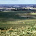
 Dunstable Downs - geograph.org.uk - 1982374.jpg 1,280 × 853; 310 KB
-
 Dunstable Downs Country Park - geograph.org.uk - 2365488.jpg 2,592 × 1,944; 1.66 MB
-
 Eaton Bray Methodist Church, Beds - geograph.org.uk - 2482260.jpg 3,072 × 2,304; 1.8 MB
-
 Eaton Bray Telephone Exchange, Beds - geograph.org.uk - 2481064.jpg 3,072 × 2,304; 1.79 MB
-
 Eaton Bray Village Hall - geograph.org.uk - 2434411.jpg 2,272 × 1,704; 1.74 MB
-
 Eaton Bray War Memorial - geograph.org.uk - 5760979.jpg 1,600 × 1,066; 547 KB
-
 Edlesborough Hill - geograph.org.uk - 3559122.jpg 3,264 × 2,448; 3.07 MB
-
 Field and drainage ditch by the Rye - geograph.org.uk - 6717625.jpg 1,600 × 1,066; 702 KB
-
 Field by Dunstable Road, Totternhoe - geograph.org.uk - 4917422.jpg 2,004 × 1,476; 762 KB
-
 Field entrance north of Eaton Green - geograph.org.uk - 4666793.jpg 640 × 480; 94 KB
-
 Field in Eaton Bray - geograph.org.uk - 4915706.jpg 2,048 × 1,536; 1.56 MB
-
 Field off Harling Road - geograph.org.uk - 2488108.jpg 640 × 480; 99 KB
-
 Footbridge over the ditch - geograph.org.uk - 6717627.jpg 1,600 × 1,070; 608 KB
-
 Footpath into Eaton Bray - geograph.org.uk - 5760975.jpg 1,600 × 1,066; 437 KB
-
 Footpath towards Dunstable - geograph.org.uk - 3827852.jpg 1,200 × 1,600; 668 KB
-
 Former 'New York Diner', Icknield Way - geograph.org.uk - 6199963.jpg 1,024 × 768; 149 KB
-
 GOC Dunstable Downs 011 Dunstable Downs (24650472582).jpg 4,162 × 3,121; 4.55 MB
-
 GOC Dunstable Downs 013 View from Dunstable Downs (24768282365).jpg 4,288 × 3,216; 4.13 MB
-
 GOC Dunstable Downs 015 Ivinghoe Beacon from Dunstable Downs (24140128334).jpg 4,288 × 3,216; 4.92 MB
-
 GOC Dunstable Downs 016 Ivinghoe Beacon from Dunstable Downs (24742065996).jpg 4,288 × 3,216; 4.1 MB
-
 GOC Dunstable Downs 018 Dunstable Downs (24400633399).jpg 4,288 × 3,216; 3.5 MB
-
 GOC Dunstable Downs 020 Dunstable Downs (24161934273).jpg 4,288 × 3,216; 3.68 MB
-
 GOC Dunstable Downs 023 Dunstable Downs (24421136039).jpg 4,288 × 3,216; 4.19 MB
-
 GOC Dunstable Downs 024 Ivinghoe Beacon from Dunstable Downs (24161946543).jpg 4,288 × 3,216; 4.38 MB
-
 GOC Dunstable Downs 029 Dunstable Downs (24695312381).jpg 4,288 × 3,216; 4.34 MB
-
 Green Lane, Eaton Bray turned white - geograph.org.uk - 3300008.jpg 1,600 × 1,067; 381 KB
-
 Harling Road - geograph.org.uk - 2488093.jpg 640 × 480; 82 KB
-
 Harling Road - geograph.org.uk - 2488109.jpg 640 × 480; 89 KB
-
 Harling Road at the end of Dunstable Road - geograph.org.uk - 4915582.jpg 2,048 × 1,536; 1.49 MB
-
 High Street, Eaton Bray - geograph.org.uk - 1323980.jpg 640 × 427; 140 KB
-
 High Street, Eaton Bray - geograph.org.uk - 2488110.jpg 640 × 480; 82 KB
-
 Icknield Way, Well Head - geograph.org.uk - 4915571.jpg 1,956 × 1,404; 752 KB
-
 Icknield Way, Well Head - geograph.org.uk - 4915948.jpg 1,964 × 1,416; 831 KB
-
 Icknield Way, Well Head - geograph.org.uk - 4917066.jpg 1,894 × 1,300; 1.12 MB
-
 London Gliding Club - geograph.org.uk - 3556918.jpg 3,264 × 2,448; 3.21 MB
-
 Methodist Chapel, Eaton Bray - geograph.org.uk - 2434432.jpg 2,272 × 1,704; 1.67 MB
-
 Moat Farm, Eaton Bray - geograph.org.uk - 1323984.jpg 640 × 427; 202 KB
-
 Nisa Local, Eaton Bray - geograph.org.uk - 4915731.jpg 2,014 × 1,490; 863 KB
-
 Northall Road - geograph.org.uk - 2488112.jpg 640 × 480; 85 KB
-
 Path down to the B4540 - geograph.org.uk - 3827853.jpg 1,200 × 1,600; 608 KB
-
 Powerlines leaning across the field - geograph.org.uk - 5761011.jpg 1,600 × 1,066; 454 KB
-
 Private Lane in Eaton Bray - geograph.org.uk - 4915792.jpg 2,048 × 1,536; 1.01 MB
-
 Public footpath towards Park Farm - geograph.org.uk - 5760973.jpg 1,600 × 1,066; 536 KB
-
 Roundabout from Harling Road - geograph.org.uk - 2488070.jpg 640 × 480; 77 KB
-
 Roundabout on Dagnall Road, Eaton Bray - geograph.org.uk - 5468537.jpg 2,048 × 1,536; 1.47 MB
-
 Roundabout on Dagnall Road, Eaton Bray - geograph.org.uk - 5473714.jpg 2,048 × 1,536; 1.49 MB
-
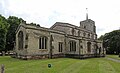
 St Mary the Virgin, Eaton Bray - geograph.org.uk - 3615050.jpg 4,320 × 3,240; 5.42 MB
-
 St Mary, Eaton Bray - Chancel - geograph.org.uk - 5003456.jpg 1,000 × 673; 312 KB
-
 St Mary, Eaton Bray - Corbel - geograph.org.uk - 5003466.jpg 754 × 1,000; 244 KB
-
 St Mary, Eaton Bray - Corbel - geograph.org.uk - 5003469.jpg 648 × 1,000; 210 KB
-
 St Mary, Eaton Bray - Corbel - geograph.org.uk - 5003470.jpg 683 × 1,000; 196 KB
-
 St Mary, Eaton Bray - Corbel - geograph.org.uk - 5003472.jpg 631 × 1,000; 203 KB
-
 St Mary, Eaton Bray - East end - geograph.org.uk - 5003446.jpg 1,000 × 682; 332 KB
-
 St Mary, Eaton Bray - East end - geograph.org.uk - 5003455.jpg 1,000 × 679; 289 KB
-
 St Mary, Eaton Bray - Font - geograph.org.uk - 5003463.jpg 1,000 × 847; 366 KB
-
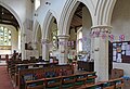
 St Mary, Eaton Bray - geograph.org.uk - 5003442.jpg 1,000 × 672; 336 KB
-
 St Mary, Eaton Bray - geograph.org.uk - 5003444.jpg 1,000 × 610; 279 KB
-
 St Mary, Eaton Bray - geograph.org.uk - 5003445.jpg 1,000 × 606; 252 KB
-
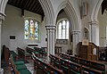
 St Mary, Eaton Bray - North arcade - geograph.org.uk - 5003450.jpg 1,000 × 720; 309 KB
-
 St Mary, Eaton Bray - North arcade - geograph.org.uk - 5003453.jpg 1,000 × 693; 299 KB
-
 St Mary, Eaton Bray - South arcade - geograph.org.uk - 5003447.jpg 1,000 × 686; 326 KB
-
 St Mary, Eaton Bray - South arcade - geograph.org.uk - 5003448.jpg 1,000 × 680; 312 KB
-
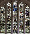
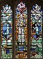 St Mary, Eaton Bray - Stained glass window - geograph.org.uk - 5003457.jpg 735 × 1,000; 548 KB
-
 St Mary, Eaton Bray - Stained glass window - geograph.org.uk - 5003461.jpg 884 × 1,000; 726 KB
-
 Steep path off the Icknield Way - geograph.org.uk - 3827855.jpg 1,600 × 1,066; 592 KB
-
 The Coffee Tavern, Eaton Bray - geograph.org.uk - 2434417.jpg 2,272 × 1,704; 1.75 MB
-
 The Coffee Tavern, Eaton Bray - geograph.org.uk - 4143446.jpg 3,072 × 2,304; 1.77 MB
-
 The entrance to Bison Hill car park - geograph.org.uk - 5468607.jpg 2,048 × 1,536; 1.51 MB
-
 The entrance to Bison Hill car park, Whipsnade - geograph.org.uk - 5468624.jpg 1,990 × 1,454; 871 KB
-
 The entrance to Dunstable Downs, Whipsnade - geograph.org.uk - 5474885.jpg 2,048 × 1,536; 1.39 MB
-
 The Five Bells, Eaton Bray - geograph.org.uk - 183109.jpg 640 × 524; 82 KB
-
 The Parish Church of St Mary the Virgin, Eaton Bray - geograph.org.uk - 4136042.jpg 3,072 × 2,304; 1.8 MB
-
 The road to Eaton Bray in the snow - geograph.org.uk - 3300016.jpg 1,600 × 1,066; 215 KB
-
 The Rye, Eaton Bray - geograph.org.uk - 4452876.jpg 3,264 × 2,448; 3.44 MB
-
 Totternhoe Road, Eaton Bray - geograph.org.uk - 4915811.jpg 2,048 × 1,536; 1.49 MB
-
 Track to Wellhead Farm - geograph.org.uk - 5761012.jpg 1,600 × 1,066; 486 KB
-
 Track to Wellhead Farm - geograph.org.uk - 757911.jpg 640 × 480; 114 KB
-
 Track towards Totternhoe - geograph.org.uk - 5761010.jpg 1,600 × 1,066; 576 KB
-
 Unusual House at Honeywick - geograph.org.uk - 193757.jpg 640 × 480; 118 KB
-
 Valance-end Farm, Whipsnade - geograph.org.uk - 5468700.jpg 2,048 × 1,536; 1.49 MB
-
 View from Bison Hill car park - geograph.org.uk - 5468612.jpg 2,048 × 1,536; 1.5 MB
-
 View from Bison Hill, Whipsnade - geograph.org.uk - 5468616.jpg 2,048 × 1,536; 1.49 MB
-
 View west from Dunstable Downs, 1973 - geograph.org.uk - 4283270.jpg 640 × 640; 152 KB
-
 Village Green - Eaton Bray - geograph.org.uk - 147324.jpg 640 × 480; 80 KB
-
 Wheat field by Dunstable Road - geograph.org.uk - 2488067.jpg 640 × 480; 82 KB
-
 Wheat field off Harling Road - geograph.org.uk - 2488096.jpg 640 × 480; 85 KB
-
 White Horse pub on Eaton Bray village green - geograph.org.uk - 5760971.jpg 1,600 × 1,068; 504 KB
-
 Great Green Farm, Eaton Bray - geograph.org.uk - 183125.jpg 640 × 480; 114 KB
-
 September Cottage and No.2 - geograph.org.uk - 147311.jpg 640 × 480; 95 KB


.jpg)
.jpg)
.jpg)
.jpg)
.jpg)
.jpg)


.jpg)
.jpg)
.jpg)