Category:Eastwick, Hertfordshire
Jump to navigation
Jump to search
civil parish in Hertfordshire, England  | |||||
| Upload media | |||||
| Instance of | |||||
|---|---|---|---|---|---|
| Part of |
| ||||
| Location | East Hertfordshire, Hertfordshire, East of England, England | ||||
| Population |
| ||||
 | |||||
Subcategories
This category has the following 2 subcategories, out of 2 total.
B
E
Media in category "Eastwick, Hertfordshire"
The following 43 files are in this category, out of 43 total.
-
 A414 - geograph.org.uk - 3512909.jpg 640 × 430; 56 KB
-
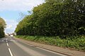
 A414 behind the trees - geograph.org.uk - 3512892.jpg 640 × 430; 106 KB
-
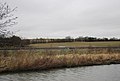 A414, Stort Valley - geograph.org.uk - 3512925.jpg 640 × 430; 53 KB
-
 Airfield Memorial RAF Hunsdon - geograph.org.uk - 2275250.jpg 640 × 480; 79 KB
-
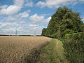 Bridleway west of Gilston Park - geograph.org.uk - 1445306.jpg 640 × 480; 162 KB
-
 Copse above Eastwick Hall Lane - geograph.org.uk - 1445327.jpg 640 × 480; 72 KB
-
 Dusty Miller, Burnt Mill Corner - geograph.org.uk - 2802410.jpg 640 × 415; 51 KB
-
 Eastwick Ford - geograph.org.uk - 3373658.jpg 3,872 × 2,592; 2.34 MB
-
 Eastwick Hall Farm - geograph.org.uk - 141276.jpg 640 × 426; 57 KB
-
 Eastwick Hall Lane - geograph.org.uk - 1025211.jpg 640 × 480; 83 KB
-
 Eastwick Hall Lane - geograph.org.uk - 141269.jpg 640 × 426; 83 KB
-
 Eastwick Hall Lane - geograph.org.uk - 1445329.jpg 640 × 480; 76 KB
-
 Eastwick Road, Pye Corner - geograph.org.uk - 6119960.jpg 1,734 × 1,154; 1.33 MB
-
 Gilston Park estate buildings in Eastwick - geograph.org.uk - 4779484.jpg 4,320 × 3,240; 2.97 MB
-
 Memorial, former RAF Hunsdon - geograph.org.uk - 4542189.jpg 640 × 480; 115 KB
-
 Mercy seat^ - geograph.org.uk - 1445325.jpg 640 × 480; 133 KB
-
 Moat, Lawns Wood - geograph.org.uk - 4540889.jpg 640 × 480; 226 KB
-
 National Grid power line 4ZM - geograph.org.uk - 4594688.jpg 480 × 640; 127 KB
-
 Ordnance Survey Drawings - Ware (OSD 141).jpg 4,000 × 2,718; 5 MB
-
 Pye Corner, Gilston - geograph.org.uk - 6119961.jpg 1,920 × 1,280; 2.07 MB
-
 Pylons across the fields - geograph.org.uk - 579620.jpg 640 × 425; 77 KB
-
 Pylons heading to Eastwick Hall Lane - geograph.org.uk - 720234.jpg 640 × 425; 49 KB
-
 Rise east of Eastwick Hall Lane - geograph.org.uk - 3895162.jpg 640 × 480; 104 KB
-
 Roundabout on Eastwick Road, Harlow - geograph.org.uk - 6119954.jpg 1,920 × 1,280; 1.4 MB
-
 Shiptons, Pye Corner - geograph.org.uk - 3895130.jpg 640 × 480; 121 KB
-
 Shopping centre at Temple Fields - geograph.org.uk - 5462081.jpg 3,264 × 2,448; 3.78 MB
-
 Site of Eastwick Manor - 2^ - geograph.org.uk - 142165.jpg 640 × 426; 113 KB
-
 Site of Eastwick Manor^ - geograph.org.uk - 141258.jpg 640 × 426; 95 KB
-
 St Botolph, Eastwick - geograph.org.uk - 4778666.jpg 2,878 × 2,160; 1.94 MB
-
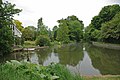 Stort Navigation - geograph.org.uk - 1317343.jpg 640 × 428; 77 KB
-
 Terlings Park - geograph.org.uk - 3586112.jpg 640 × 480; 80 KB
-
 The Lion at Eastwick - geograph.org.uk - 1445079.jpg 640 × 480; 152 KB
-
 The Lion pub, Eastwick - geograph.org.uk - 4779578.jpg 4,320 × 3,240; 2.91 MB
-
 The Lion, Eastwick - geograph.org.uk - 3895173.jpg 640 × 428; 96 KB
-

-
 Traffic on the A414 - geograph.org.uk - 3520450.jpg 640 × 430; 76 KB
-
 Traffic on the A414 - geograph.org.uk - 3520456.jpg 640 × 430; 70 KB
-
 Traffic on the A414 near Eastwick - geograph.org.uk - 3520614.jpg 640 × 430; 61 KB
-
 Vanished moat - geograph.org.uk - 1445321.jpg 640 × 480; 131 KB
-
 Victorian almshouses, Eastwick - geograph.org.uk - 1445074.jpg 640 × 480; 127 KB
-
 View to Eastwick Church - geograph.org.uk - 3520615.jpg 640 × 430; 59 KB
-

-
 Wild apple tree at Eastwick - geograph.org.uk - 1445056.jpg 480 × 640; 227 KB


.jpg)


