Category:Eastriggs
Jump to navigation
Jump to search
village in Dumfries and Galloway, Scotland, UK   | |||||
| Upload media | |||||
| Instance of | |||||
|---|---|---|---|---|---|
| Location |
| ||||
| Population |
| ||||
 | |||||

Subcategories
This category has the following 4 subcategories, out of 4 total.
D
- Devil's Porridge Museum (81 F)
E
- Eastriggs, HM Factory Gretna (33 F)
Media in category "Eastriggs"
The following 16 files are in this category, out of 16 total.
-
 A boulder on the beach at Torduff Point - geograph.org.uk - 1061829.jpg 640 × 427; 119 KB
-
 Browhouses, Eastriggs, Dumfriesshire. - panoramio.jpg 4,000 × 3,000; 4.01 MB
-
 Eastriggs - geograph.org.uk - 465490.jpg 640 × 427; 96 KB
-
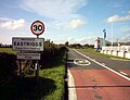 Eastriggs approached from the east.JPG 1,248 × 960; 198 KB
-
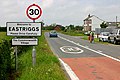
 Eastriggs approached from the west.JPG 1,248 × 960; 234 KB
-
 Eastriggs Cemetery - geograph.org.uk - 473712.jpg 640 × 457; 140 KB
-
 Eastriggs Explosive Storage Depot, Disused (OpenStreetMap).jpg 1,557 × 687; 217 KB
-
 Eastriggs Munitions Depot, Building R14 (geograph 4063944).jpg 3,448 × 4,592; 3.88 MB
-
 Gravestone in Eastriggs Cemetery - geograph.org.uk - 465536.jpg 443 × 640; 148 KB
-
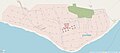
 Mapa dg eastriggs.jpg 2,004 × 1,363; 599 KB
-
 Millennium milepost at Eastriggs - geograph.org.uk - 511048.jpg 480 × 640; 177 KB
-
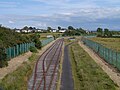
 Ordnance Depot Railway, Eastriggs - geograph.org.uk - 751592.jpg 640 × 480; 81 KB
-
 Railway Entrance To Eastriggs Munitions Depot (geograph 4061257).jpg 4,592 × 3,448; 4.51 MB
-
 Road sign on the A75 - geograph.org.uk - 1307377.jpg 640 × 459; 61 KB
-
 Scots Pines near Scotsfields Farm - geograph.org.uk - 715836.jpg 480 × 640; 74 KB
-
 The Graham Arms - geograph.org.uk - 849474.jpg 640 × 480; 80 KB


.jpg)
.jpg)


.jpg)


